Investigating the Natural Hazards of Western Canada
Current Research Projects - B. Ward / G. Williams-Jones
Western Canada is particulalry prone to a broad range of natural hazards including earthquakes, landslides, flooding, wildfires - many of these are becoming more frequent yet less predictable due to changing climate. Our projects tackle a wide number of projects ranging from understanding the processes that trigger landslides to how best to communicate these hazards to the broader public.

Landslide and rock fall assessment within the Canadian Cordillera
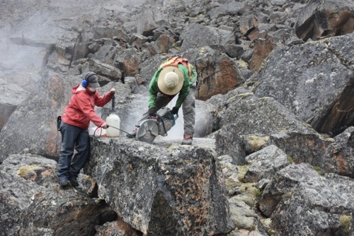
Mountains including those in the Garibaldi Volcanic Belt consist of many unstable ice-clad mountains such as Mount Meager and Mount Currie. Their proximity to population centres makes them tourist attractions and as well critical natural resources (e.g., potential geothermal resource at Mount Meager). We are taking a multi-disciplinary approach (e.g., structural geology, geotechnical numerical modelling, optical and radar remote sensing, seismic and infrasound monitoring) to assess the trigger mechanisms of landmass failure and develop reasonable mitigation strategies to reduce natural hazard exposure.
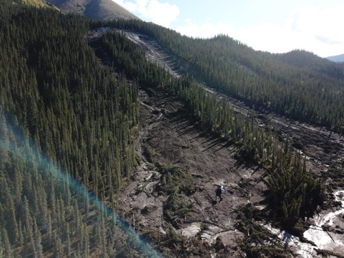
Permafrost related landslides, Kluane Range, Yukon
Permafrost related landslides, such as active layer detachment slides (ALDS), appears to be increasing in frequency, possibly associated with climate change. As part of his terrain mapping project, Crey Ackerson’s MSc thesis will try to determine if the frequency of ALDS in Kluane Range, SW Yukon is increasing. Recent slides, including a large cluster that occurred August 17, 2020, were mapped, photographed and visited. Older slides will be identified on historical air photo coverage, providing 10-20 year time slices starting in 1946, and satellite imagery from 2001 to present. The number, area and distribution of ALDS will be made for each time slice to determine changes in frequency and compared to regional climate data.

How to effectively communicate information before, during and after a natural hazard emergency?
Although British Columbia is subjected to multiple natural hazards (e.g., wildfires, landslides and floods), only about 13% of British Columbians have completed their emergency response plans. To encourage emergency preparedness in BC, we are cooperating with local communities, emergency managers, scientists, and computer engineers, to figure out the most effective and appropriate ways to communicate natural hazard information.
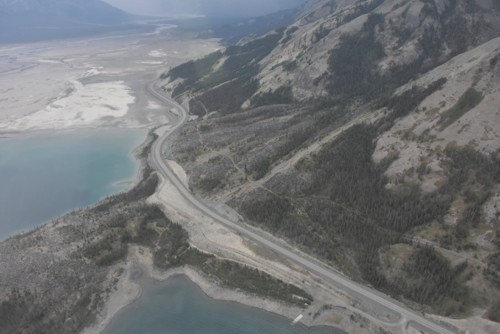
Dating Landslides Along the Eastern Denali and Duke River Fault System, Kluane Lake, Yukon
The Denali Fault system is an intracontinental, dextral strike-slip and thrust system that extends southeast from northwestern British Columbia, through Yukon and into Alaska. This fault system has produced large historic earthquakes, but older events are not well constrained. Nora Whelan’s MSc will determine the ages of rockslides in SW Yukon to see if they were triggered by earthquakes along the Denali system. Dating of these landslides will be by terrestrial cosmogenic nuclides (10Be and 36Cl), radiocarbon, and dendrochronology. If several landslides have the same age, it is likely they were triggered by ground shaking from an earthquake.