A Three Neighbourhood Analysis of Objective and Perceived Walkability
Group 4
Grandview Woodlands, Hastings-Sunrise, and Fraserview
Introduction
What is the purpose of the research project?
Introduction
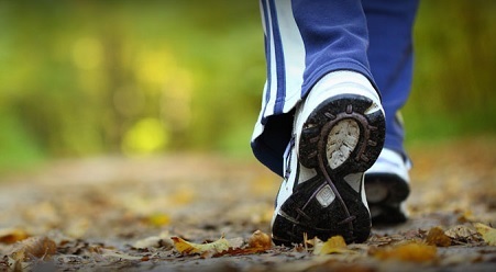
The walkability of a certain neighbourhood influences the potential for physical activity within that neighbourhood, and can be measured through an objective or subjective means. This paper compares objective vs. perceived walkability for the Grandview Woodlands, Hastings Sunrise, and Fraserview neighbourhoods in Vancouver, BC, Canada. Objective walkability will be measured and mapped using GIS, based on a multi-criterion evaluation encompassing land use mix, dwelling density, and connectivity. The perceived walkability of each neighbourhood will be calculated through the use of an altered NEWS-A environmental scan. These two approaches will be applied using a stratified random sampling method to assure that the sample points are dispersed throughout the neighbourhoods. The interpolation method of kriging will be used to determine the influence of distance for the walkability scores. These scores are significant to the Vancouver City Council’s, Sustainable City of Sustainable Neighbourhoods Project.
- Client: Dr. Nadine Schuurman & Aateka Shashank
- Role: Academic research and study on walkability in Metro Vancouver
- Year: 2016
Data Collection
Data we collected and used

Data Collection and Management
This page contains all of the data and data types that were used in the analysis.
Methodology
How it is done

Methodology
This section contains the information regarding the methods that were used to undergo our analysis.
Results
What we archived

Results
This section describes the results found from our analysis.
Conclusion
What we learned

Conclusion
The conclusion is as follows...
Reference
List of articles we used

Reference
This section includes both the literature and data references that were used in this research.
About us
We are students from Simon Fraser University presenting our research project for GEOG 455- Theoretical and Applied GIS in Spring 2016. Our group members are:
Trung Ngo
BA Environmental Geography from SFU (to be completed 2017)
Certificate in Spatial Information Systems from SFU (to be completed 2017)
Academic interests:
Environmental Protection
Social and Environmental Justice
Sustainable Futures
GIS and Database Management
Geoff Price
ADVG Diploma from TRU (2011)
BA Environmental Geography from SFU (in progress)
Certificate in Spatial Information Systems from SFU (in progress)
Academic interests:
Human Interactions With Nature
GIS & Outdoor Recreation
GIS & Resource Management
Walter Homewood
BA Archaeology from SFU (2014)
Certificate in Cultural Resource Management from SFU (2014)
Certificate in Spatial Information Systems from SFU (to be completed 2016)
Academic interests:
The use of GIS in Cultural Resource Management
Cultural Landscapes
BC Archaeology
Gayatri Allard
BA Environmental Geography from SFU (2016)
Certificate in Spatial Information Systems from SFU
(to be completed in 2017)
Academic interests:
Resource and Environmental Management
Geography and Spatial Information Systems
Environmental Toxicology
- Institution: Simon Fraser University, Canada
- Course: GEOG 455- Theoretical and Applied GIS
- Professor: Dr. Nadine Schuurman
- Term: Spring 2016
- Final Report