Care Home Placement
|
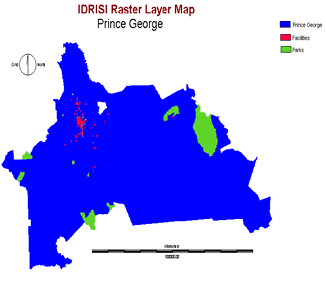
Spatial Analysis
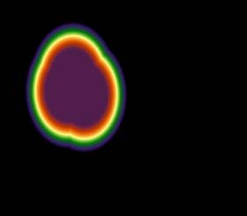
The extracted vector ArcGIS files were imported into IDRISI using the software specific format to import ERSI shapefiles. During the process the projection system was changed to Universe Transverse Mercator 10n. Then all file the social consideration, parks and the Prince George locality were converted to raster using RASTERVECTOR. As there was no template to copy spatial perametres from, I chose to define the parametres myself. I used INITIAL to define the projection as UTM 10n with a map unit of 1m and then by working out the difference between the maximum and minimum x and y coordinates I entered the number of columns as 4575 and the number of rows as 4000. This defined the size of the raster coverage. |
|||||||||||||
 |
|||||||||||||
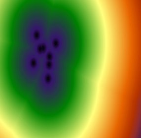
| To create the surfaces for analysing suitability I created DISTANCE surfaces from the social consideration and park raster images. Below I have included a distance map for each of the factor sets: medical and emergency facilities, high, medium, and low priority social considerations. | |||||||||||||
 |
|||||||||||||
| The above image is the distance surface from a firehall an emergency facility. | |||||||||||||
 |
|||||||||||||
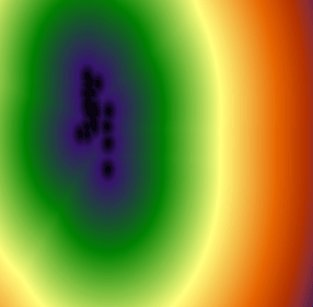
| The above image is a distance from a elementary school surface a medium priority social consideration. | |||||||||||||
 |
|||||||||||||
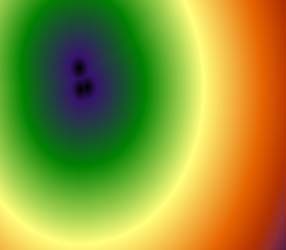
| The above image is a distance surface from a golf course a low priority social consideration. | |||||||||||||
 |
|||||||||||||
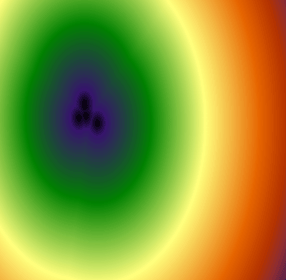
| Above is the distance surface image for distance from a reccentre which is a high priority social consideration.
To be able to use the Prince George Raster coverage in Decision Wizard, CONVERT was used to change the raster from integer to binary. I then began the Decision Wizard. A new Decision Wizard file was created and its objective set to "location". Prince George binary raster coverage was added as the constraint. Then the factor distance rasters were entered as factors and then standardized them using FUZZY. All images were standardized using a sigmoidal monotonically decreasing suitability range. I chose this as elderly patient's ability to walk to a facility decreases directly with an increase in distance. |
|||||||||||||
 |
|||||||||||||
| The above image is the factor image for firehalls. The medical and emergency facility factor images were created using the control points c at 5000 and d at 6000. This meant a suitable area for a care home would be within 5 km of medical and emergency services.
The high priority social consideration factor images were created using the control points c at 500and d at 6000. This meant a suitable area for a care home would be within 0.5 km of high priority social considerations. Unfortuantly I lost the disk containing my data so I cannot present a factor image for a high priority social consideration. |
|||||||||||||
 |
|||||||||||||
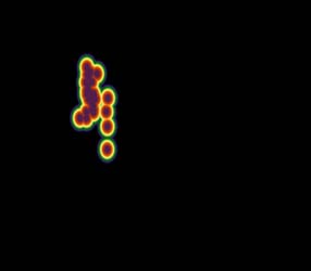
| The above image is the factor image for elementary schools. The medium priority social consideration factor images were created using the control points c at 1000 and d at 6000. This meant a suitable area for a care home would be within 1 km of medium priority social considerations. | |||||||||||||
 |
|||||||||||||
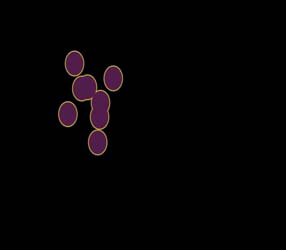
| The above image is the factor image for elementary schools. The low priority social consideration factor images were created using the control points c at 15000 and d at 30000. This meant a suitable area for a care home would be within 15 km of low priority social considerations.
The factor images were then combined in a multi criteria evaluation. The factor images were assembled into one map image within the contraint of Prince George. |
|||||||||||||
 |
|||||||||||||
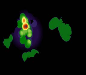
| The above is the most suitable area coverage using a ramp of suitability from 0 to 255. | |||||||||||||