BIOGEOCLIMATIC ZONES
In British Columbia, areas with similar climate, vegetation, and soil
types are
often grouped together as biogeoclimatic zones. There are 14
zones in total:
i) Alpine
Tundra ii)
Spruce-Willow-Birch
iii) Boreal White and Black
Spruce iv) Sub-boreal Pine-Spruce
v) Sub-boreal Spruce vi)
Mountain Hemlock
vii) Engelmann Spruce - Subalpine
Fir viii) Montane Spruce
ix)
Bunchgrass x) Ponderosa
Pine xi) Interior Douglas Fir
xii) Coastal Douglas
Fir xiii) Interior Cedar-Hemlock
xiv) Coastal Western Hemlock
These zones can be further divided into subzones used to describe
slight variations between different areas of each zone (e.g. xh1
bunchgrass (drier) vs xw bunchgrass (wetter) ).
For more information on these biogeoclimatic zones, here are two
sites which are particularly good:
Selkirk College: Selkirk.bc.ca/RR/bec/zones
(site gives general overview of biogeoclimatic zones plus has a map)
BC Ministry of Forests Website On
Biogeoclimatic Zones. http://www.for.gov.bc.ca/hre/becweb/index.html
(this site contains information on the history of biogeoclimatic zones,
various features of the biogeoclimatic zones, and interactive map of
biogeoclimatic zones)
Kamloops
Forest Region:
The Ministry of Forests in British Columbia, for administrative
purposes, has broken down various parts of the province into forest
regions. These regions are named based on geographic features
(e.g. large cities) and are quite large in size. There are six
regions in total:
i) Kamloops Forest
Region ii) Prince Rupert Forest
Region.
iii) Cariboo Forest
Region iv) Prince George
Forest Region
v) Nelson Forest
Region vi) Vancouver
Forest Region
These regions contain many biogeoclimatic zones and subzones. The
Kamloops Forest Region is very diverse in its geographical
properties.
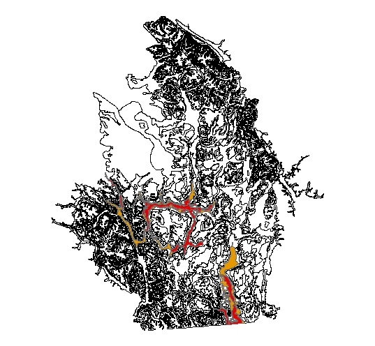
This is a map of British Columbia (the area in red represents the
Kamloops Forest District)
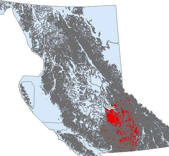
This is a map of the Kamloops Forest District created using ArcGIS and
edited using Freehand.
The Kamloops Forest Region is a region of contrasts. Some areas,
such as the Alpine Tundra zones, are cold and very snowy. Other
areas, such as the Bunchgrass zones, have Canada’s hottest summer
temperatures and some of the driest conditions in Canada.
Alpine Tundra Zone:
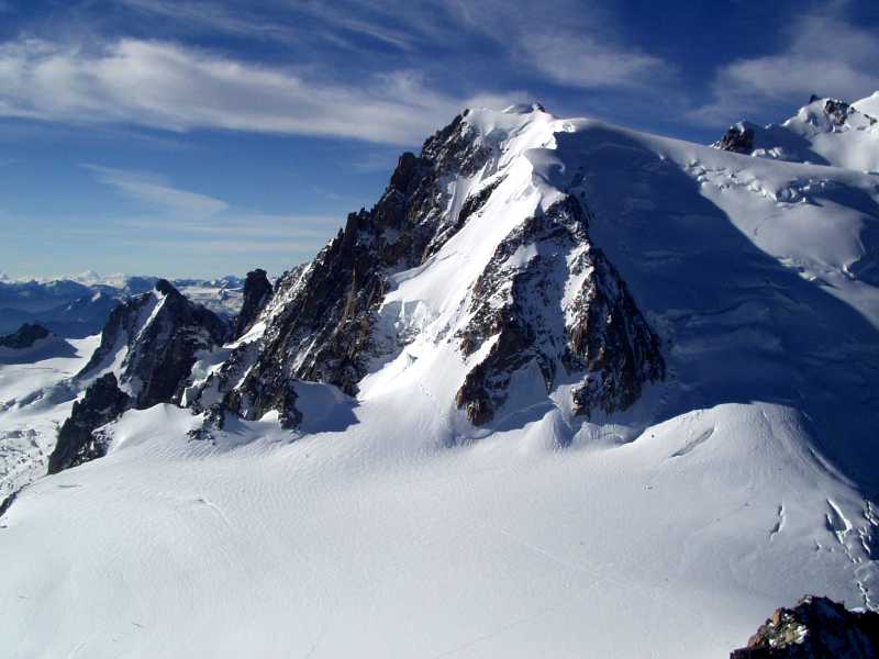
Photo: from www.moorewallpaper.com
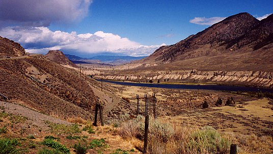
Bunchgrass Zone:
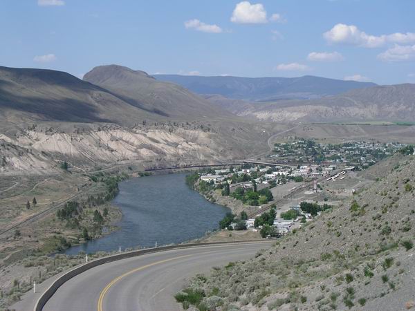
Photo: from www.goldcountry.bc.ca
Coastal Western Hemlock Zone:
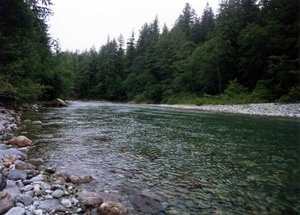
Photo: from www.rodjules.com
Englemann Spruce - Subalpine Fir Zone:
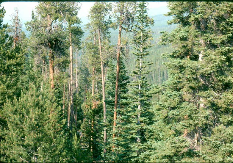
Photo: from www.tarleton.edu
Interior Cedar-Hemlock Zone:
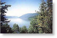
Photo: from www.mabellakevacations.com
Interior Douglas Fir Zone:
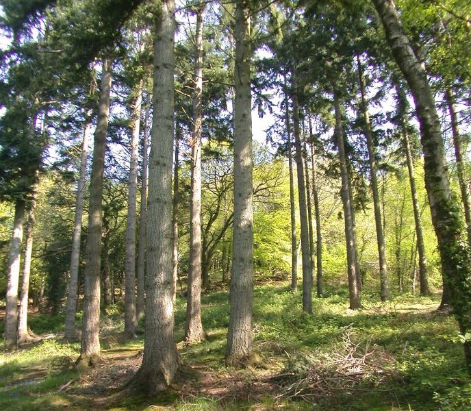
Photo: from
www.offwell.free-online.co.uk/tree_gallery/douglas_fir/douglas_fir.html
Montane Spruce Zone:

Photo: from www.karenmissire.com/natural%20surroundings.html
Ponderosa Pine Zone:
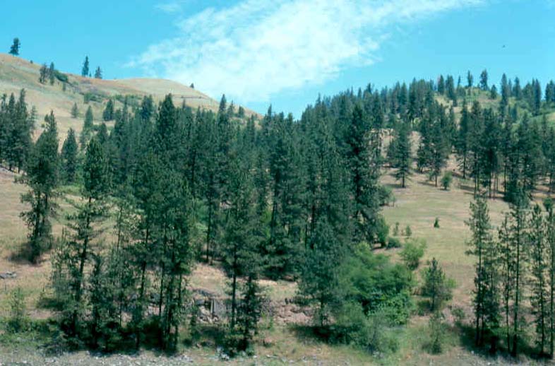
Photo from: www.tarleton.edu
Subboreal Spruce Zone:
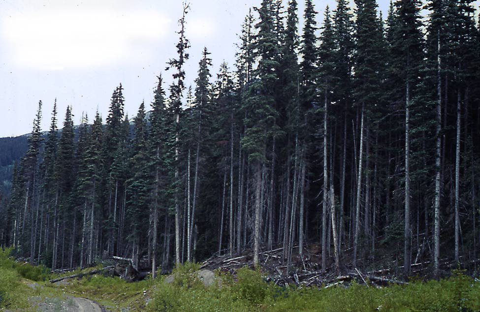
Photo from: sis.agr.ca/cansis/taxa/landscape/veget
Climatic Data Was
Added to Each Subzone of the Zones found in the Kamloops Forest Region:
(Present Climate Data);
1) Frost-Free Period
(Shortest)
(Longest)
AT (minimum 4 days)
CWH ds1 and ms1 (178 days)
2) Growing Degree Days
(Fewest)
(Most)
AT (200)
BG Xh2 (2269)
3) January Mean Daily Minimum Temperatures (in Kelvin)
(Lowest)
(Highest)
AT (251 K)
CWH ds1 and ms1 (268 K)
4) July Mean Daily Maximum Temperatures (in Celsius)
(Lowest)
(Highest)
AT (12)
BG Xh2 and Xh1
(Both 30)
5) Average Annual Precipitation (in mm)
(Lowest)
(Highest)
BG Xh2 (242)
MH mm2 (4000)
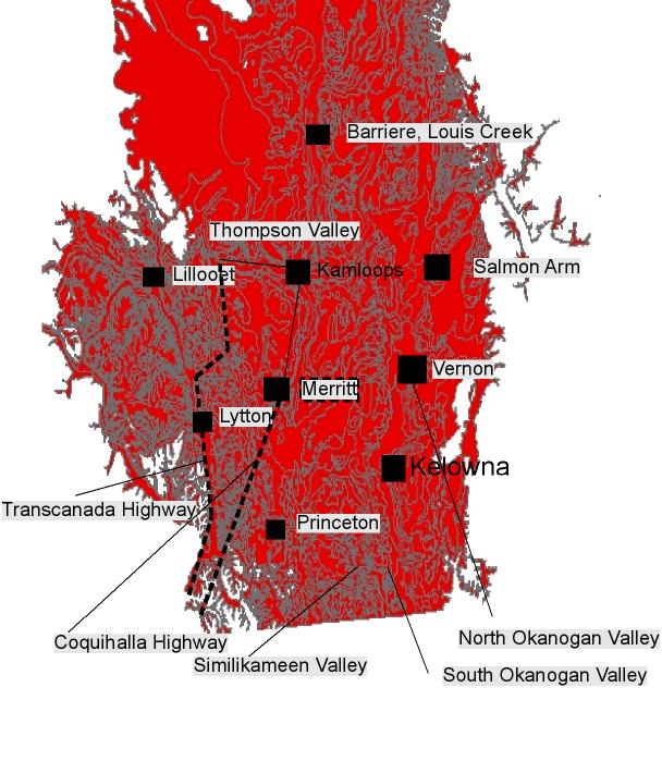
Here is a map of the BG and PP zones in the Kamloops Forest Region,
zones with the warm, dry climatic conditions desirable for apple
and grape-growing: *Brown Areas are Ponderosa Pine areas at present and
Red Areas are Bunchgrass Zones at Present.
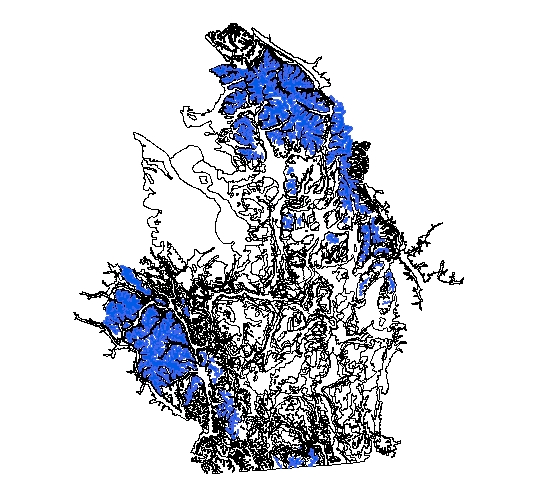
Here is a map of the AT zone in the Kamloops Forest Region, a zone in
which climatic conditions are cold and wet (i.e. we wouldn`t
expect wine-grape and apple growing to be good here): *Blue areas are
AT.
For more information on the zones and subzones found within the
Kamloops Forest Region and the Kamloops Forest Region itself, here is a
good resource:
Forest Science Handbook and Abstract
Page on the Ministry of Forests Website (http://www.for.gov.bc.ca/hfd/pubs/Lmh.htm)
(This website contains various documents (mostly in PDF format) about
various forest regions and issues of interest to forest regions)
Here is the link to the “Guide to Site Identification and
Interpretation for the Kamloops Forest Region”:
(http://www.for.gov.bc.ca/hfd/pubs/Docs/Lmh/Lmh23.htm)
This guidebook consists of climatic, soil, and vegetation information
on every zone and subzone found within the region.
BacktoIndex