Methodology
Study Design and Hypothesis:
The question: which campground should I camp at?
I am looking for a campground that: is on the ocean, allows dogs, close to a surf spot, has alot of trees, is close to where a river enters the ocean (for better fishing), is located on the northern 1/3 of the coastline, has lots of hiking in the area, has showers, is not over $20 US / night, are not cement campsites, are not walk-in campstes, and are not really close to a city / town.
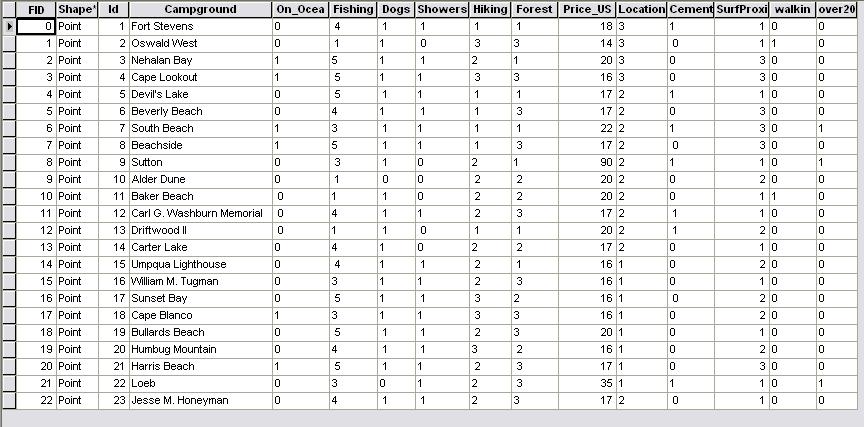
To start I made a basemap of the Oregon West Coast. I plotted 23 campgrounds and 19 surf spots. I had to first narrow down the campgrounds to the ones that are very close or on the ocean (there are hundreds of campgrounds in Oregon). I made fields in the attribute tables for all of my contraints and factors. The constraints were labled 1 or 0 (boolean) depending on wether or not they had what I was looking for. The factors were weighted 1 - 3, and 1 - 5 depending on how well they fit into the analysis. 1 being the lowest.
Campground Attributes
Once I finally had all the information I needed to start the analysis, I was ready to start to rasterize my shapefiles and begin the MCE. This is where the trouble began.