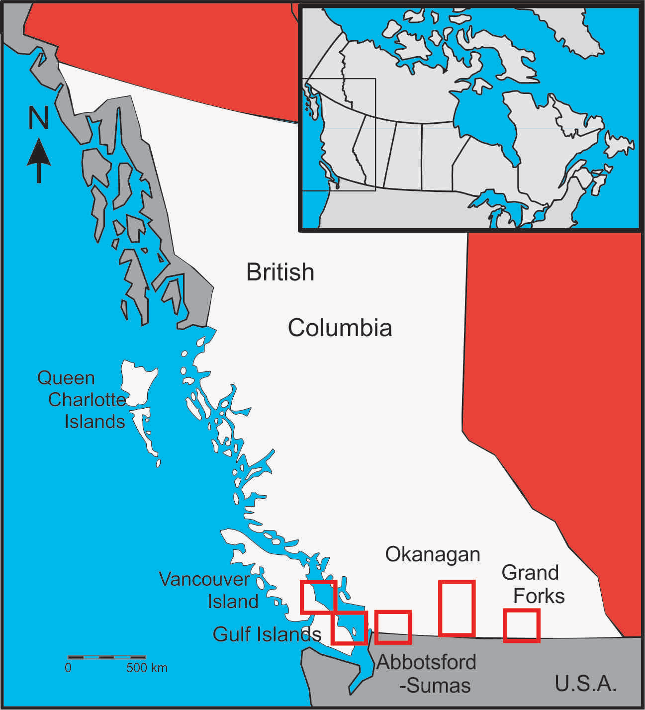
The hydrologic cycle is strongly controlled by climate. Therefore, changes in climate can be expected to influence water cycles and water stores globally. Our research has focused primarily on understanding the potential impacts of climate change on groundwater systems, specifically groundwater recharge, the interactions between groundwater and surface water, and the security of water. We have conducted many modeling studies in British Columbia, including the Grand Forks aquifer, the Abbotsford-Sumas aquifer, the Okanagan Valley, the Gulf Islands and the Cowichan Watershed (see map) The study areas represent a range of current hydroclimatic regimes, spanning wet to semi-arid to arid, and focus on both alluvial aquifers and bedrock aquifers. Similar approaches were used to assess climate change impacts in each aquifer system, although over the course of these studies we refined our techniques, bringing in greater spatial resolution, a wider selection of global climate models and downscaling methods, and more rigorous modeling techniques. Lower flows and extended low flow periods during the late summer and early autumn are of particular concern as they threaten not only water supplies, but also the health of wetlands and aquatic habitats. Combined with an increasing water demand due to a rapidly growing population, this is a cause of concern, particularly for the southern part of BC. With extended low flow periods, streams may be more strongly influenced by interaction with groundwater.
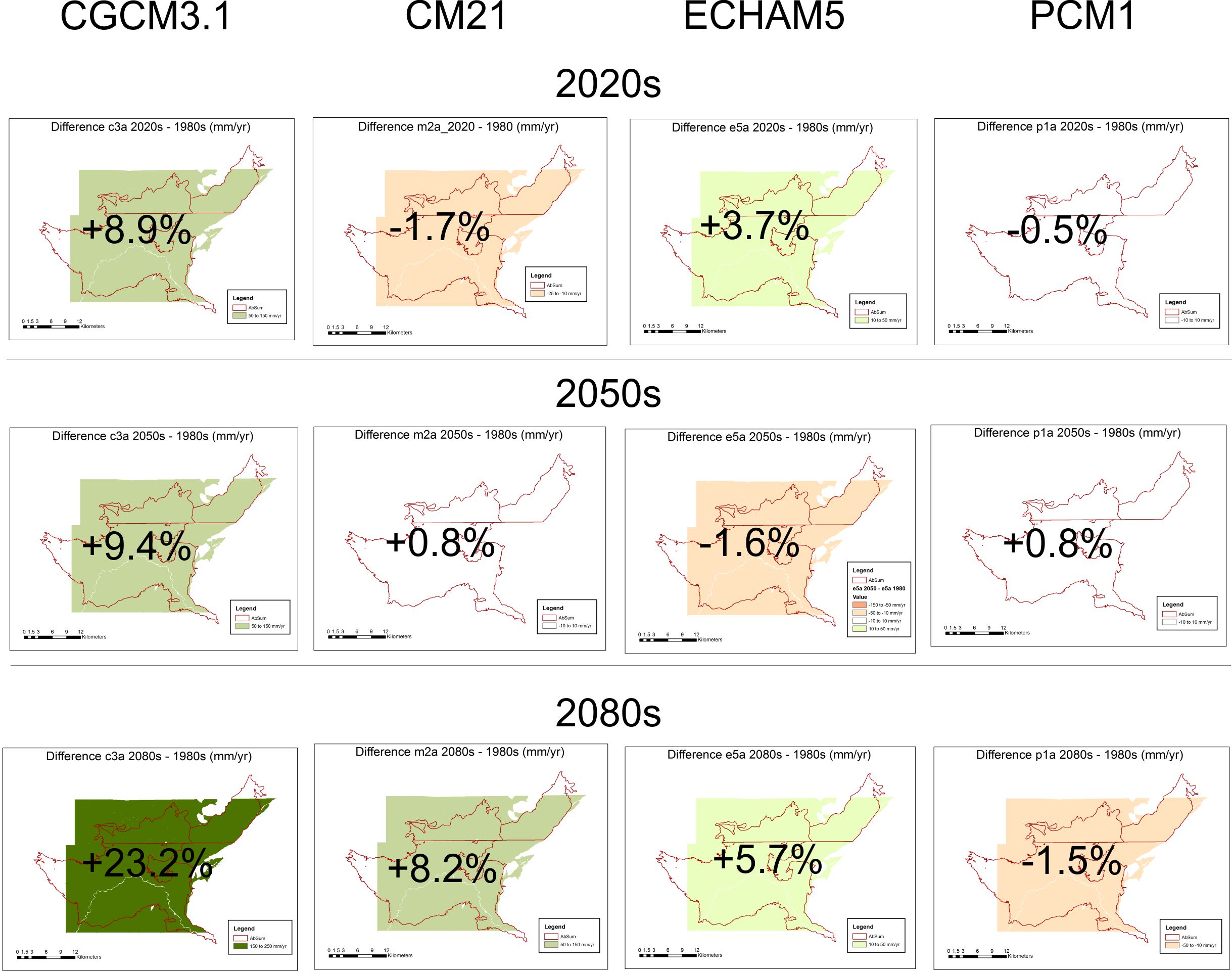
Recharge to aquifers was simulated in the Abbotsford-Sumas aquifer (BC and WA) using climate data projections from four global climate models (GCMs). The figure above shows the difference in projected mean annual recharge for three future time periods based on these four GCMs. The results point to the high uncertainty in GCM projections and the need to consider a range of GCMs when making hydrologic predictions. (Allen, Cannon, Toews and Scibek, 2010: Water Resources Research).
|
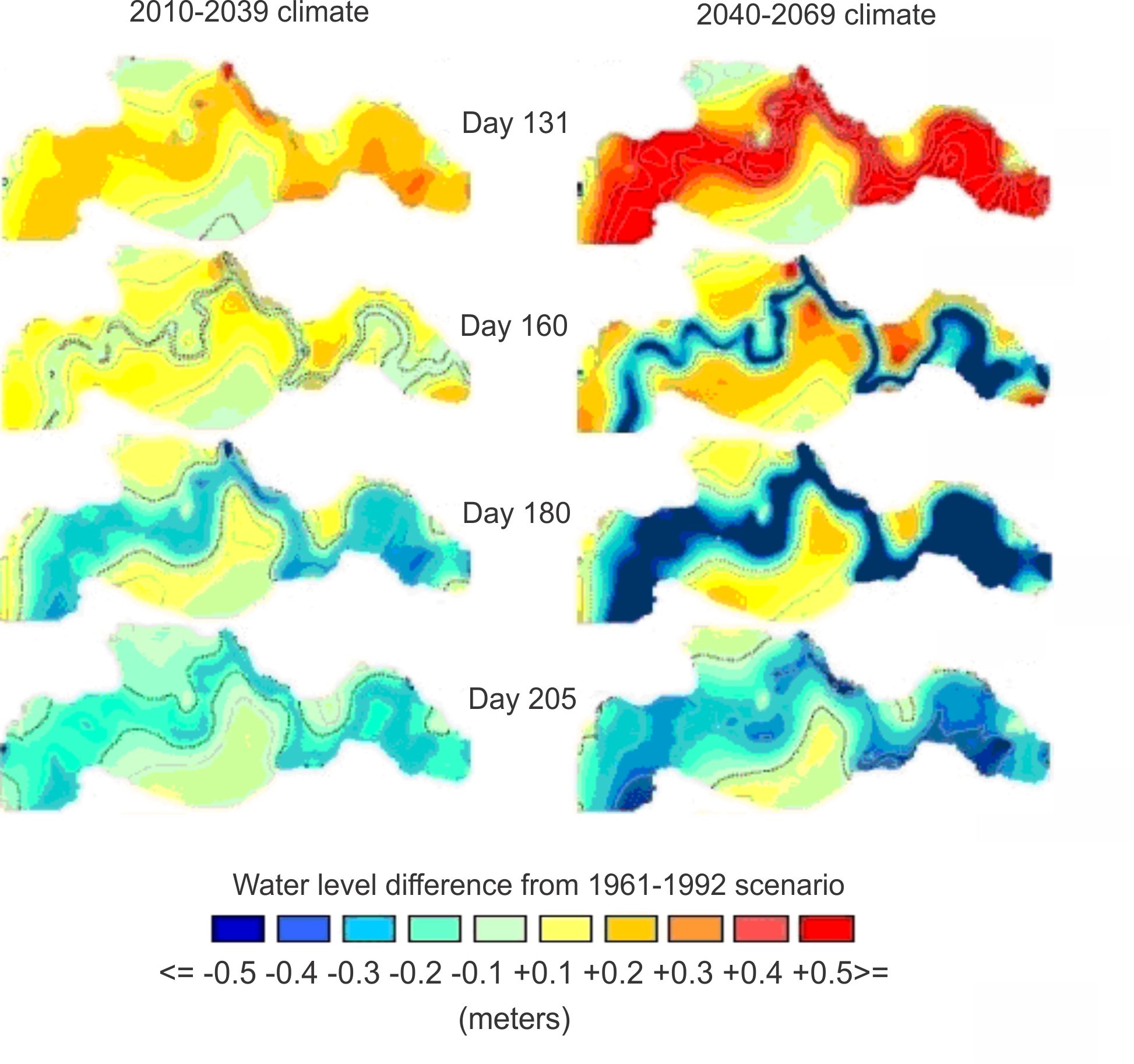
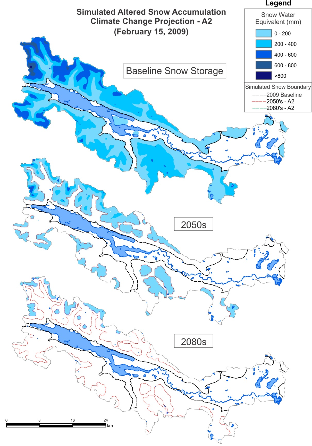
The figure above shows a series of maps of simulated groundwater levels in the Grand Forks aquifer. The left column shows the difference in groundwater levels projected for the 2020s for different days of the year relative to current groundwater levels. The right column shows the results for the 2050s. During the spring (e.g. day 131) groundwater levels are projected to be higher on the same day of the year due to higher streamflows from earlier snowmelt. During the late summer (e.g. day 180) groundwater levels are projected to be lower. This aquifer is strongly influenced by flows in the Kettle River and the aquifer generally responds synchronously with river stage (Scibek, Allen and Whitfield, 2007: Journal of Hydrology) In the Cowichan Watershed on Vancouver Island, a drastic decrease in snow accumulation is projected for the 2050s and 2080s. The snowpack becomes increasingly restricted to higher elevations, controlled largely by the temperature lapse rates, as temperatures within the valley are largely above 0°C. Both the spatial extent of the snowpack and the amount of accumulation within snowpack areas are greatly reduced. In general, in the Cowichan, the freshet will occur approximately 44 days earlier by the 2050s, and >100 days earlier by the 2080s. The simulated earlier freshet season results in increased peak flows during the winter months, and lower flows during the summer and fall.
|