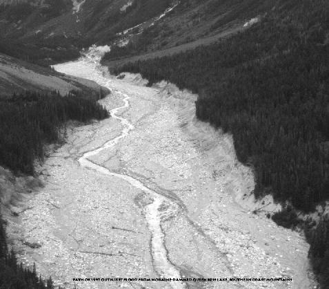
Path of 1997 outburst flood from moraine-dammed Queen Bess Lake, southern Coast Mountains, BC
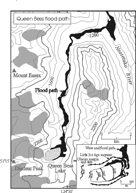
This photo shows the valley floor below Queen Bess Lake, ravaged by the outburst flood of July 1997. A large avalanche of ice from Diadem Glacier struck Queen Bess Lake and produced a huge displacement wave that overtopped the Little Ice Age moraine impounding the lake. The displacement wave and outflow through a rapidly growing breach produced a large, although short-lived flood that was recorded more than 100 km away at the mouth of Bute Inlet. Outburst floods from moraine- and glacier-dammed lakes, although relatively rare, pose a hazard to development in high mountain valleys. Similar floods in other parts of the world (e.g., Nepal, Bhutan, Peru) have caused much loss of live and property damage. (photo by John Clague).
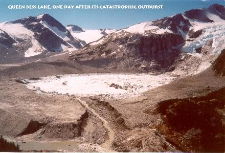
Queen
Bess Lake, one day after catastrophic outburst
Queen Bess Lake
is filled with icebergs derived from the glacier avalanche that triggered the
outburst of July 1997. Note icebergs stranded at the pre-outburst level
of the lake, which is 8 m higher than the level of the lake when the photo was
taken. Also note the breach in the moraine dam in the foreground.
The present level of the lake is controlled by a bedrock sill at the downvalley
end of the breach. (photo courtesy of Interfor Ltd.).