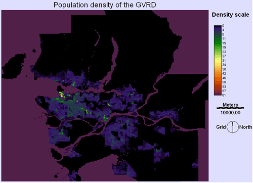
HUMAN POPULATION DENSITY LAYER
Originally, human density determined on ARCMap. Dissemination areas was joined with the GVRD land use map to create a density map. This was then converted to raster and imported into IDRISI where it is used as a factor on the MCE.
| Home | Background | Sources | Methodology | Spatial Analysis | Problems | Final plan |
|---|