| Water resources around the world are periodically impacted by droughts, which can reduce water available for human use and put stress on the environment. The effects of long-term changes in climate on groundwater resources are difficult to determine, as most observed groundwater level records are short (< 60 years). However, observational records can be extended using proxy records such as tree ring widths.
This research used two methods to study past groundwater changes (1850-2002) in the North American Cordillera: a nested principal component regression technique to reconstruct past groundwater levels from tree ring widths, and a nonparametric approach which reconstructs daily temperature and precipitation based on annual tree ring widths and then uses the reconstructed climate timeseries as input to a hydrological model for simulating past groundwater levels. The past spatial and temporal occurrence of droughts in the North American Cordillera is examined, as are the associations between past groundwater levels and climate teleconnections. A short description of three studies following these methods as a part of this research are provided below. Additional information can be found in: Hunter, S.C. (2021). Reconstructing groundwater levels from tree ring widths in the North American Cordillera. (Doctoral Dissertation). Simon Fraser University, Burnaby, British Columbia, Canada. |
|
 |
|
Study 1: Nested principal component regression approach: exploring tree ring-groundwater relationships for groundwater level reconstruction |
|
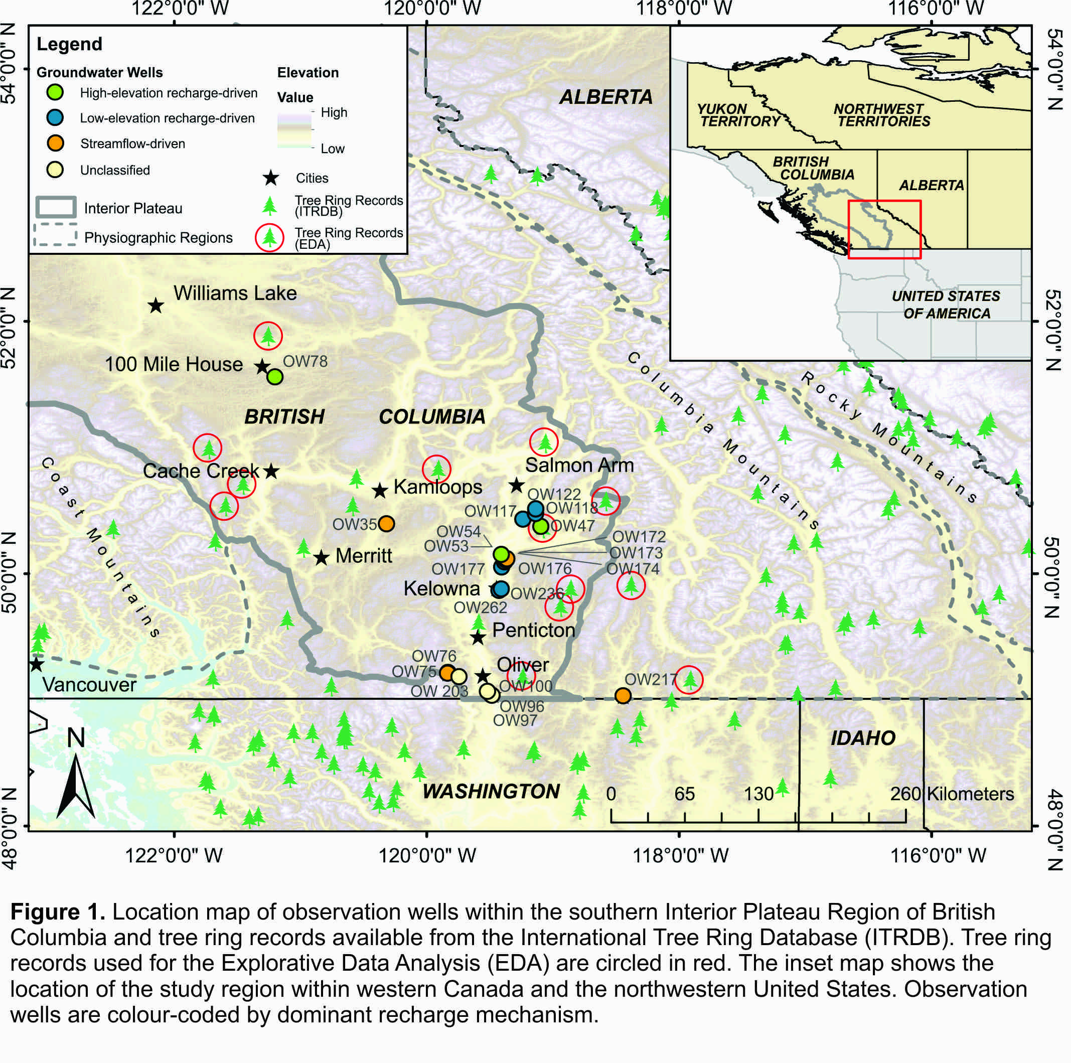
This study explored the use of tree ring widths for reconstructing groundwater levels in the snowmelt-dominated Southern Interior region of British Columbia, Canada (Figure 1). This study aimed to outline the best methods for tree-ring reconstruction of groundwater levels in this region, considering both the appropriate selection of groundwater observation wells (using a regional average of groundwater levels or dividing wells by recharge mechanism) and the search area for potential tree ring records (North American Ecoregions vs. a climatically-defined footprint).
|
|
Study 2: Nested principal component regression approach: reconstructing past groundwater levels in the North American Cordillera |
|
 |
|
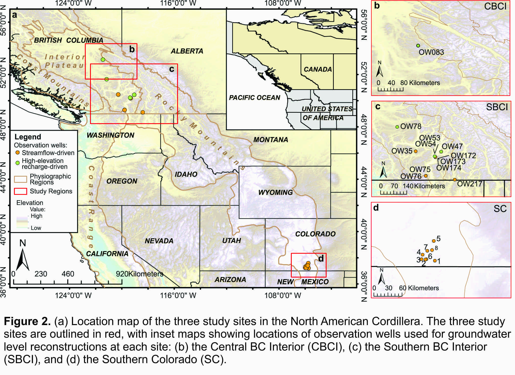
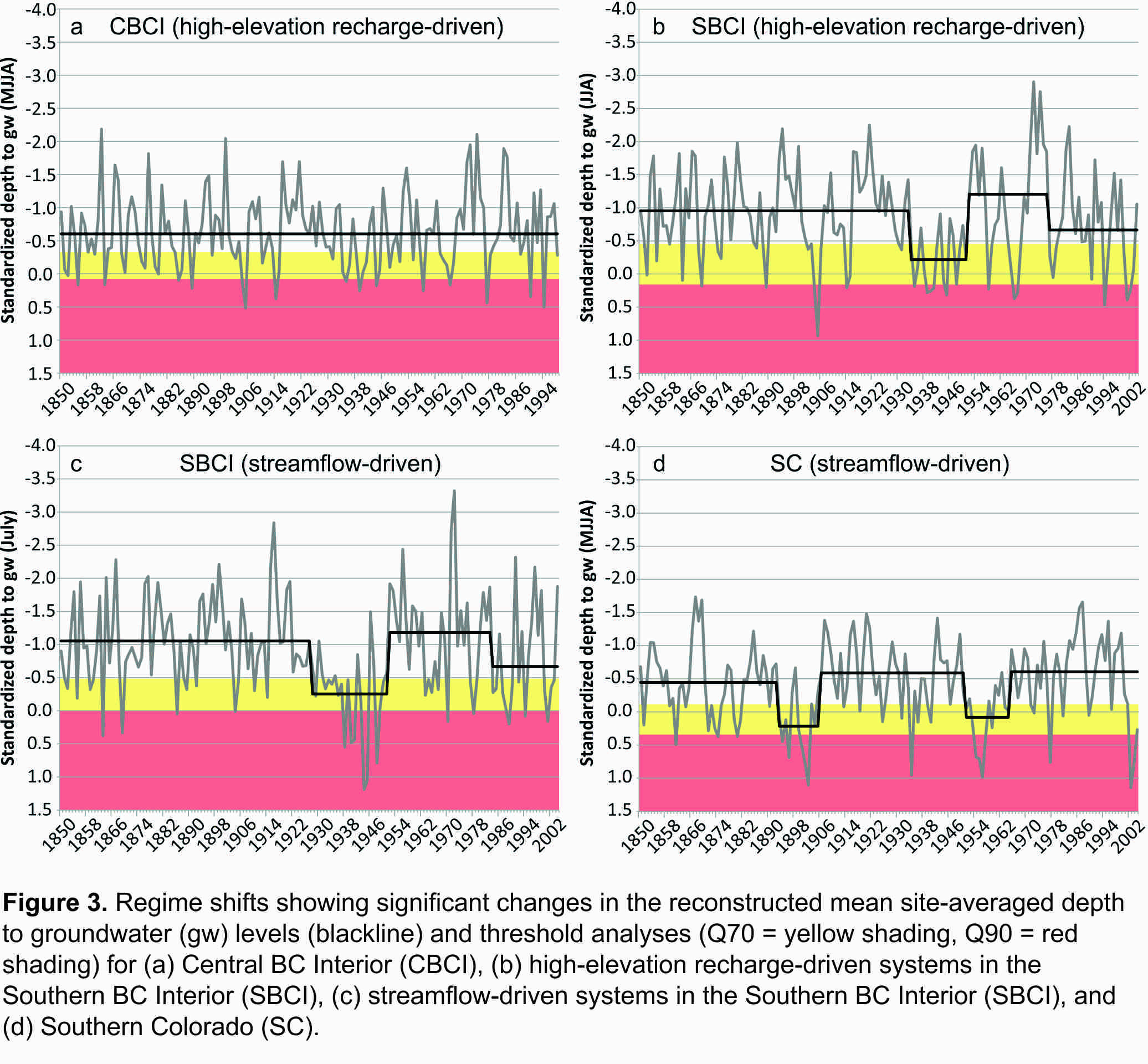
| This study involved using the methods defined in Study 1 to reconstruct groundwater levels for three regions in the North American Cordillera: the Southern BC Interior, the Central BC Interior, and Southern Colorado (Figure 2). These reconstructions were used to identify past periods of drought and explore past drivers of drought using a cross-correlation analysis. Severe drought periods were identified as: 1890-1900 and 1950-1970 in Southern Colorado, 1920-1940 in the Southern BC Interior, and 1935-1945 in the Central BC Interior (Figure 3). Some of these past droughts were more severe than recent droughts, suggesting severe droughts could occur in the future, and may be exacerbated by recent trends in snowpack decline. The cross-correlation analysis showed that the El Niño Southern Oscillation was related to variations in groundwater levels in all three study regions throughout the period of the reconstructions. | |
 |
|
Study 3: Reconstructing groundwater levels using a nonparametric approach |
|
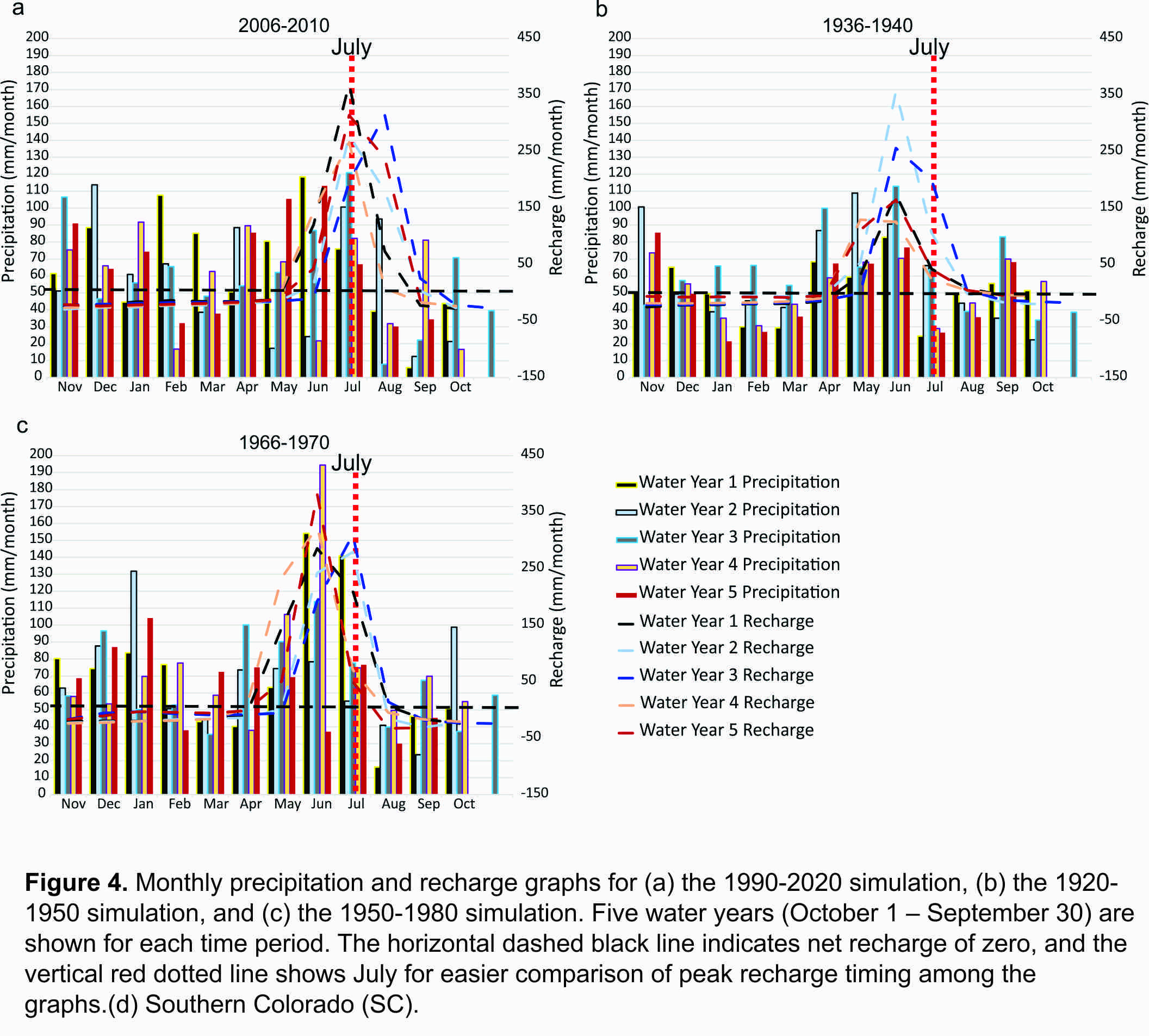
| This study involved modified an existing nonparametric approach to reconstruct past daily temperature and precipitation from tree ring records and then using the daily climate timeseries as input into an integrated hydrological model to simulate groundwater levels in the Upper Penticton Creek Watershed, located in the Southern BC Interior. Models were run for two paleo-periods (1920-1950 and 1950-1980), which represented a wet period and a dry period, respectively, and compared to a model calibrated to recent historical data (1990-2020). The results show that the timing of peak recharge varied between model simulations, with peak recharge occurring earlier in both paleo-simulations compared to the recent period (Figure 4), likely due to warmer spring (March-April) temperatures and earlier snowmelt. This research showed that the nonparametric approach can be used for creating paleo-groundwater simulations, but that it may not be appropriate for watersheds in arid climates due to a tendency to overestimate the number of consecutive days with rain in a month. | |
 |
|