History 321 Home
Historical Maps of Europe
Maps of the Holy Roman Empire
Imperial Circles
Ottoman Empire, 1481-1683
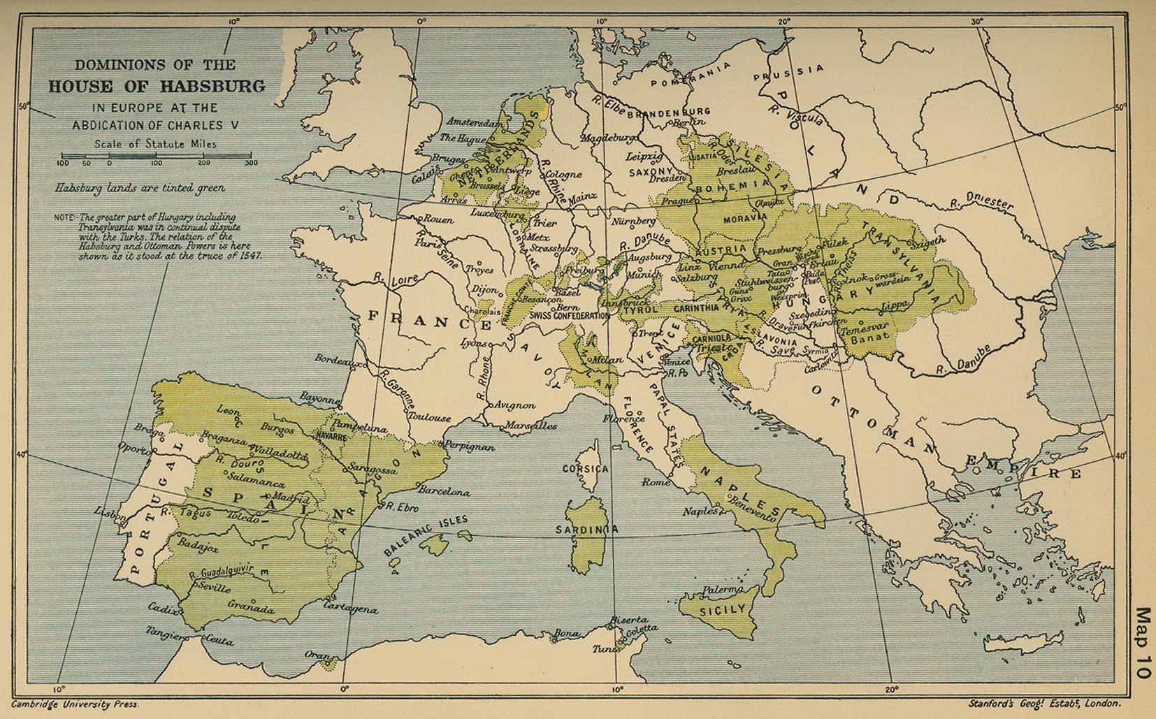
Habsburg Lands, 1547
Reference Maps on the Thirty Years War
Religious Divisions in the Holy Roman Empire
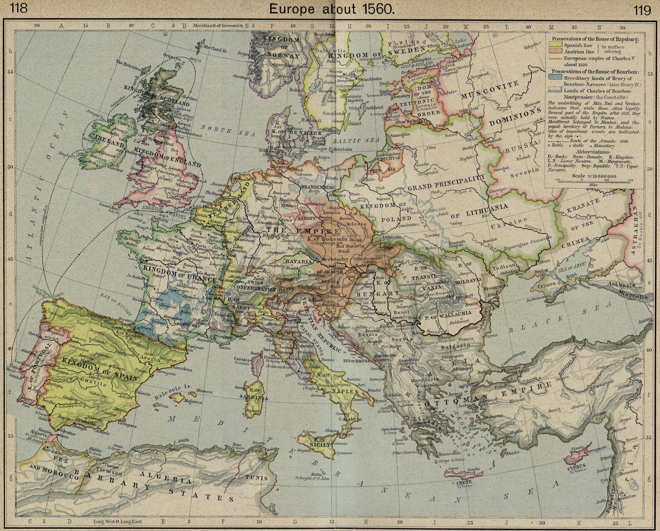
Europe about 1560 A good map for looking at Austria, Hungary, and Transylvania. Click on the map to zoom in.
Europe in 1580
Central Europe, 1618 (the map in Europe's Tragedy)
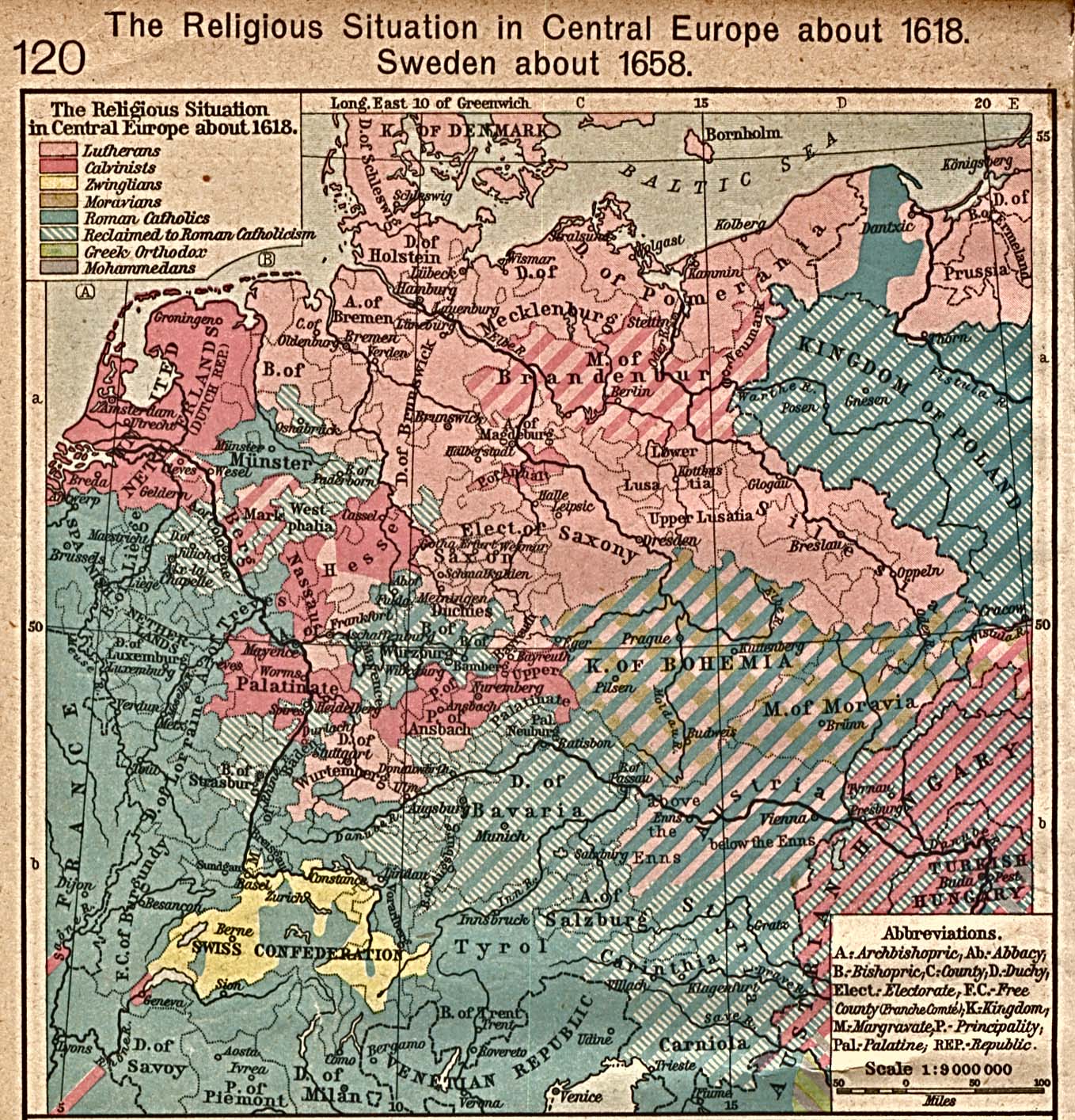
Religious Situation in Central Europe ca. 1618,
another version of the same map
Austria, 1648-1795
Habsburg-Ottoman frontier: 1. Eastern Hungary,
2. Habsburg / Ottoman Hungary, Croatia & Transylvania,
3. Transylvanina and environs, 1606,
4. Partium, 1570, 5. South-Eastern Europe, 1672
Rhenish Palatinate, 1512
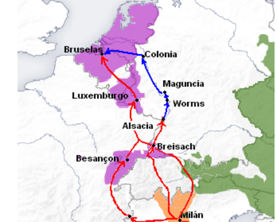
Spanish Road
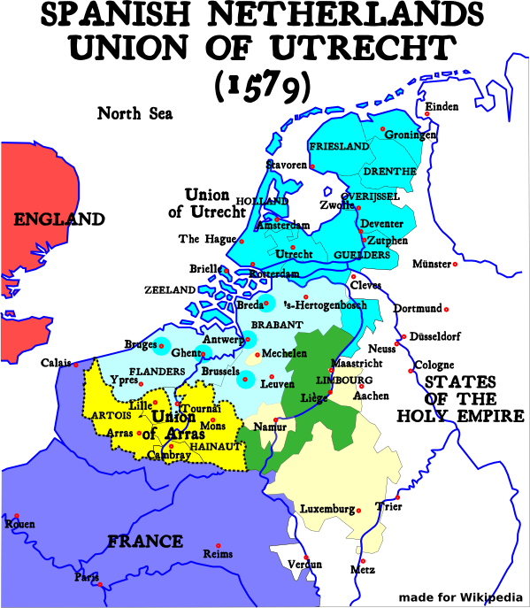
Dutch Revolt: Union of Utrecht / Arraas, 1579,
Twelve Years Truce, 1609
Duchy of Savoy (sixteenth century), Savoy and environs, 1627, Duchy of Savoy and environs, 1690
Venetian Republic
1. Baltic region,
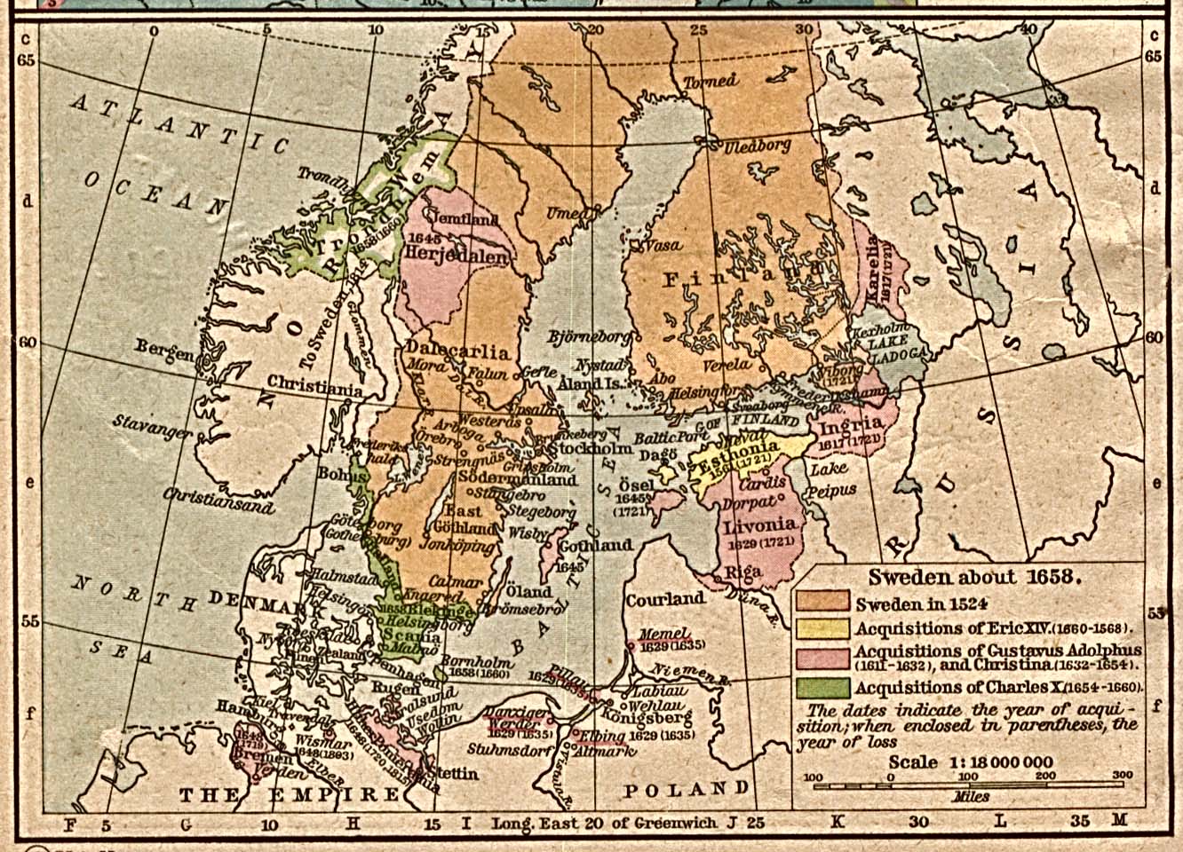
2. Sweden 1560-1660,
3. Sweden 1658.
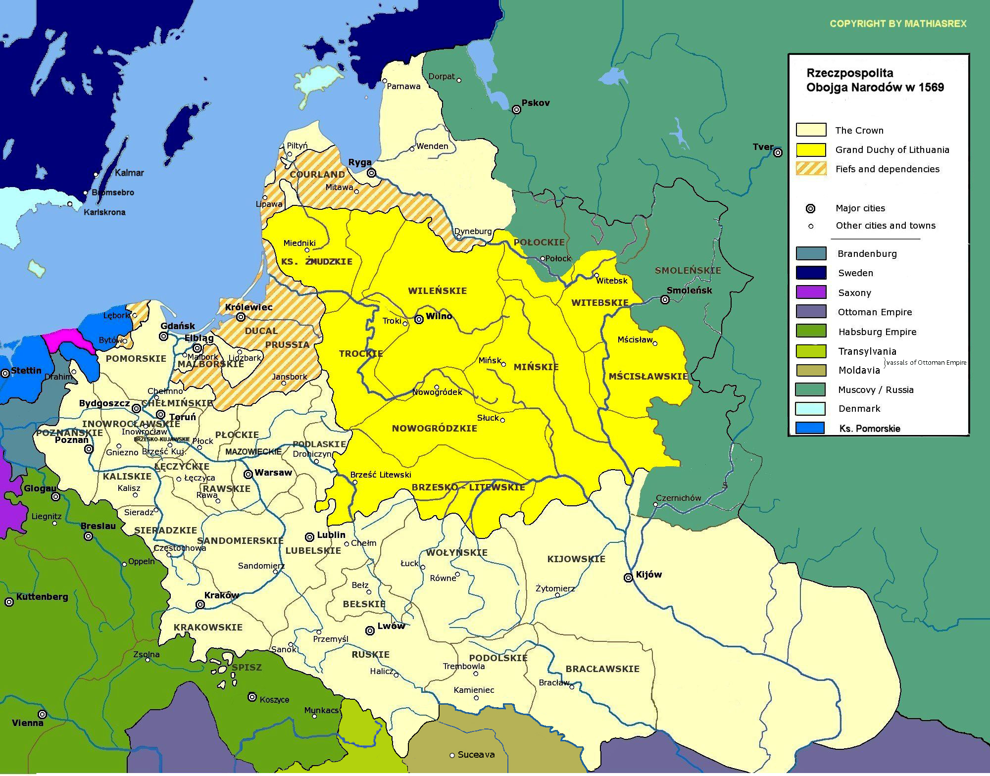
1. Poland and Lithuania: Union of Lublin (1569),
2. Another map of the Union of Lublin,
3. Polish-Lithuanian Commonwealth (1569-1667),
4. Polish-Lithuanian Commonwealth
Duchies of Jülich,
Cleves, Berg; Counties of Mark and Ravensberg (ca. 1540).
Note: Herzogtum (Hzm) = Duchy, Gft = County, Fürstbistum (Fbm) = prince bishopric
Uksok War
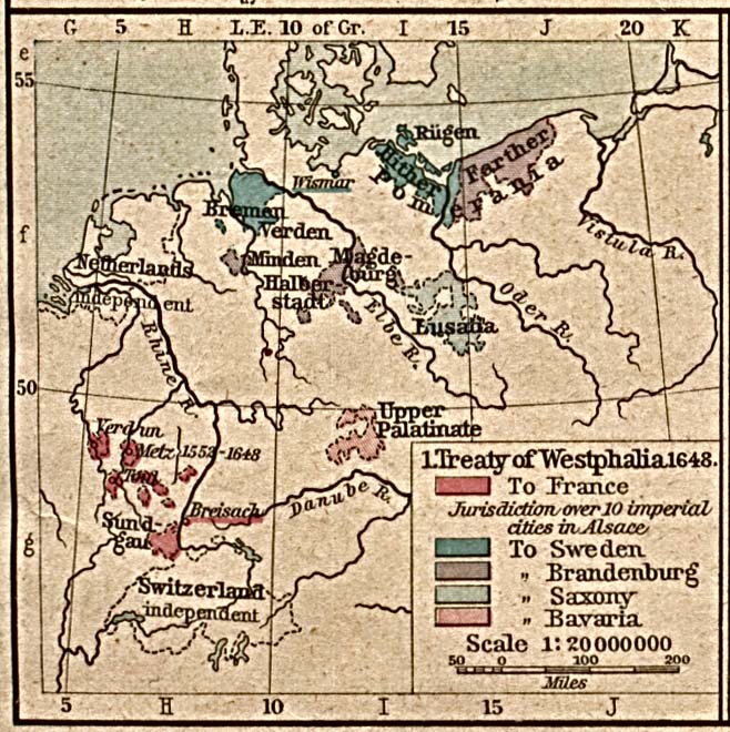
Treaty of Westphalia
Europe, 1648: Peace of Westphalia
-EN.svg)