Earthquake Hazard GIS Modelling in the Greater Vancouver Regional District
Results
Running the MCE on the four Geotechnical hazard maps (Soil Liquefaction, Soil Amplification, Slope Instability, and Earthquake Intensity) resulting in the following relative earthquake hazard map in the GVRD:
 |
25m DEM was then draped on the above relative earthquake hazard map to give the following:
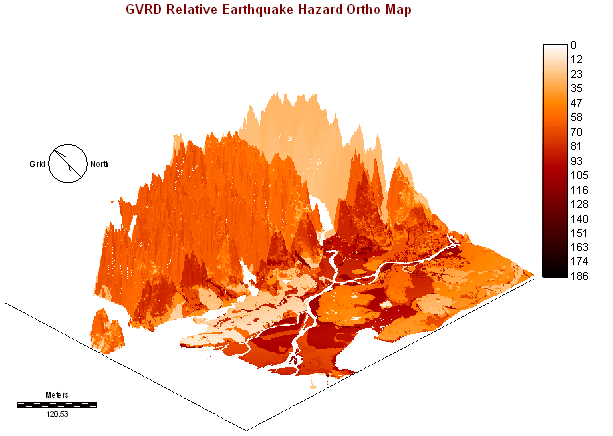 |
The relative earthquake hazard map was also ranked using the decreasing ranking module to see which areas are more dangerous compared to others where most dangerous = 1.00:
 |
NOTE: This web is created on Nov 19, 2002 by Carol Cheuk (Student #: 973003525) for course GEOG355 Project. It is optimized for resolutions of 1024x768 and above and requires the use of Microsoft Internet Explorer or Javascript enable browser for best results.