San Francisco Maps
California, USA
![]()
California, USA
![]()
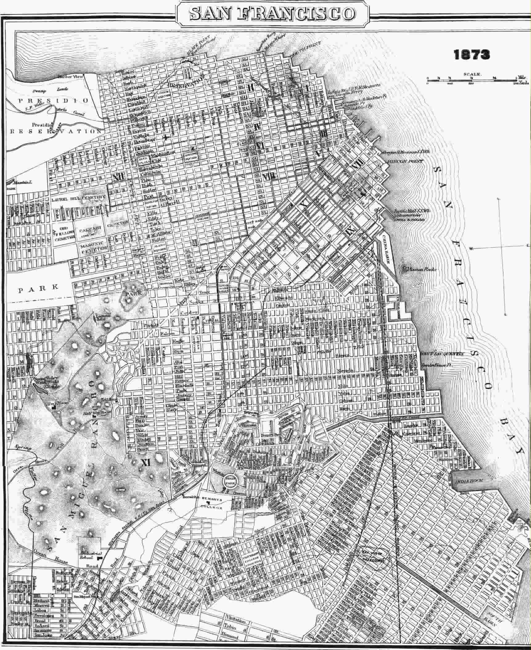 SF 1873 cable car map (by Val Golding)
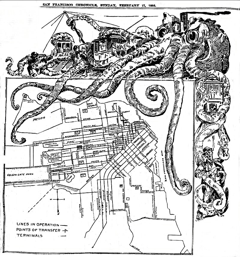 SF cable map 1893
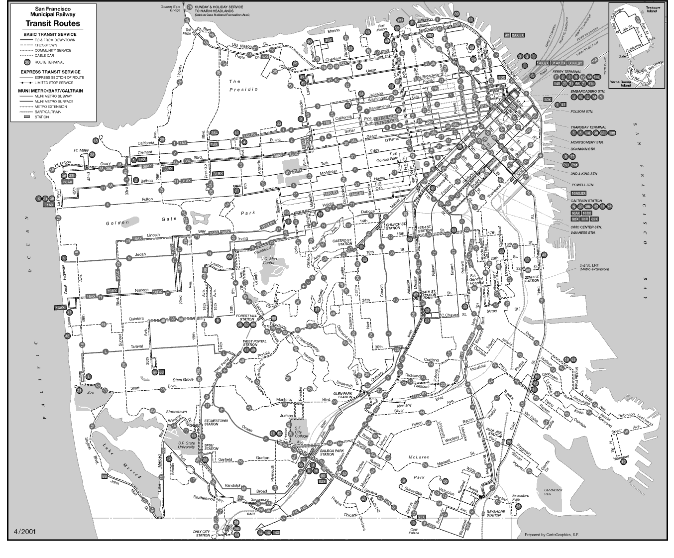 SF Route Map.
 Overhead Map of Muni's Electric Trolleybus System--early 90s.
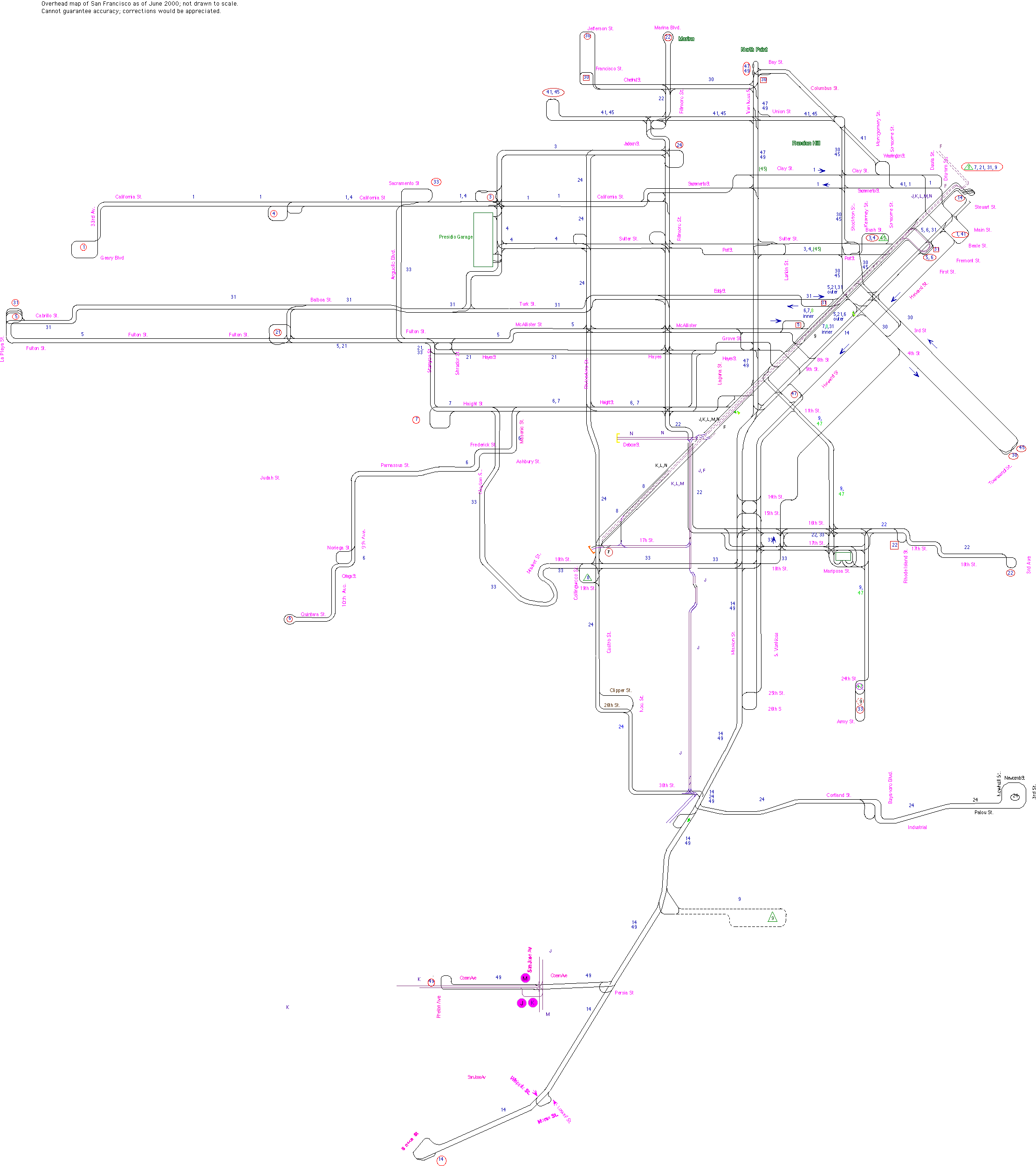 Overhead Map of Muni's Electric Trolleybus System--late 90s.
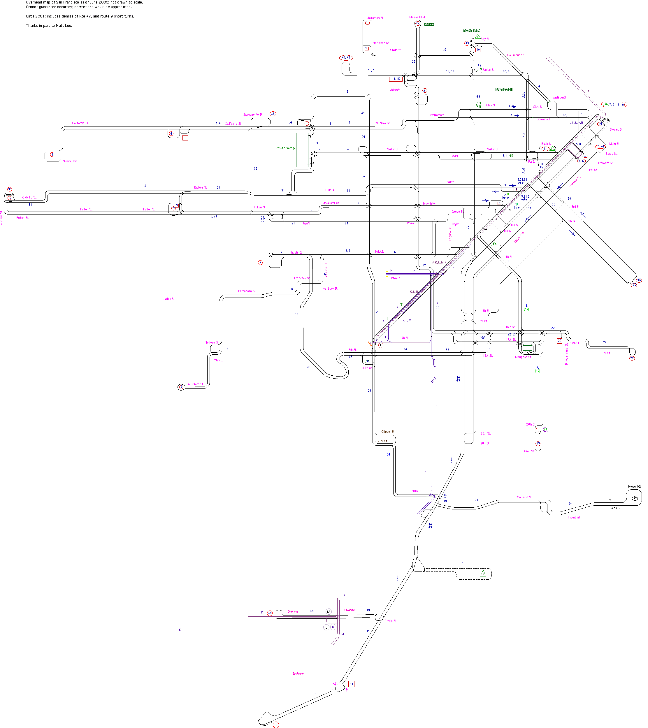 Overhead Map of Muni's Electric Trolleybus System--early 2001.
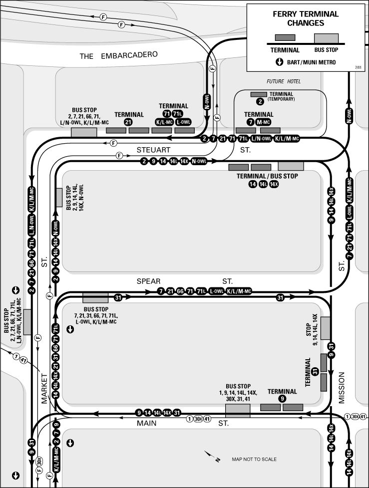 Route Map of Muni's Revised
Ferry Termini--July 2001.
Route Map of Muni's Revised
Ferry Termini--July 2001.
 Overhead Map of Muni's Electric Trolleybus System--August 2001.
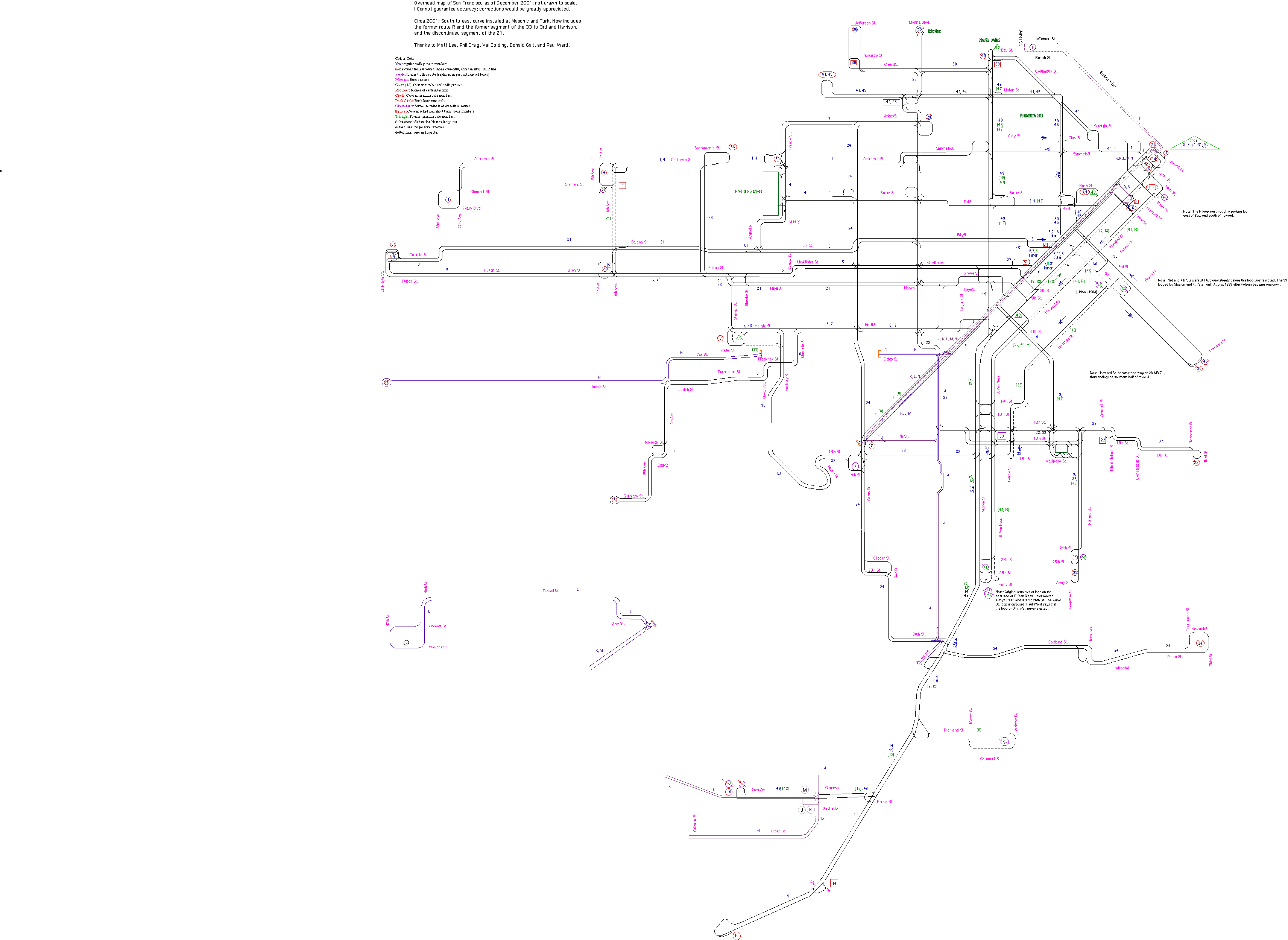 Overhead Map of Muni's Electric Trolleybus System--December 2001.
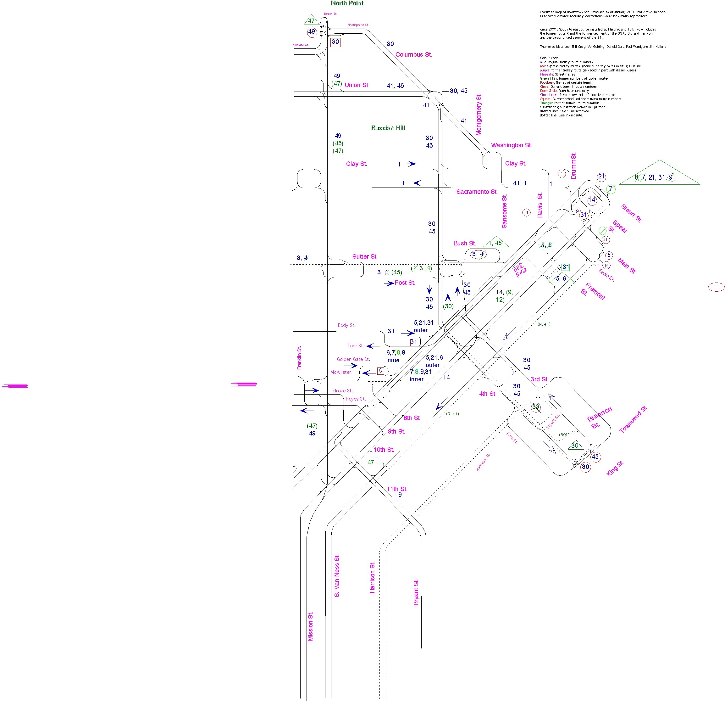
 Overhead Map of Muni's Electric Trolleybus System--January 2002.
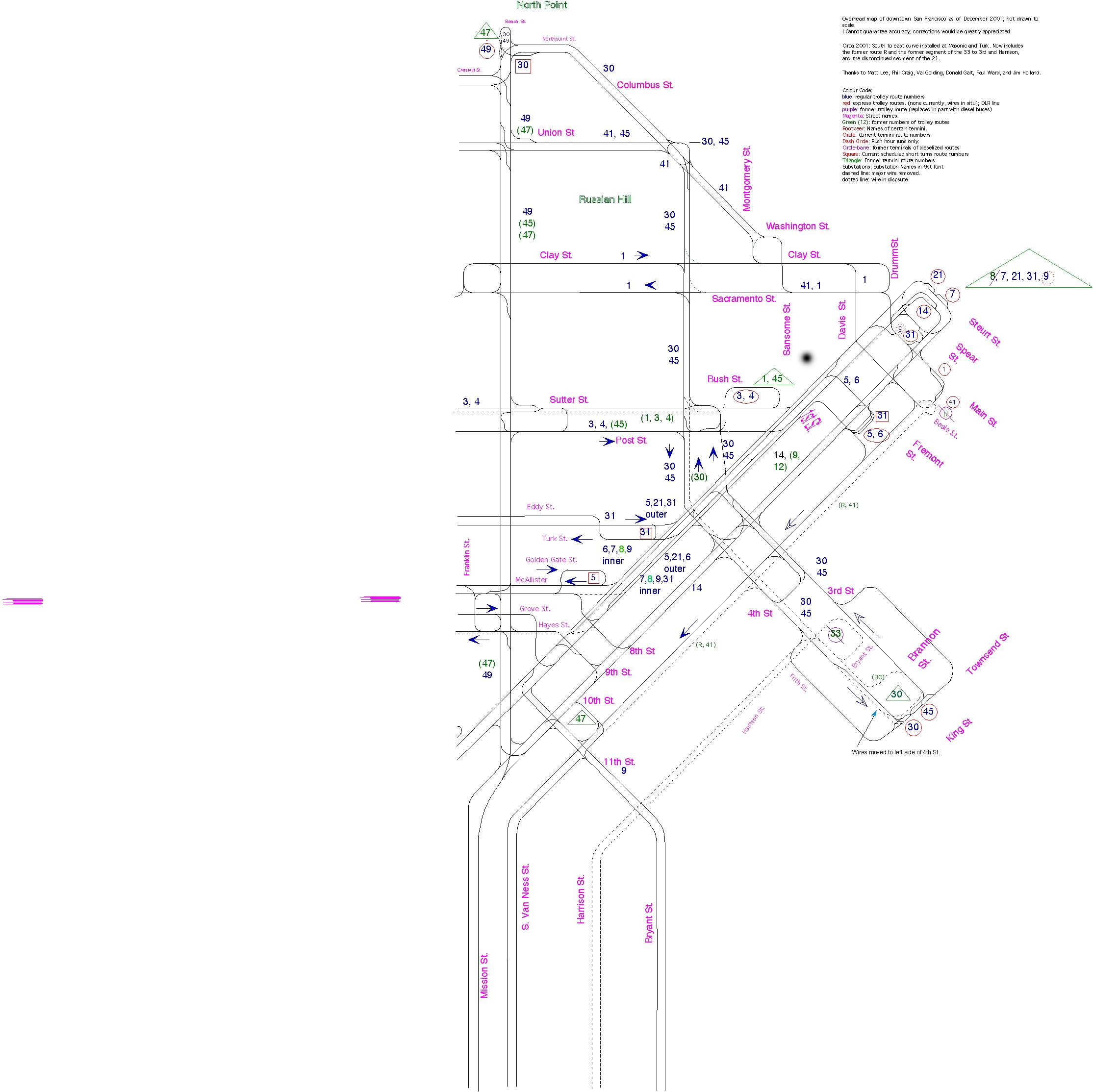
 Downtown Overhead Map
of Muni's Electric Trolleybus System--December 2001.
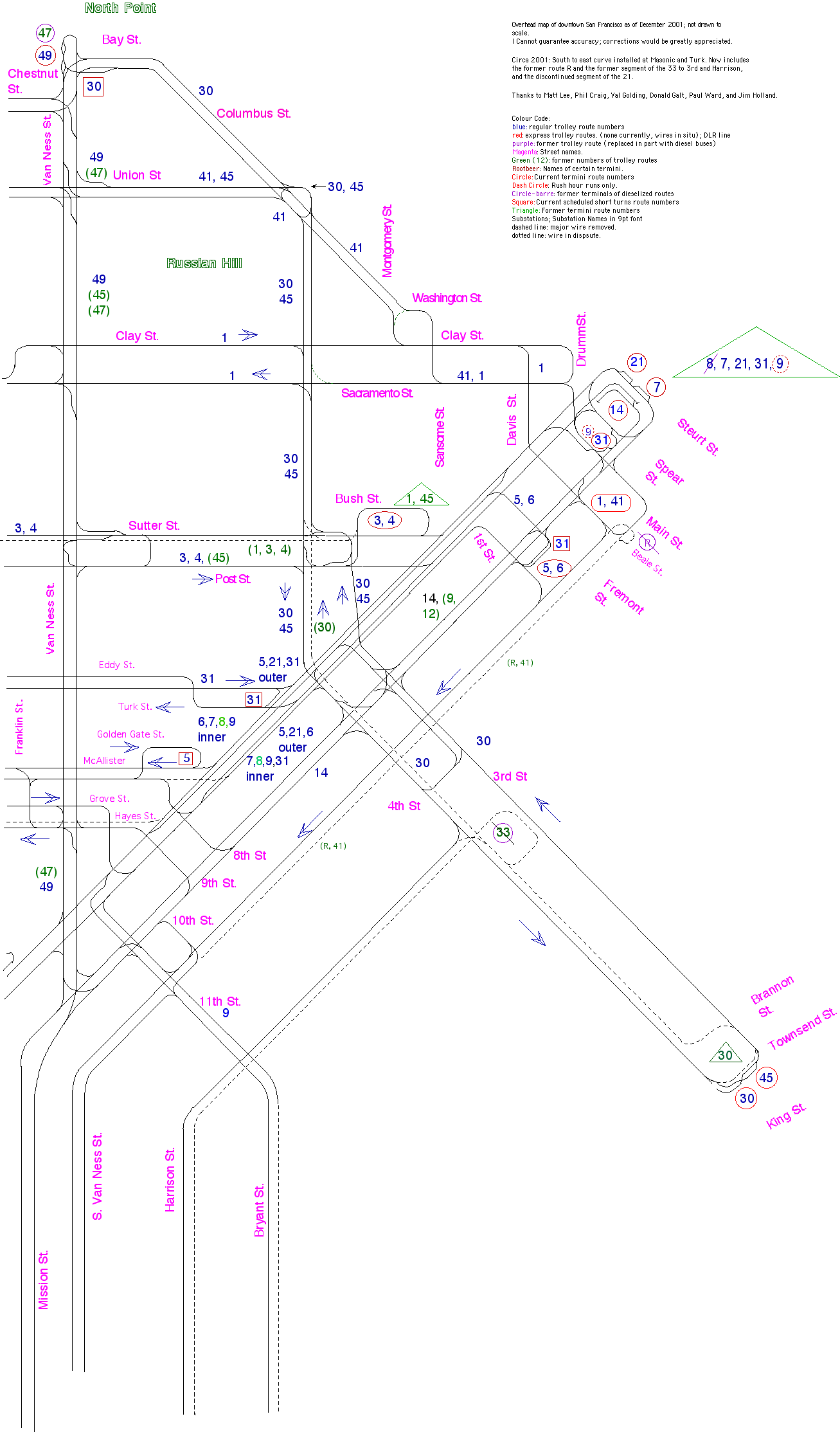
Downtown Overhead Map
of Muni's Electric Trolleybus System--December 2001.
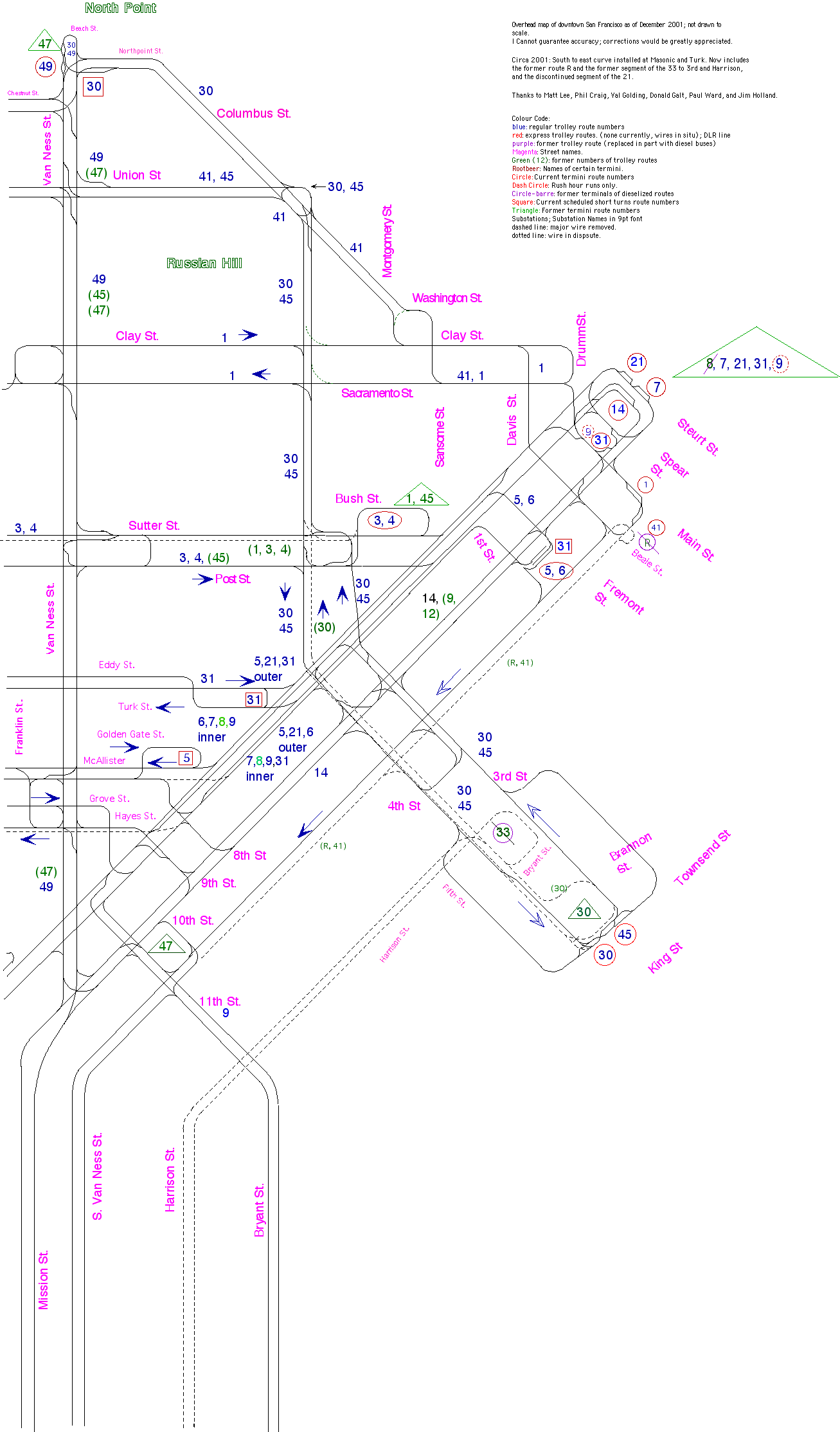 Downtown Overhead Map of Muni's Electric Trolleybus System--January
2002.
Downtown Overhead Map of Muni's Electric Trolleybus System--January
2002.
Downtown Overhead Map of Muni's Electric Trolleybus System--Septermber 2006.
PDF file.
 Downtown Overhead Map of Muni's Electric Trolleybus System--September 2010.
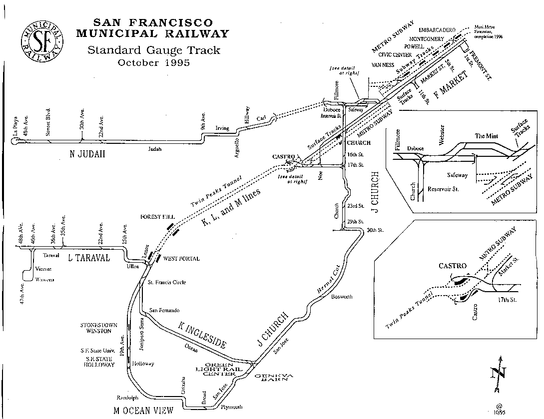 Streetcar rail map--1995.
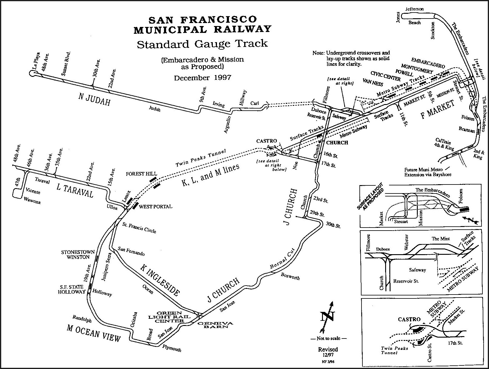 Streetcar rail map--1997.
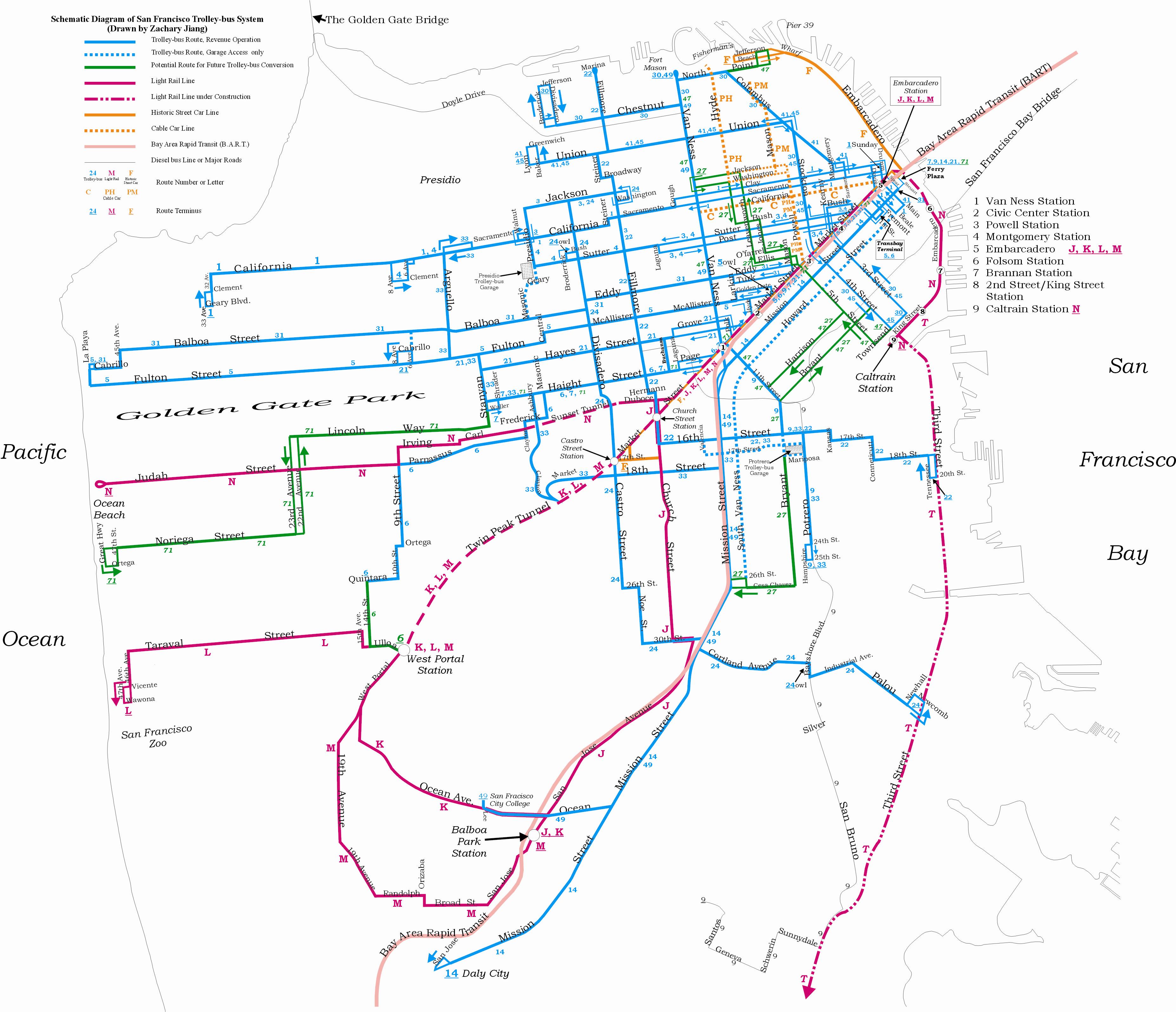 System Map — 2005. Drawn by Zachary Jiang.
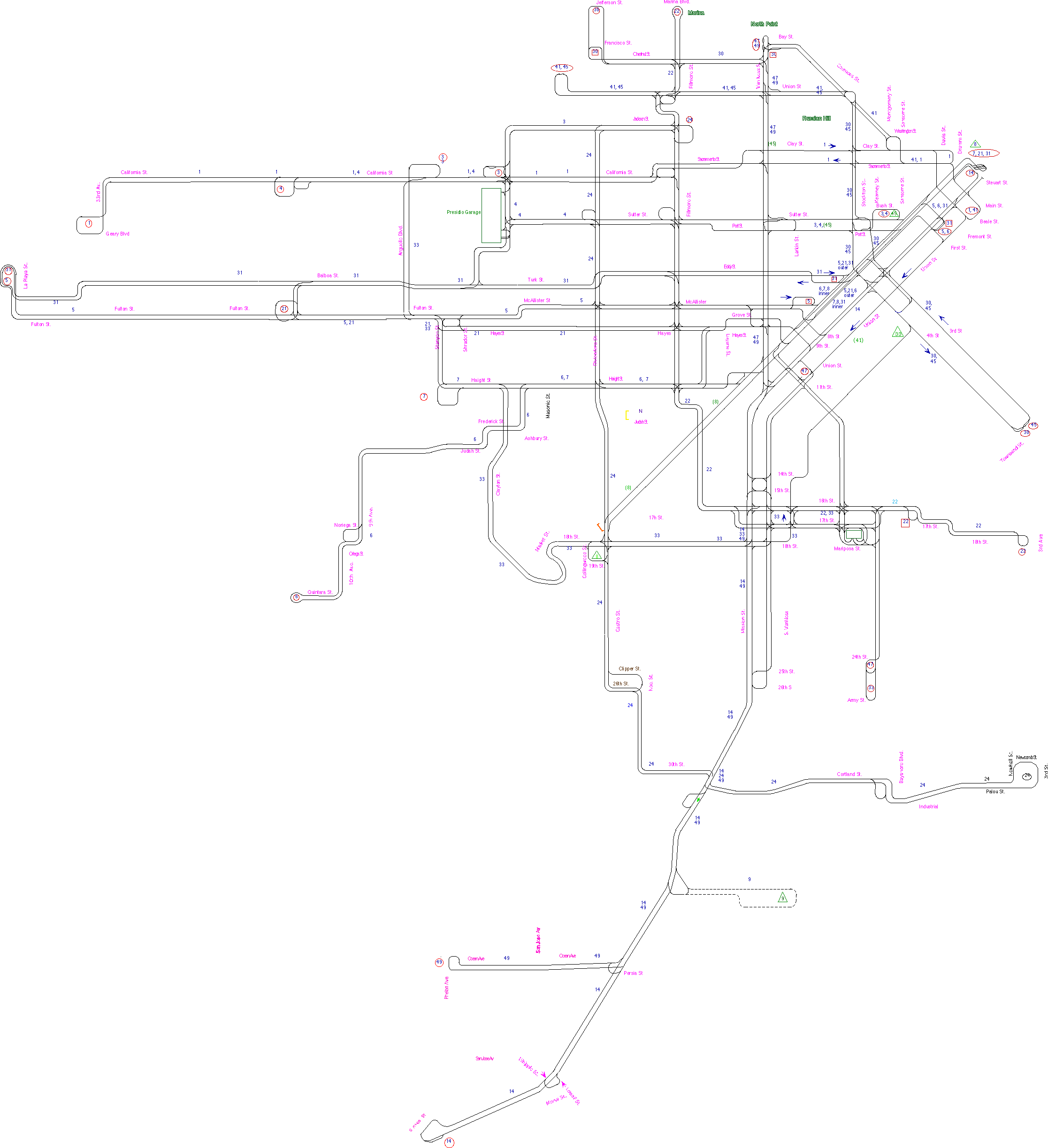
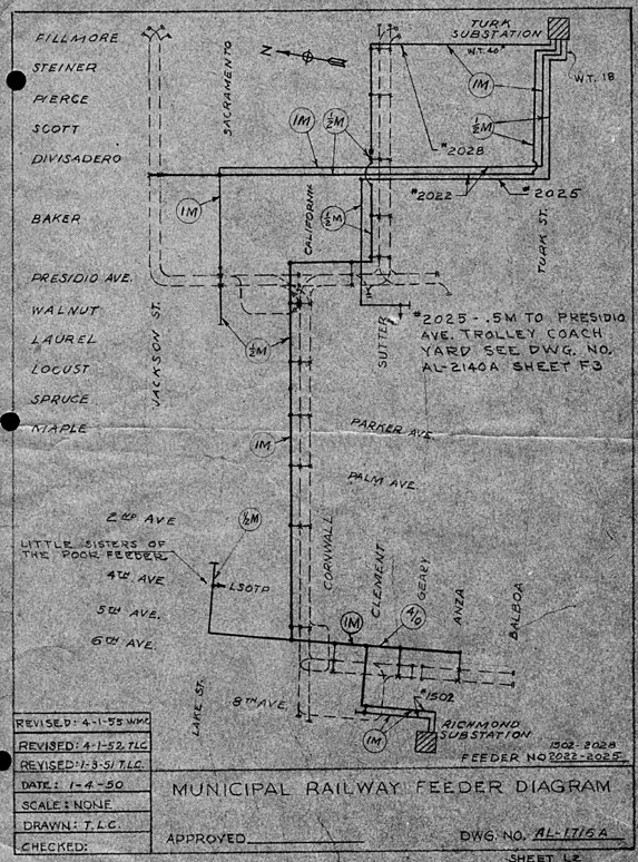 Feeder map of the area including Presidio Garage and the Richmond Substation
and the Turk Substation. Original drawer not known. 1 AP 1955. Reproduced by
Val Golding and enhanced by Jim Holland. 2006.
Feeder map of the area including Presidio Garage and the Richmond Substation
and the Turk Substation. Original drawer not known. 1 AP 1955. Reproduced by
Val Golding and enhanced by Jim Holland. 2006.
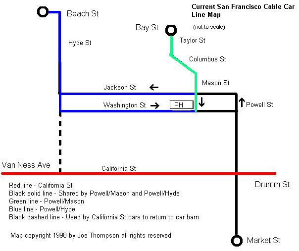 Cable car route map. Drawn by Joe Thompson. 1998.
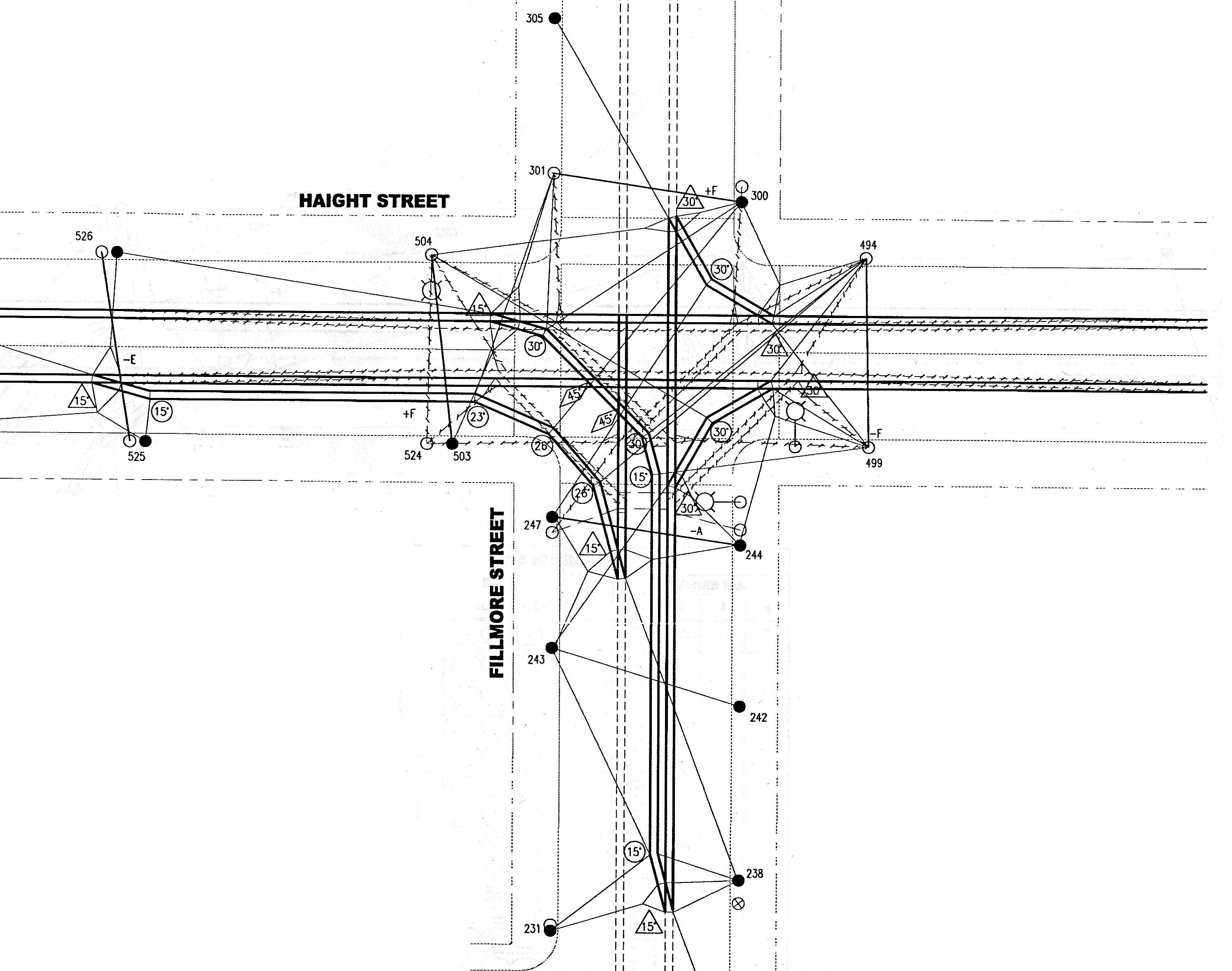 Plans for upgrading the overhead at Fillmore and Haight Sts. From the collection
of Jim Holland. 2004 or thereabouts.
Plans for upgrading the overhead at Fillmore and Haight Sts. From the collection
of Jim Holland. 2004 or thereabouts.
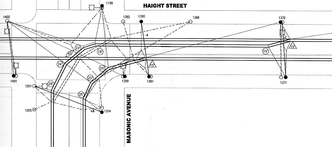 The revised overhead constructed in 2003 at Haight St. and Masonic St. The dashed
wire represents the old configuration. From the collection of Jim Holland. 2006.
The revised overhead constructed in 2003 at Haight St. and Masonic St. The dashed
wire represents the old configuration. From the collection of Jim Holland. 2006.
Route map along Market Street. early 2010.
![]()
This page last updated 4 MAY 2011.
![]()