Chapter Contents
Previous
Next
|
Chapter Contents |
Previous |
Next |
| The SIM2D Procedure |
In this example, the data consist of coal seam thickness measurements (in feet) taken over an approximately square area. The coordinates are offsets from a point in the southwest corner of the measurement area, with the north and east distances in units of thousands of feet.
It is instructive to see the locations of the measured points in the area where you want to perform spatial simulations. It is generally desirable to have these locations scattered evenly around the simulation area.
First, the data are input and the sample locations plotted.
   data thick;
      input east north thick @@;
      datalines;
       0.7  59.6  34.1   2.1  82.7  42.2   4.7  75.1  39.5
       4.8  52.8  34.3   5.9  67.1  37.0   6.0  35.7  35.9
       6.4  33.7  36.4   7.0  46.7  34.6   8.2  40.1  35.4
      13.3   0.6  44.7  13.3  68.2  37.8  13.4  31.3  37.8
      17.8   6.9  43.9  20.1  66.3  37.7  22.7  87.6  42.8
      23.0  93.9  43.6  24.3  73.0  39.3  24.8  15.1  42.3
      24.8  26.3  39.7  26.4  58.0  36.9  26.9  65.0  37.8
      27.7  83.3  41.8  27.9  90.8  43.3  29.1  47.9  36.7
      29.5  89.4  43.0  30.1   6.1  43.6  30.8  12.1  42.8
      32.7  40.2  37.5  34.8   8.1  43.3  35.3  32.0  38.8
      37.0  70.3  39.2  38.2  77.9  40.7  38.9  23.3  40.5
      39.4  82.5  41.4  43.0   4.7  43.3  43.7   7.6  43.1
      46.4  84.1  41.5  46.7  10.6  42.6  49.9  22.1  40.7
      51.0  88.8  42.0  52.8  68.9  39.3  52.9  32.7  39.2
      55.5  92.9  42.2  56.0   1.6  42.7  60.6  75.2  40.1
      62.1  26.6  40.1  63.0  12.7  41.8  69.0  75.6  40.1
      70.5  83.7  40.9  70.9  11.0  41.7  71.5  29.5  39.8
      78.1  45.5  38.7  78.2   9.1  41.7  78.4  20.0  40.8
      80.5  55.9  38.7  81.1  51.0  38.6  83.8   7.9  41.6
      84.5  11.0  41.5  85.2  67.3  39.4  85.5  73.0  39.8
      86.7  70.4  39.6  87.2  55.7  38.8  88.1   0.0  41.6
      88.4  12.1  41.3  88.4  99.6  41.2  88.8  82.9  40.5
      88.9   6.2  41.5  90.6   7.0  41.5  90.7  49.6  38.9
      91.5  55.4  39.0  92.9  46.8  39.1  93.4  70.9  39.7
      94.8  71.5  39.7  96.2  84.3  40.3  98.2  58.2  39.5
      ;

   proc gplot data=thick;
      title 'Locations of Measured Samples';
      plot north*east / frame cframe=ligr haxis=axis1
                        vaxis=axis2;
      symbol1 v=dot color=blue;
      axis1 minor=none;
      axis2 minor=none label=(angle=90 rotate=0);
      label east   = 'East'
            north  = 'North'
      ;
   run;

|
   proc g3d data=thick;
      title 'Surface Plot of Coal Seam Thickness';
      scatter east*north=thick / xticknum=5 yticknum=5
         grid zmin=20 zmax=65;
      label east  = 'East'
            north = 'North'
            thick = 'Thickness'
      ;
   run;

|
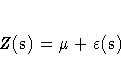
Figure 70.1 shows the small scale variation typical of spatial data, but there does not appear to be any surface trend. Hence, you can work with the original thickness data rather than residuals from a trend surface fit. In fact, a reasonable approximation of the spatial process generating the coal seam data is given by
where the ![]() is a Gaussian SRF with
Gaussian covariance structure
is a Gaussian SRF with
Gaussian covariance structure
Note that the term "Gaussian" is used in two ways in this description. For a set of locations s1,s2, ... ,sn, the random vector
![Z(s) = [
Z(s_1) \Z(s_2) \\vdots \Z(s_n) \]](images/simeq6.gif)
has a multivariate Gaussian or normal distribution are visually estimated using PROC VARIOGRAM, a
DATA step, and the GPLOT procedure.
Refer to the "Getting Started" section in the
chapter on the VARIOGRAM procedure
for details on how these parameter values are obtained.
The choice of a Gaussian functional form for
Cz(h)
is simply
based on the data, and it is not at all crucial to the
simulation. However, it is crucial to the
simulation method used in PROC SIM2D that Z(s) be
a Gaussian SRF. For details, see the section "Computational and Theoretical Details of Spatial Simulation".
Copyright © 1999 by SAS Institute Inc., Cary, NC, USA. All rights reserved.
![]() .The (i,j)th element of
.The (i,j)th element of ![]() is computed by
Cz(si-sj), which happens to be a Gaussian functional form.
Any functional form for Cz(h) yielding a valid covariance matrix
is computed by
Cz(si-sj), which happens to be a Gaussian functional form.
Any functional form for Cz(h) yielding a valid covariance matrix
![]() can be used. Both the functional form of
Cz(h) and the parameter values
can be used. Both the functional form of
Cz(h) and the parameter values
![]()
![]()
Chapter Contents
![]()
Previous
![]()
Next
![]()
Top