Approach and Goal of GVRD Study
 With
limited study done previously regarding aerosol's relationship with precipitation
in the Greater Vancouver area, this study is designed to address the issue.
The approach taken for this study is to use data collected from Environment
Canada weather stations over the GVRD area. The period of study is is 2001 with
precipitation and aerosol data being collected. After that, visual analysis
with the aid of GIS (Geographic Information Systems) maps will be conducted
to search for patterns of correlation between aerosol concentration and precipitation.
With
limited study done previously regarding aerosol's relationship with precipitation
in the Greater Vancouver area, this study is designed to address the issue.
The approach taken for this study is to use data collected from Environment
Canada weather stations over the GVRD area. The period of study is is 2001 with
precipitation and aerosol data being collected. After that, visual analysis
with the aid of GIS (Geographic Information Systems) maps will be conducted
to search for patterns of correlation between aerosol concentration and precipitation.
Futher, the goal of this study is to find out smog generating
locations in the GVRD that will be bad for the air quality downwind. This give
us a big picture of the smog generating areas in need of correction. Finally,
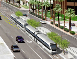
this study will apply all the environmental factors along with topographic features,
and social geographic phenomenon into the analysis of finding a location for
the area most in need and most feasible for a new non-polluting rapid transit
line that will help lower the use of private vehicles and lower aerosol pollution
to the atmosphere.
Next Page (Methodology)