spatial analysis
Now that I had finished preparing my data in IDRISI, I was ready to do my analysis using Multi-Criteria Evaluation. My images are as follows
| Factors: | Constraints: |
| Slopebool | Suitable Land (Open and Undeveloped Land) |
| Bus Stop | |
| Skytrain | |
| Major Roads |
Results
Before proceeding to do the MCE, I needed to assign weights to my factors. Using the WEIGHT module I assigned the following values. Slope = 0.1140, Bus Stop = 0.4806, Roads = 0.4054. As you can tell I did not have a weight for the Skytrain, as previously noted I could not get this image to function properly until the end of my project. Anyway, the weights were assigned based on what I thought was important. The new location would preferably have good access by public transportation, but still very accessible by cars, hence the higher weighting. Then it was on to the MCE.
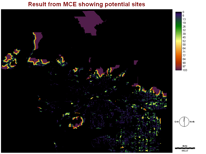
After running the MCE, here is the result
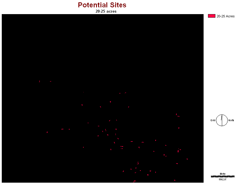
The resulting image from the MCE was not helpful as it did not show the most suitable location, so further analysis had to be done. Next I used the GROUP module, the GROUP module finds and labels spatially contiguous groups of like-value pixels, since I wanted to find lots between 20 - 25 acres. After using the GROUP module, I needed to calculate the area of each individual plot, so that I could find the plots that were between 20 - 25 acres. I decided to go with the plot size of 20-25 acres because BC place stadium occupies roughly 10 acres, and that does not include parking.
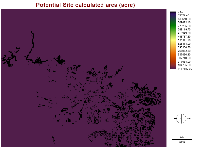
Finding the size of each individual plot was not easy. I had to use to AREA module and then the Tabular function to find out the area of each individual plots, then I went through and picked out the ones that fit my criteria. Once that was done I used the ASSIGN module, and assigned a 1 to all the plots that fit my criteria of areas that were 20-25 acres.
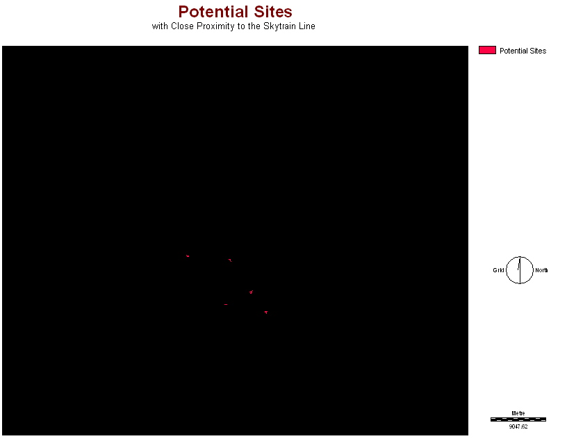
At first, I could not get my Skytrain image to function properly. It was not until near the end of my project that I got it to work properly. So once I had it functioning right, I overlayed the Skytrain image with the POTENTIAL SITES image to get the plots that were within close proximity to the Skytrain Line.
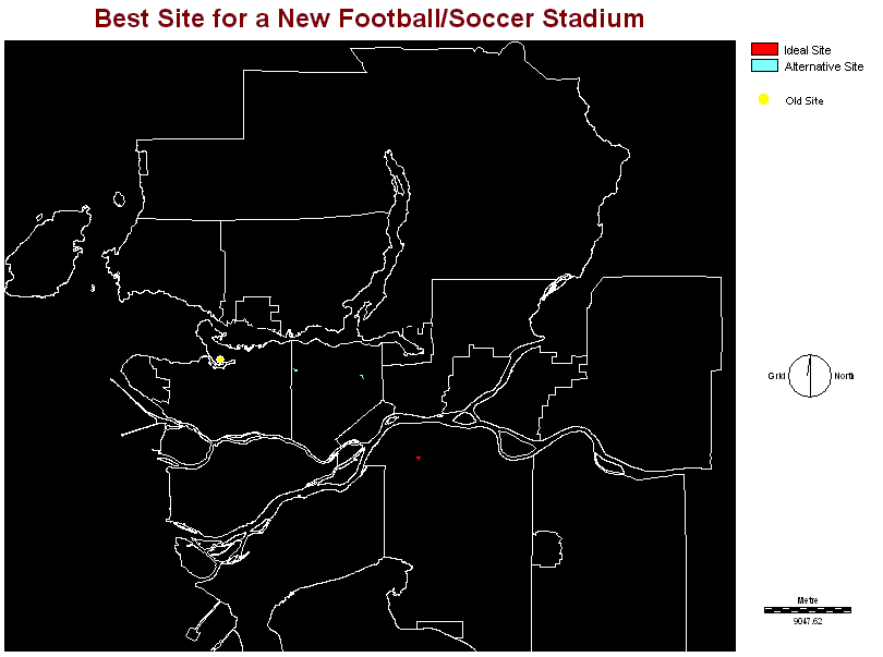
Site Choice
The final analysis left me with five potential sites. I then placed the city layers onto the map and noticed that one of the sites was on Annacis Island, while the other was near the CPR railway yard, so I eliminated those two, by using the ASSIGN module. I decided that if the Lions were to build a new stadium, it should be in Surrey. The City of Surrey has one of the fastest growing populations, and is expected to surpass that of Vancouver by 2010. Also, the new site location is right at the end of the skytrain line, King George Station, so it would be very accessible, by both skytrain and bus. The City of Surrey is also home to the Lion's practice facility.
Final Thoughts
Locating a new open-air stadium would be my recommendation based on the outline above. The City of Surrey is quickly growing. Many businesses are locating in the new business parks that are being developed in Surrey. The city has also been a victim of urban sprawl, and has seen a huge influx of people moving out to live in the suburb, many consisting of small families. These small families are the target markets. BC Lions games are very family oriented and do not cost and arm and a leg to take the whole family to see. So instead of waiting for the people to come to the games, maybe the Lions should take the game to the people.
| CARTOGRAPHIC MODEL |
| Part I |
| Part II |