Methods
Data Acquisition
The first step in this analysis is to acquire the spatial data needed for the MCE. This was done through the use of the S:drive as well as online sources and digitizing. The sources for each data file is shown below:

The GVRD DEM and GVRD landuse files were already in IDRISI format and were simply added to the project file. The GVRD water file needed to be converted from ArcGIS to IDRISI format and was done through the use of import in the files tab that converts Arcshapefiles to IDRISI. This file was converted to a raster file through the use of the Polyras module.
The BC file of Biogeoclimatic zones was clipped by the GVRD municipalities file, and through the use of the ArcGIS attribute table for this clipped image the subzones were reclassed. Subzones were used because they represent climate better than the zones, which better represent vegetation type. The subzones in the GVRD were reclassified using a new field called ID as: (to see properties of subzones refer to http://www.for.gov.bc.ca/hre/becweb/resources/maps/)
- dry maritime
- eastern dry maritime
- moist maritime
- windward moist maritime
- very wet maritime
- alpine tundra
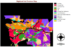
The GVRD soil texture file was produced through digitizing in ArcGIS and were classified as: (See below for map image after digitization)
1: Silt and Clay
2. Sand and Silt
3. Peat
4. Till
5. Silt and Clay: Ice age sediments
6. Sand: Ice age sediments
7. Gravel and Sand: ice age sediments
8. Barerock
9. Steepland
10. Gravel and sand
11. Landfill
The resulting image:
Multi-Criteria Evaluation
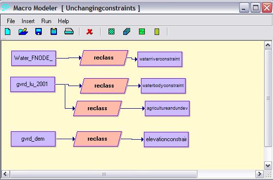
The criteria examined for the MEC are elevation, water, and land-use. The GVRD DEM was reclassed to give a value of 1 to all elevations below 914 meters, which is a limit for most grape species. The GVRD land-use file was reclassed to give a value of 1 to agriculture zones. Another reclass was used to give water bodies a value of 0 because clearly viticulture cannot occur on water. Another file, of just streams, was given a value of 0 as well.
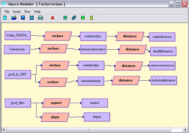
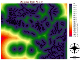
The files used for defining factors were the GVRD land-use, GVRD DEM, GVRD soil texture, and Water. The GVRD Landuse was reclassed to give a value of 1 to water, and also reclassed to give a value of 1 to industrial zones. The GVRD DEM was run through the module Aspect and Slope. The GVRD soil texture was reclassed to give a value of 1 to landfills. The reclassed files were then run through the Distance module:

Constraints and factors for the each grape species:
V. vinifera
V. riparia
V. labrusca
The lake and water factors for these three species have the same distance image:

A Decision Wizard MEC was created for each grape species, including both variable and invariable factors and constraints. The resulting fuzzy images are as shown:
The weighting in Decision Wizard was user-defined because each factor had different levels of effects on the vines and grapes. The weighting for each factor was:

The resulting suitability image for each grape was then reclassed to give suitability classes. The values for the reclass file were:
0 0 44
1 45 90
2 91 135
3 136 200
4 201 255
A pallete was used to show the reclassed images. The value of 4 was given to the most suitable locations. The module Area was then used to calculate the area of the suitability of each grape to the GVRD.
