
Student experience
Replicating river flows in the lab sheds new light on landslides
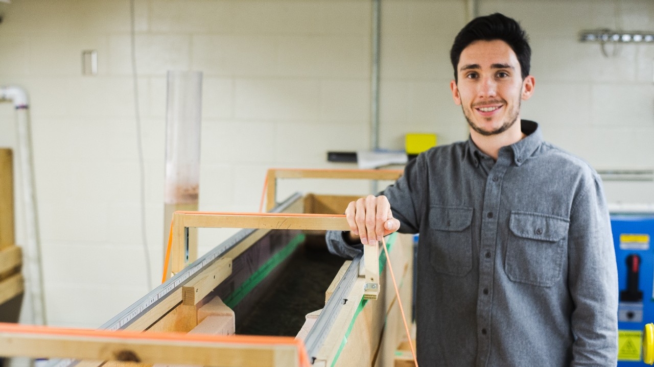
Landslides in B.C. canyons can cause devastating effects on salmon spawning grounds. To better understand their causes, Simon Fraser University geography master’s student Kyle Kusack is studying how the flow of rivers may factor into their occurrence.
Shortly after discovering the Fraser Canyon Big Bar landslide in 2019, Kusack, an outdoor enthusiast, began investigating a morphology in bedrock canyons known as constriction-pool-widening (CPW). CPW consists of deep scour pools where the river becomes laterally narrow, followed by downstream channel widening, and can be found in all 42 Fraser River canyons.
The observed channel widening is thought to occur by erosion undercutting the canyon walls, which in turn may play a part in causing landslides. Learning more about how this flow system works will enable researchers to predict future landslide locations better.
“The Fraser River canyons are dynamic environments in areas of steep terrain,” says Kusack. “The erosive processes in bedrock rivers can act to undermine canyon walls, which can lead to mass wasting events.”
Supervised by professor Jeremy Venditti, who plans to lead research in the Big Bar area later this month, Kusack constructed a flume roughly six metres in length to replicate CPW within a controlled environment. Using a pump system he devised, he has run several experiments—some lasting weeks—where recirculating water runs through the flume at a constant flow.
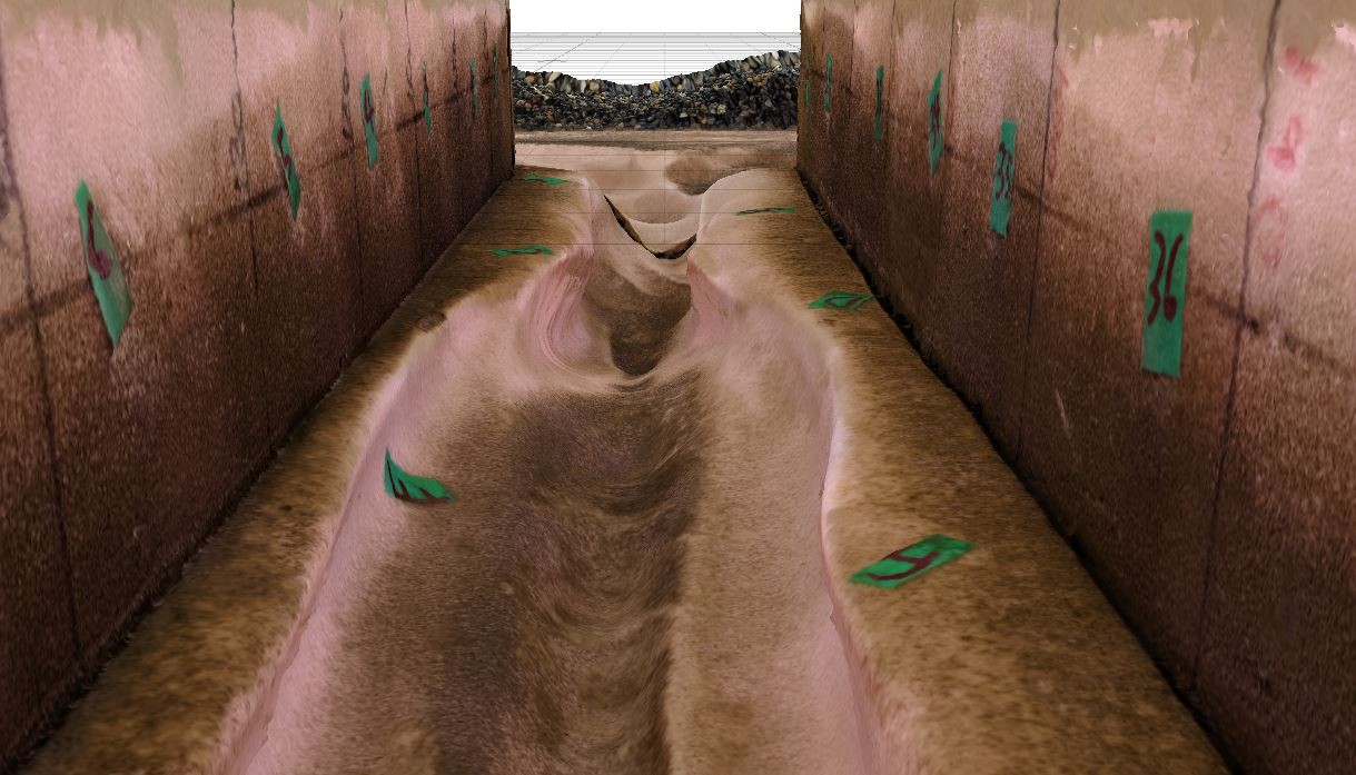
“The flume recirculates water and gravel over top of a special type of foam,” he explains. “This foam erodes similarly to real bedrock—just much faster—so I can model thousands of years of erosion in a short period.”
As Kusack’s plans were developing at the height of the pandemic, campus closures meant he couldn’t access labs. So instead, he constructed a scale model of his flume in his garage. “When the pandemic started, I was just starting to build a flume for my experiments which I physically needed to be on campus to do,” he says. Since then, Kusack has been able to move his experiment back to SFU.
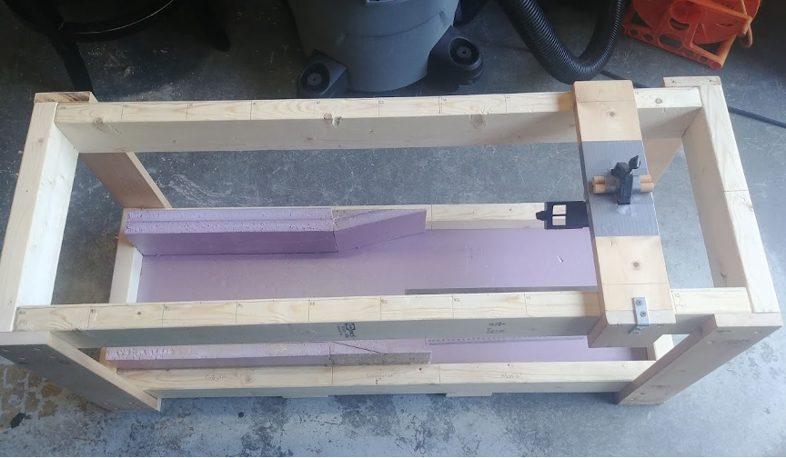
The most promising method for measuring the rates and patterns of erosion is a process known as Structure from Motion. “This involves taking many pictures of an object and loading them into a program that combines them into a 3D model. First, I needed to test the amount of overlap per photo and whether the resulting 3D model would be precise enough to be useful for tracking changes in erosion. While unable to be on campus, I used the scale model of the flume to test out this methodology.”
Kusack says understanding CPW morphology and how it forms can help researchers predict the locations of channel wall undercutting in canyons—and whether slides are likely. “This can help us focus resources on high-risk areas to identify external controls, such as rock structure, to create more accurate landslide assessments. Ultimately, we want to find ways to protect the salmon who use these waterways, and the better we understand them, the more we can help.”