Results
The initial proposed methodology included using the results of the previous steps to perform a pairwise comparison such that appropriate weights could be determined, which would then be used to perform a multi-criteria evaluation. A raster would then be produced showing the areas which would be most or least likely to obtain a GPS fix. However, the results from statistical testing indicated that there were very weak relationships between the spatial variables and fix rate.
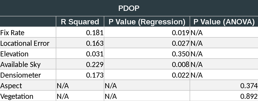
There were three relationships found relative to PDOP:
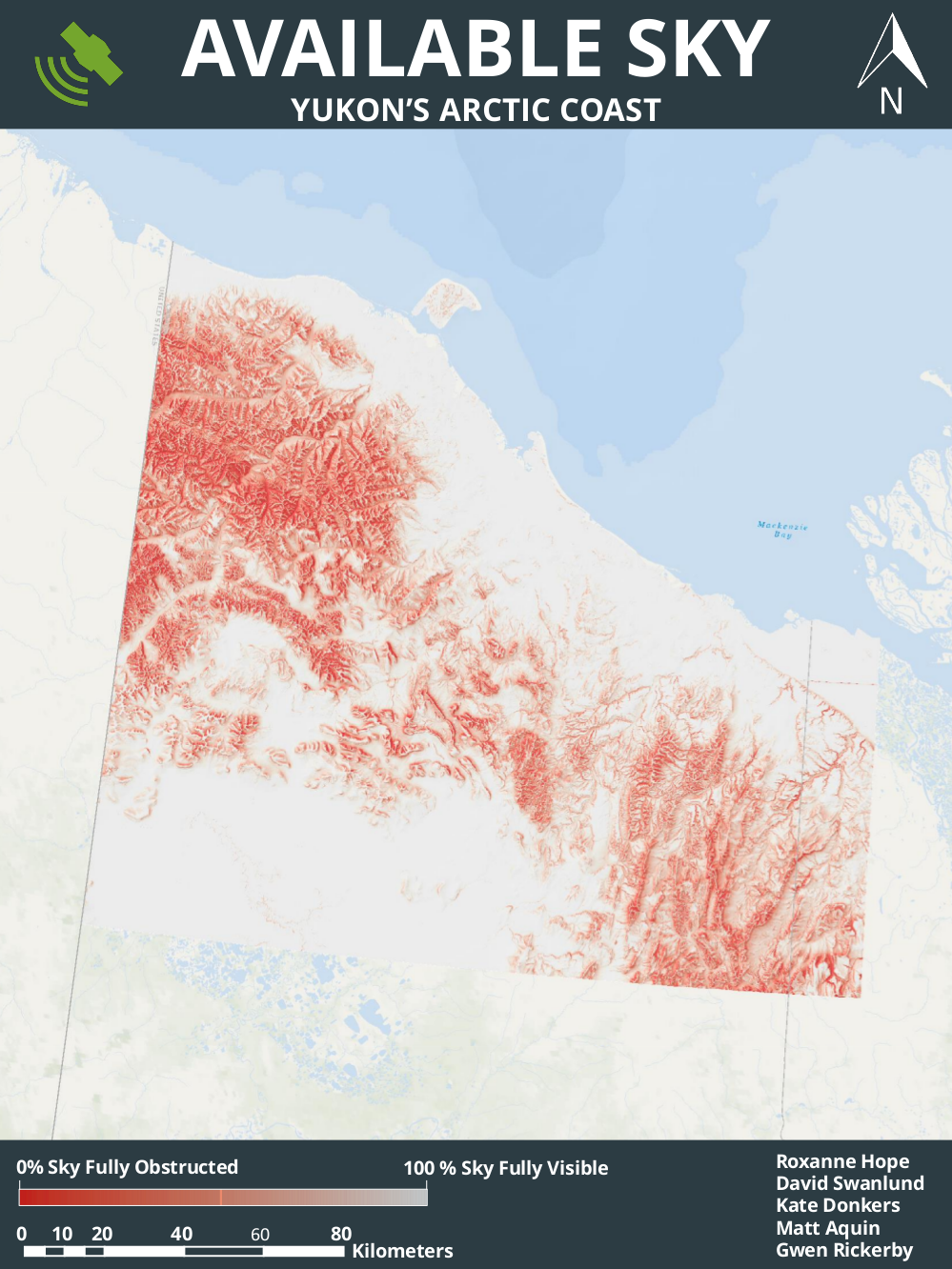
- Between available sky and PDOP (R Squared = 0.22, P = 0.01)
- Between densiometer values and PDOP (R Squared = 0.17, P = 0.02)
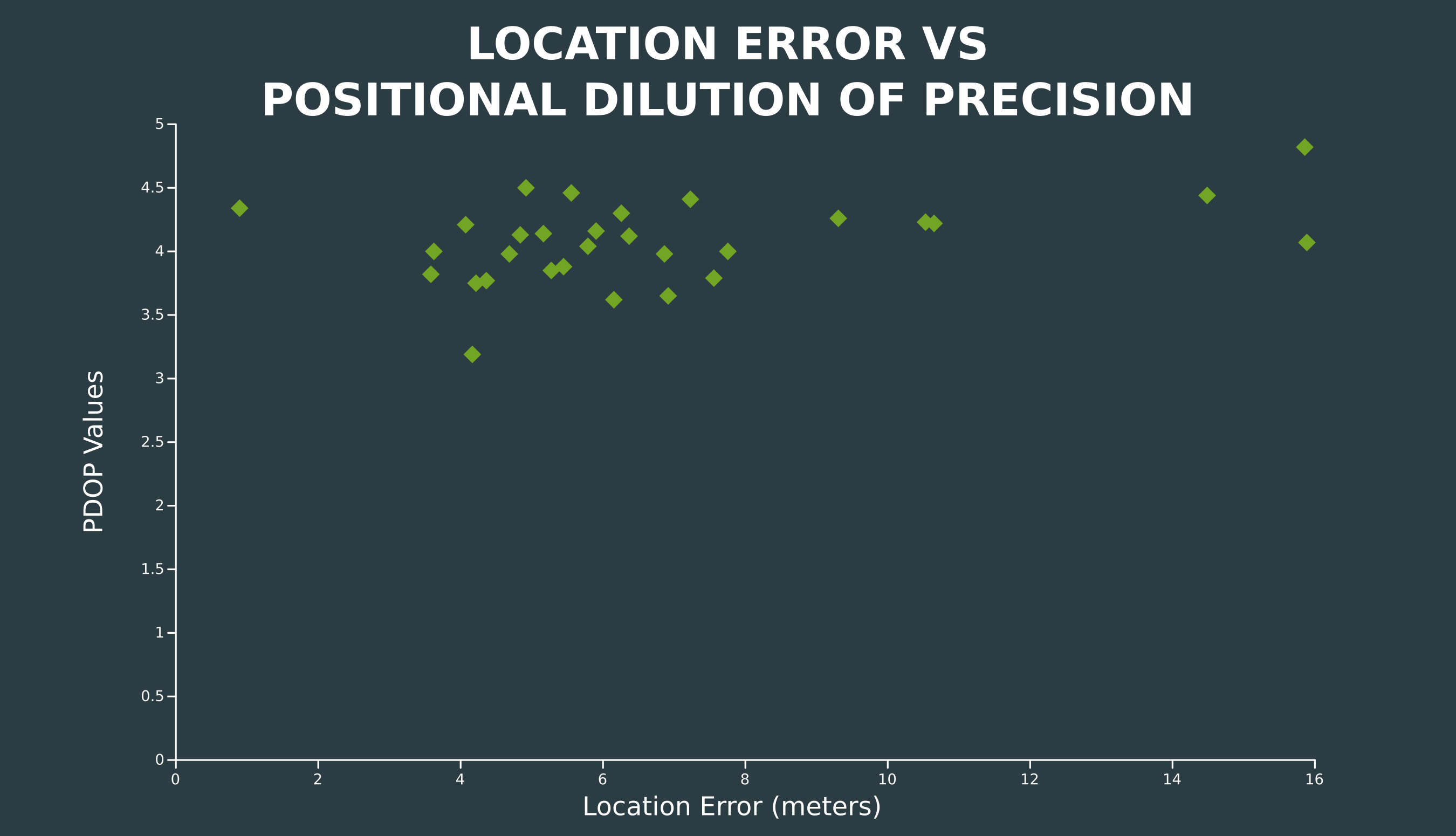
- Between locational error and PDOP (R Squared = 0.16, P = 0.03)
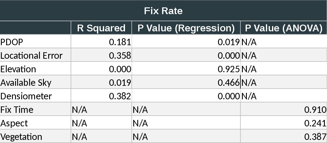
There were two relationships found relative to fix rate:
- Between densiometer values and fix rate (R Squared = 0.38, P < 0.01)
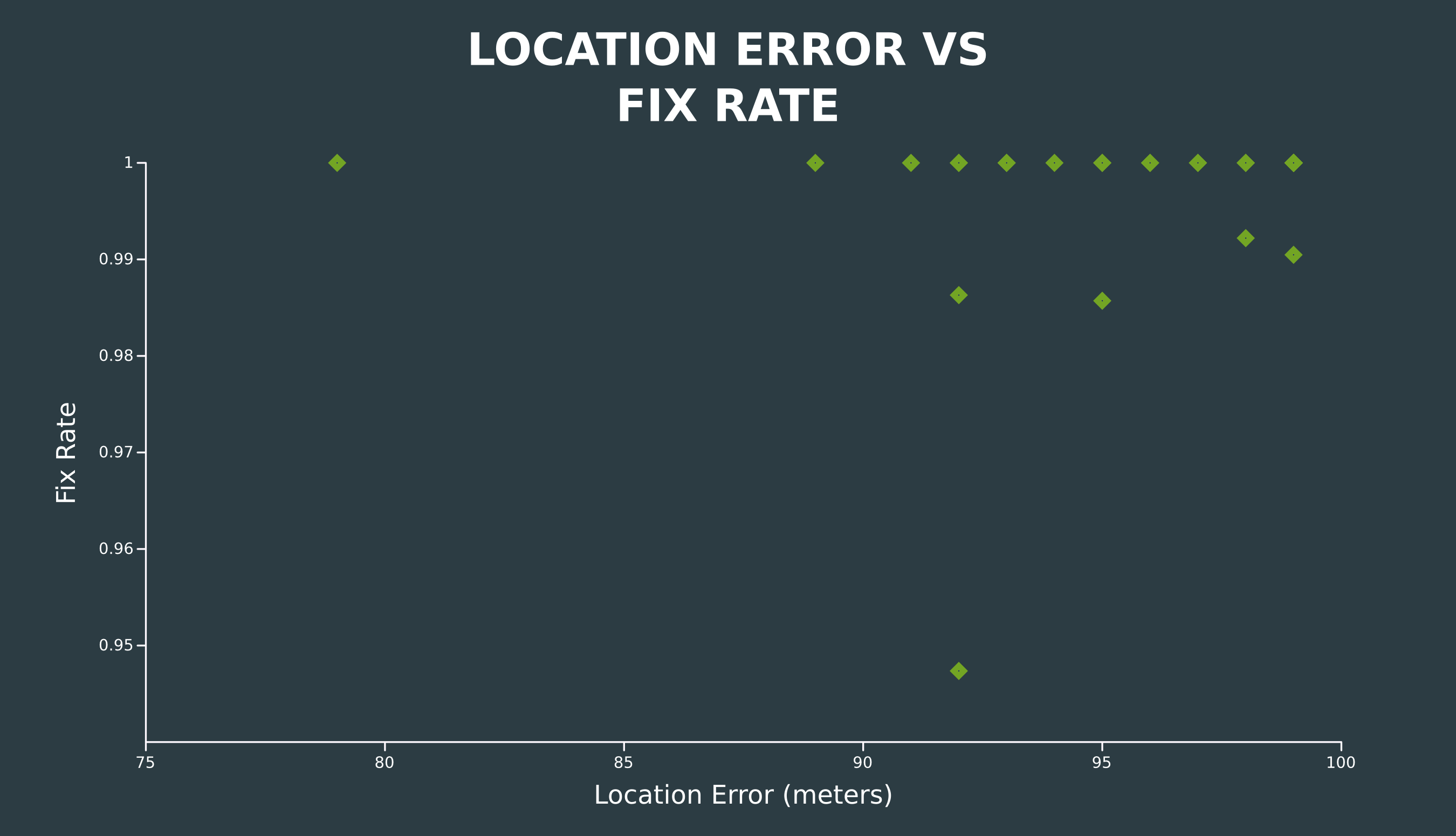
- Between locational error and fix rate (R Squared = 0.36, P < 0.01)
There was also a relationship between fix rate and PDOP itself (R2 = 0.18, P = 0.02), while ANOVA testing of the categorical data resulted in very high P values.
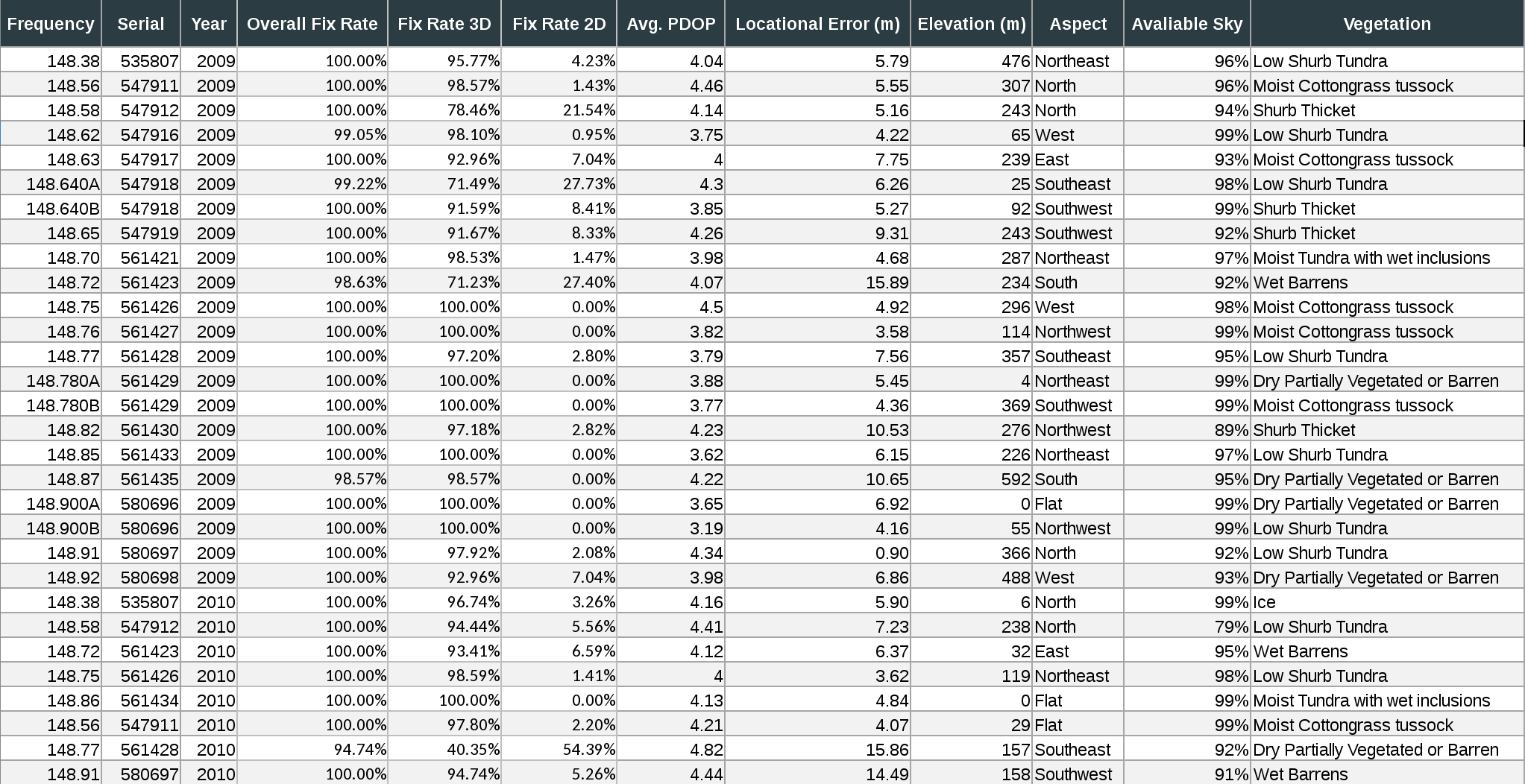
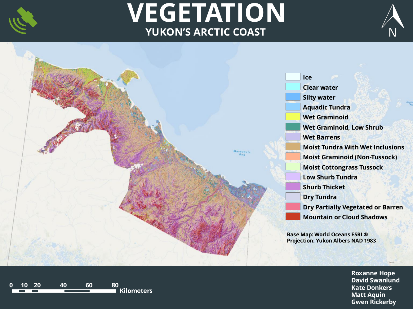
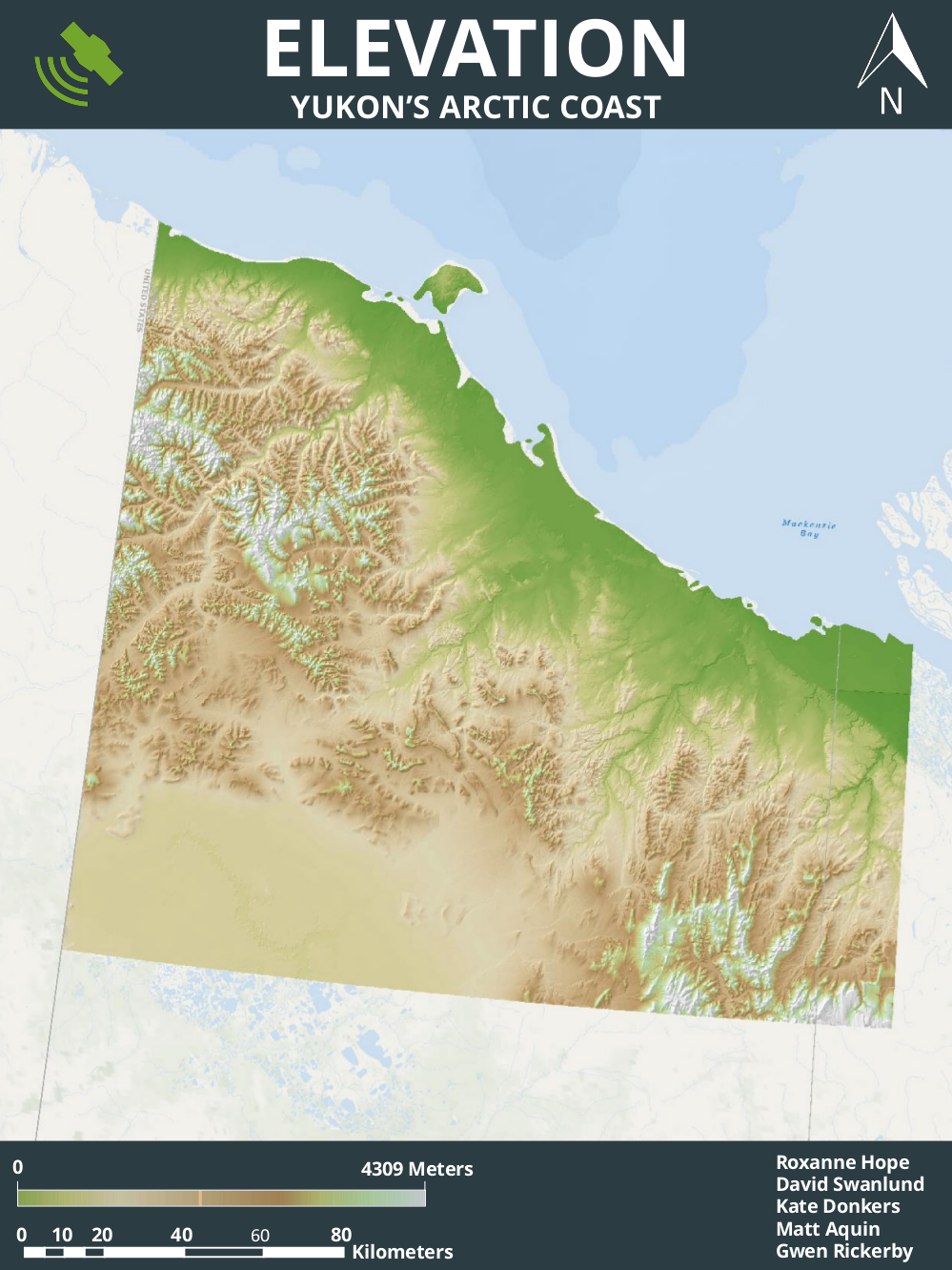
Further analysis of the five collars which did not get a 100% fix rate suggested that three were very likely influenced by topography. Field notes indicate that these collars were placed by cliff faces, at the bottom of valleys, and in a mountain saddle. Note that the only environmental variable to affect fix rate was densiometer values, which cannot be extrapolated continuously over the landscape.
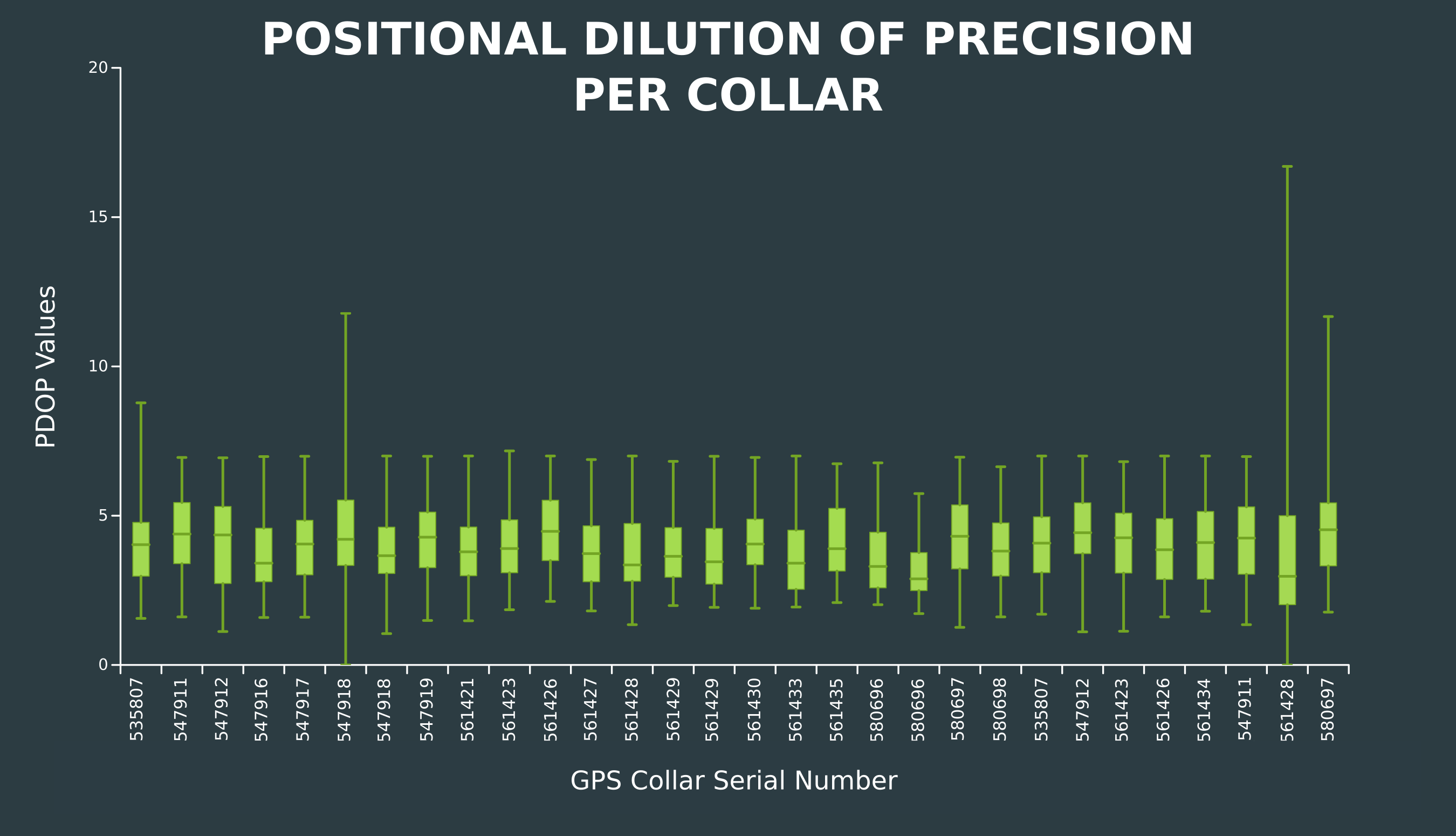
PDOP values were quite consistent with only three collars experiencing major variability. Overall, the collars had an average PDOP of approximately 4, where a value of 5 or less is considered to be nearly ideal.