Mapping Play Deserts
A GIS Approach to the Study of Playability in the City of Vancouver
Omada - Terran wilkie, Andrew Wilson, Hollie Moulaison, Ian Lochhead, & Samantha Bets
Outcomes
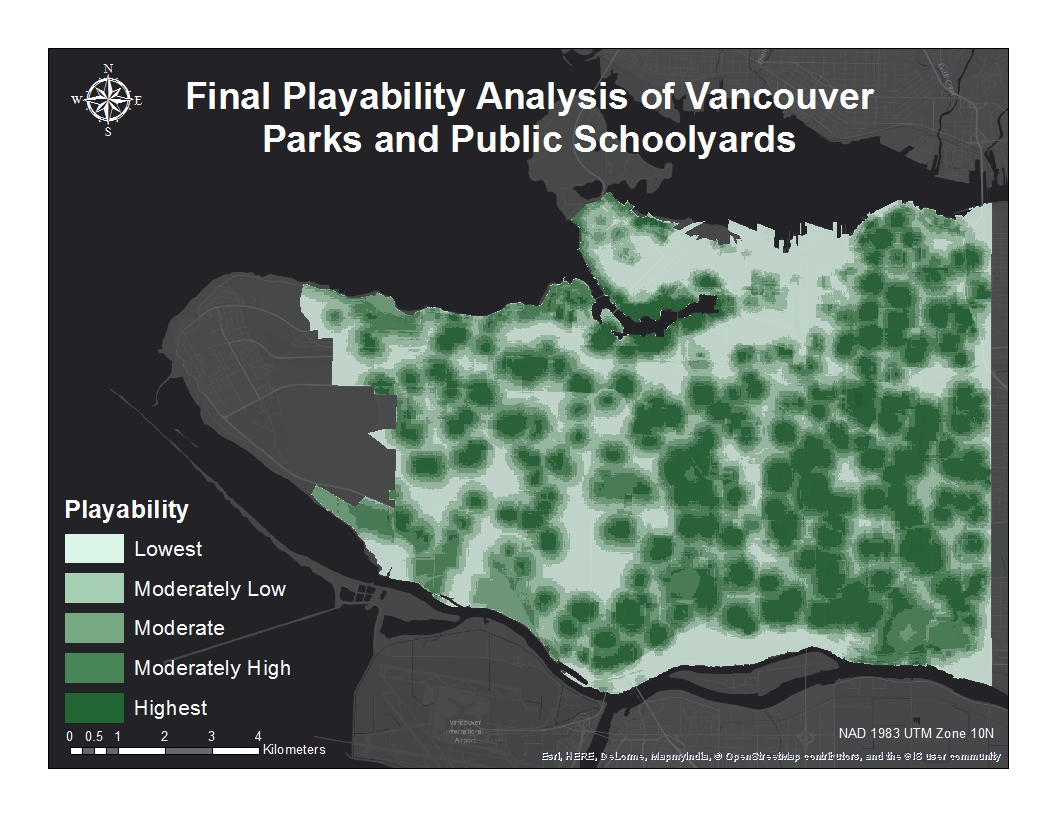
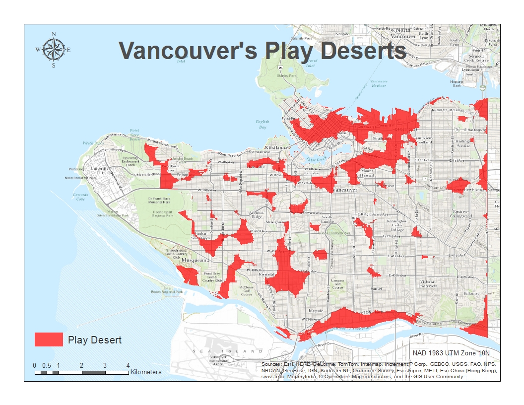
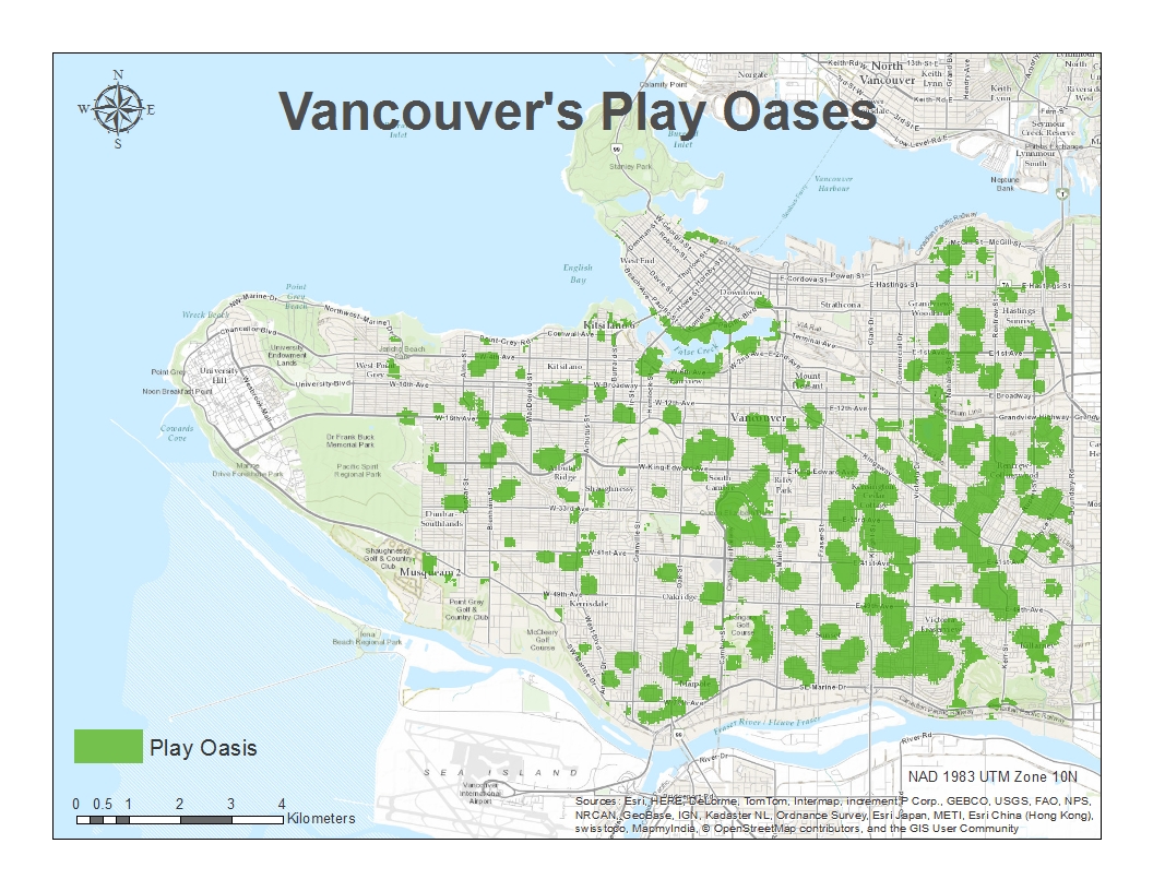
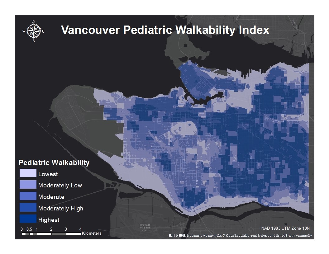
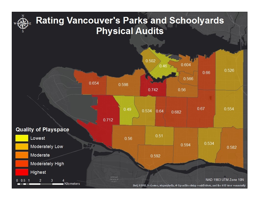
The final output from the play desert MCE shows a continuous measure of play space suitability. It also reveals the areas of Vancouver that would be considered play oases (high scoring areas) and those areas that would be considered play deserts (lowest scoring areas). This map also reveals a greater density of high playability scores within the southeast quadrant of the study area. There also appears to be a higher concentration of low playability scores in the downtown and east downtown neighborhoods as well as areas around Granville St.
