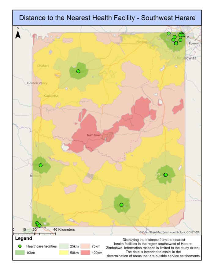
This map is the final output of the network analysis done within ArcGIS. The distance to the nearest health facility map provided clear indications of the service area southwest of Harare. It was evident that Harare being the capital city of Zimbabwe had the most health facilities in the region. 20 out of the 27 health facilities were located in the city of Harare. The remaining 7 health facilities were in other nearby urban centers. It was found that every single facility was situated along a major road network or highway. The area with no direct highway access fell outside the 50-km moderate service area. The highway was the clear conduit between each city and the skewness of the 50km service areas shows this.
The following map is the final output of our multi-criteria evaluation. The resultant suitability map is using continuous data which assigned a suitability value per class using a scale of 0 to 1 (0 = least suitable, 1 = most suitable). It is intended to assist in finding the optimal location for new Healthcare facilities in rural Zimbabwe. The suitability map clearly displayed where it is possible to build new healthcare facilities in southwest Harare. In the city of Harare, it is not a good place to build a new health facility based on the factor we calculated due to there was a lot of existing healthcare facilities located in that area. The southeast of Turf Town is not a suitable place to build a new health facility due to lack of electrical lines and roads. Per the suitability map, the range of Turf Town within 25km -50km diameter would be the most optimal areas to build new healthcare facilities.
