
Canyons of Concern Identification
Interactions between flow structures, river discharge, and canyon morphology can produce a diverse set of hydraulic barriers to upstream salmon migration and result in undercutting and the destabilization of canyon walls. However, flow dynamics, the morphology of bedrock canyons, and their links to hydraulic barriers and landslides are not well known in the Fraser Canyon.
Current work
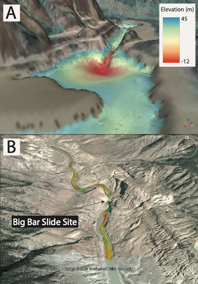
Using two multibeam echosounders (MBES), we mapped the bed topography of the Fraser River at Yale Rapids and the Big Bar Landslide site and have produced maps of the river bed in these areas. At the Big Bar Landslide site, researchers from the Hakai Institute collected high resolution imagery via drones to produce high resolution maps of the canyon walls. In April-May 2022, we collected MBES data along the entire length of the Fraser Canyon (Soda Creek - Yale) to identify sites with concerning morphologies that require more detailed mapping. This data are currently being processed.