The Desertification in Australia's Murray-Darling Basin
The Desertification in Australia's Murray-Darling Basin
Australia
- Australia Government: .shapefile of Australia
Murray-Darling Basin
- Australia Government: .shapefile of Murray-Darling Basin
Types of Land in Australia
- Australia Government: Landuse Australia 2005-2006
Preciptation
- Murray Darling Basin Authority: Climate_Averages/Precipitation
Temperature
- Murray Darling Basin Authority: Climate_Averages/Temperature
Evaporation
- Murray Darling Basin Authority: Climate_Averages/Evaporation
Relative Humidity
- Murray Darling Basin Authority: Climate_Averages/Relative_Humidity
Sun Exposure
- Murray Darling Basin Authority: Climate_Averages/Sunshine_Hours
Groundwater SDL Resource
- Government of Australia: .shapefile Groundwater SDL Resource
Surfacewater SDL Resource
- Government of Australia: .shapefile Surfacewater SDL Resource
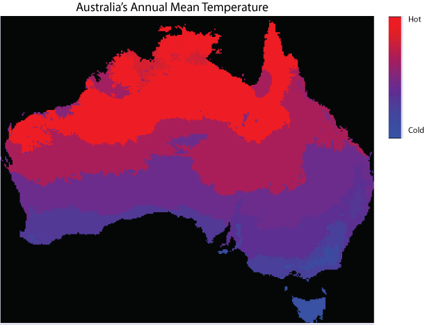
The photo shows Australia's mean annual temperature. The equator is north of Australia. This is the reason why the temperature is relatively hotter towards the tip of the country and relatively cooler in the south.
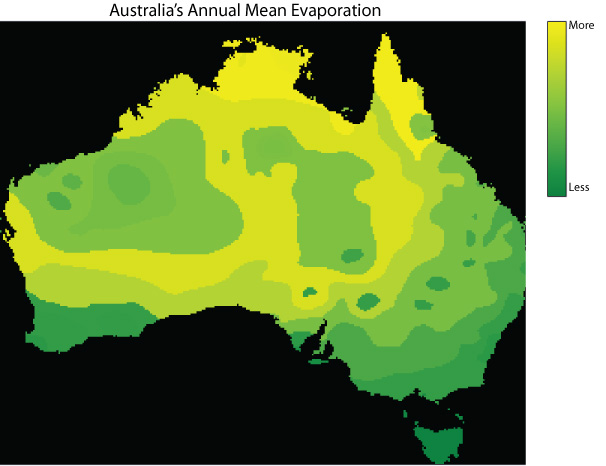
Austustralia experiences most of its evaporation around the center, north, and east of the country. Evaporation is not as prevalent in the south west. The Murray-Darling Basin will be in favour of this type of weather.
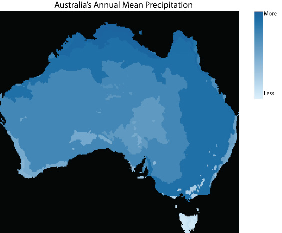
The occurence of rainfall (precipitation) occurs around the border of Australia. The central and eastern part of Australia is very dry and does not experience as much precipitation.
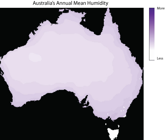
The humidity is seen to have increase around the coast of Australia. Central Australia does not experience humidity because there is no large body of water to produce a humid climate.
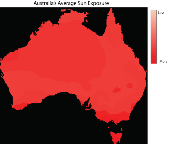
Australia experience more sun exposure towards the southern tip and central part of the country. More sun exposure will increase the rate of evaporation, which is not optimal for basins or any water to be present.
File Format
- Data formats used were Shapefile and DEM. The DEM file was converted into ASCII through ESRI's ARCMAP.
Projection
- Daturms were converted from GDA 84 and GDA94, to WGS 1984 UTM 55s.
Clipping
- Most of the data collected was in the form of vector data. Using Esri's ArcToolbox Clip option, the Murray-Darling Basin polygon was clipped by selecting an unqiue attribute a part from the other basins.
Conversion
- Vector data was converted into Raster data using Esri's ArcMap using two ways:
1. Using Esri's ArcToolbox Conversion Tools>To Raster> Polygon to Raster, data was converted into a Raster format. Following the operation, data was then converted into ASCII by selecting ArcToolbox>Conversion Tools>From Raster>Raster to ASCII.
2. Using Esri's ArcToolbox Conversion Tools>From Raster> Raster to ASCII, DEM data was converted into an ASCII format. Data was then exported as a .TIFF file.
Importing to Idrisi
- Files imported to Idirisi were imported two ways:
1. Import>Software Specific Formats> Esri Formats>ARCRASTER
2. Import>Government Data Provider Formats> GEOTIFF/TIFF