
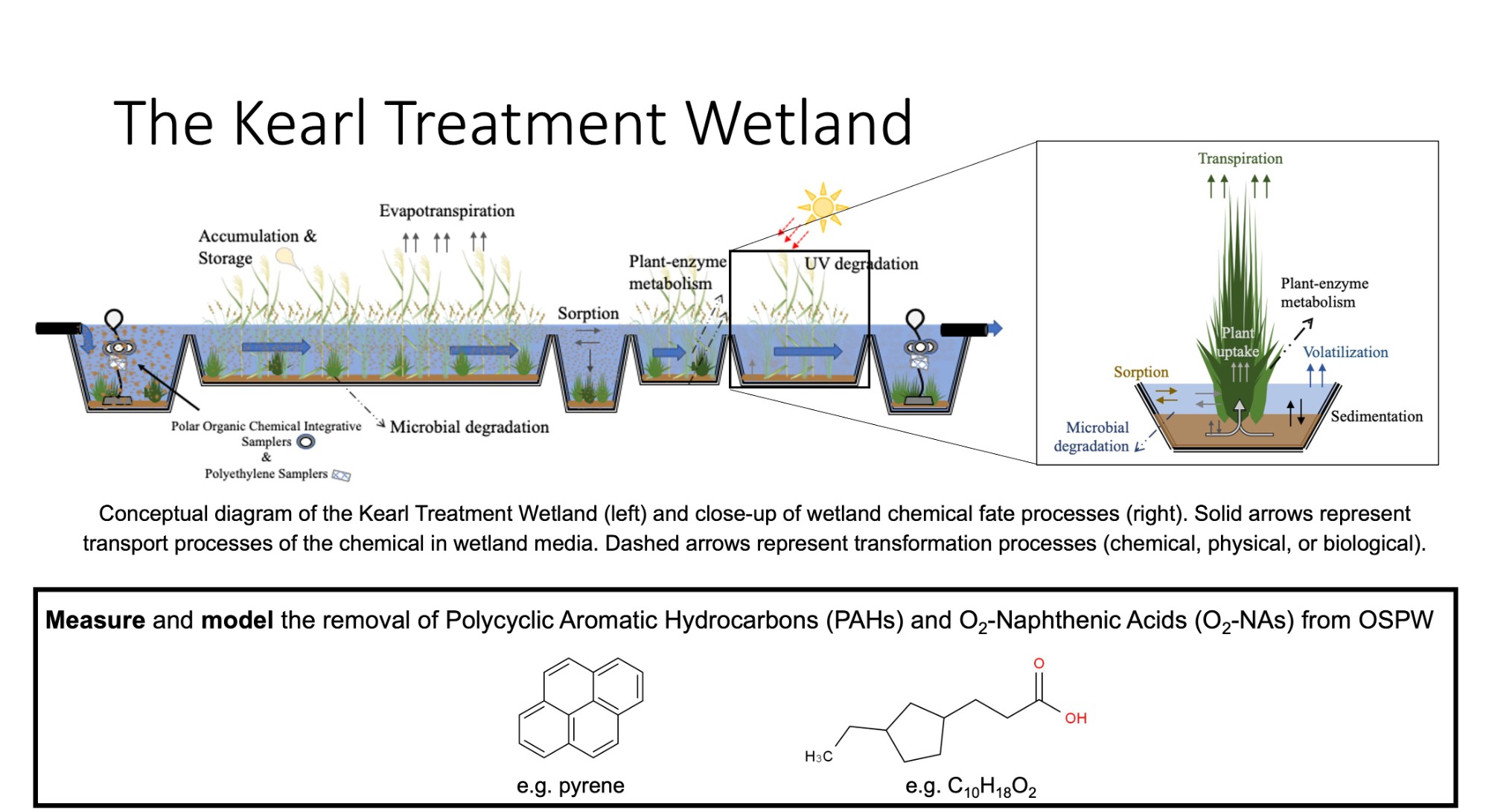
Conceptual diagram of the Kearl Treatment Wetland with a fully recycled (top) and flow through (bottom) regime. Solid arrows represent transport processes of the chemical in wetland media. Dashed arrows represent transformation processes (chemical, physical, or biological).
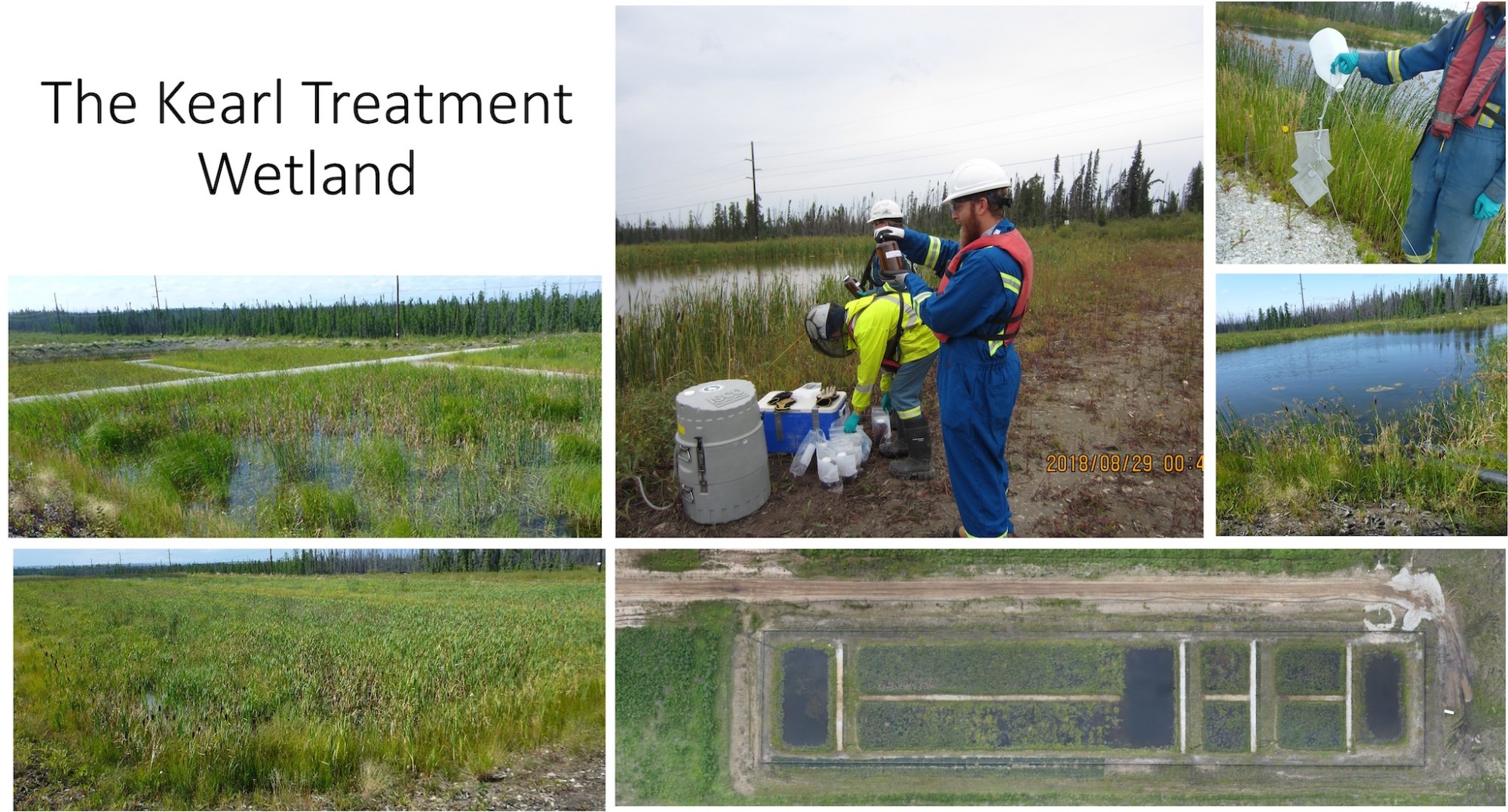
The Kearl Treatment Wetland is a free water surface-flow wetland constructed in 2013 at the Kearl Oil Sands mine site (approx. 75 km NNE of Fort McMurray, AB, Canada). The wetland consists of six cells in series (3 deep pools, 3 shallow pools) with a longitudinal slope of 0.014%. Water percolates over shallow berms that separate each adjacent cell. Shallow berms were also constructed parallel to water flow in the middle of the shallow pool sections to improve directional water flow, and provide access for wetland monitoring (e.g. vegetation, erosion, water quality). The total capacity for storage in the Kearl treatment wetland is approximately 6,000 m3.