
Project Sidewalk
The SWAN Project is collaborating with Project Sidewalk, a project focusing on, "Building tools for collecting street-level accessibility information from every street in the world and enable design and development of novel set of location-based technologies for accessibility" - Project Sidewalk.
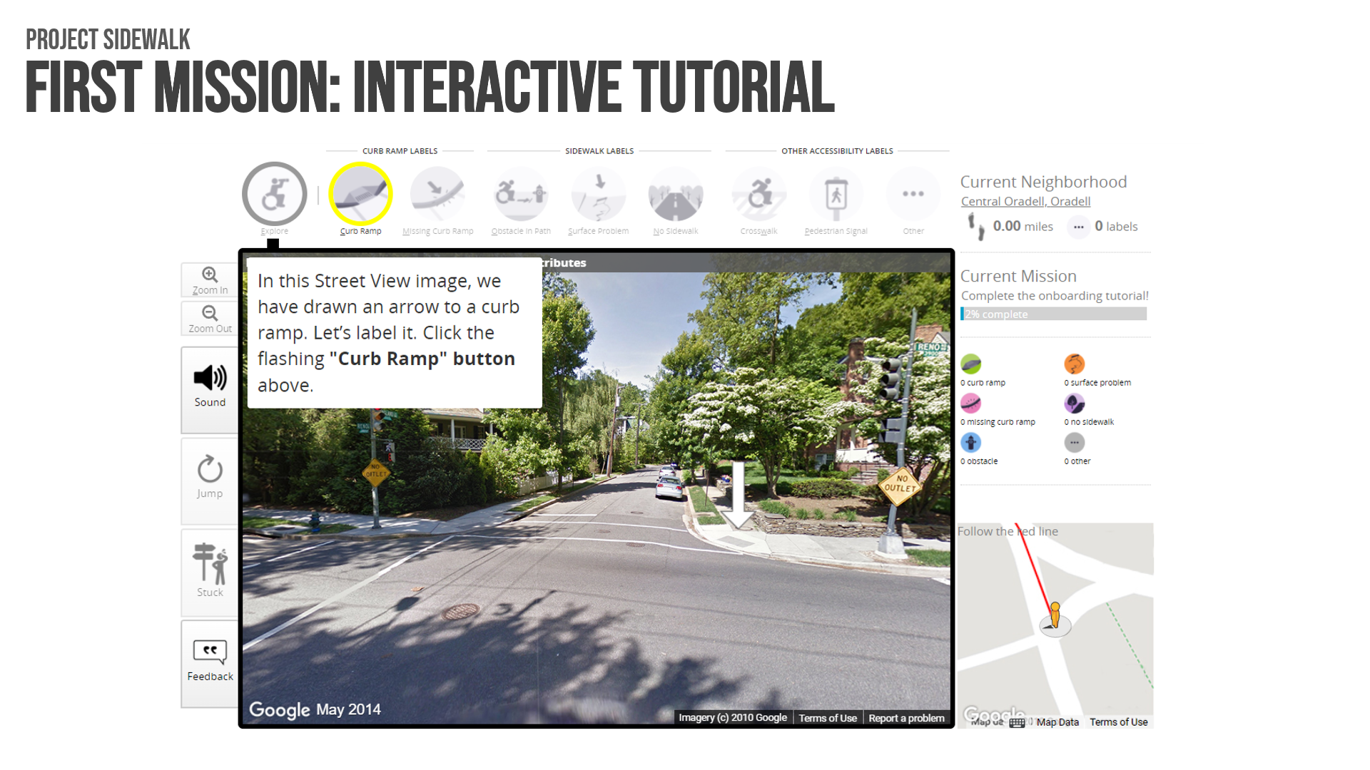
In this project, streets are virtually explored and accessibility issues are labeled. Project Sidewalk combines online map imagery, remote crowdsourcing interfaces for labeling and validation, and machine learning to scalably map and assess sidewalks. Project Sidewalk is being used to improve urban planning, build new interactive visual analytics for urban accessibility, and improve government accountability.
Project Sidewalk has two types of game missions:
- Exploring and labelling;
- Validating and correcting
Labelling is a four-step process:
- Find a problem
- Select a label type
- Rate the severity of the problem
- Fill in a description
In data validation, you receive missions to validate other people’s labels.
Learn more about Project Sidewalk at this link: https://makeabilitylab.cs.washington.edu/projects/sidewalk/
Explore city streets at this link: https://sidewalk-sea.cs.washington.edu/