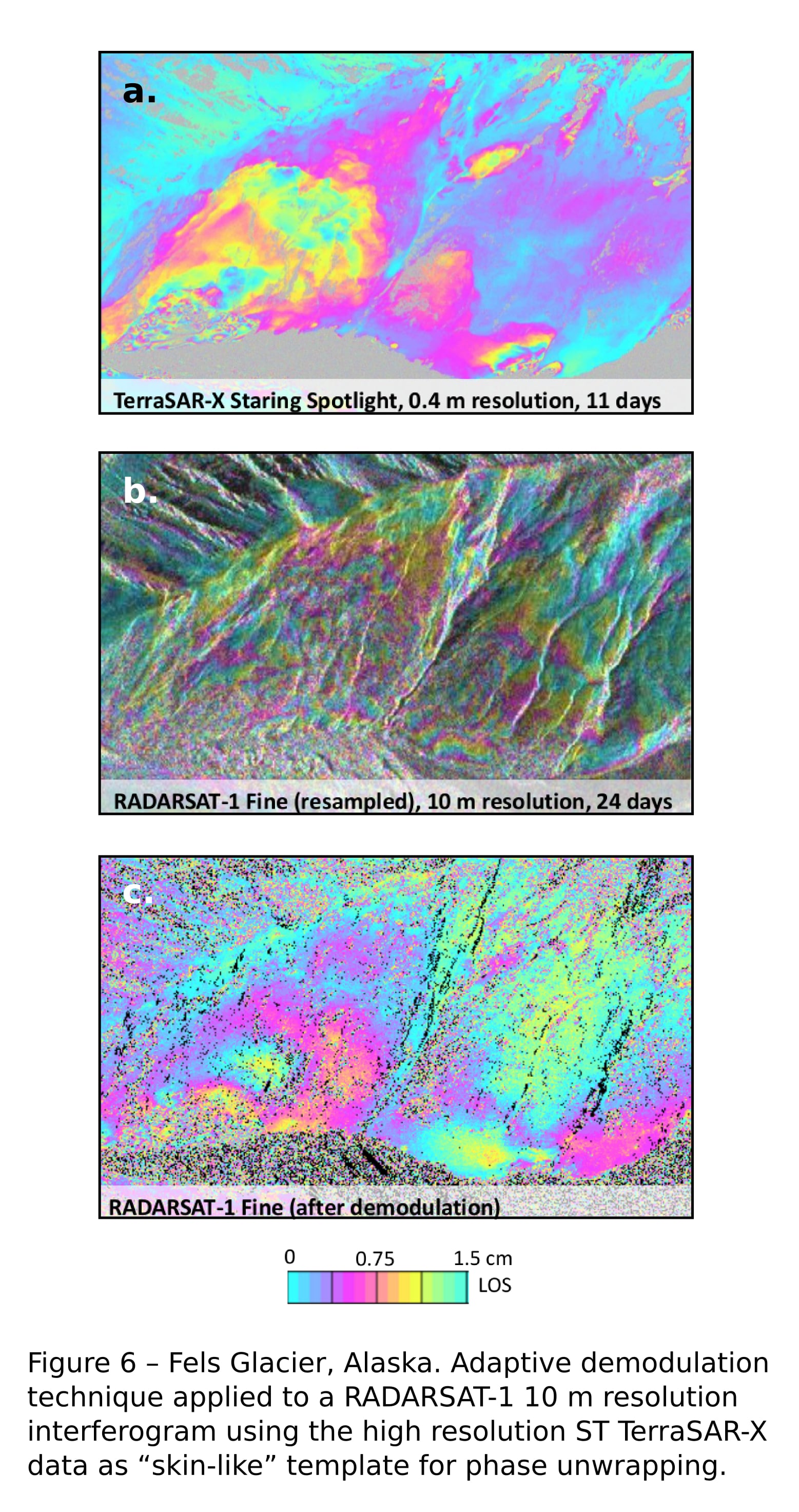
Wrapped phase demodulation: We develop novel demodulation approaches that makes use of parametric modeling and higher resolution interferometric data (e.g. as those provided by TerraSAR-X in Staring Spotlight mode) to disambiguate the phase of historic interferometric data stacks at a coarser spatial resolution (e.g. ERS, RADARSAT-1).
Advanced atmospheric correction for InSAR: Our goal is to better model/characterize the InSAR atmospheric phase component, using both InSAR time series and Global Circulation Model (GCM) outputs. This will in turn improve the detection of temporally non-linear, spatially long range displacements (e.g. “mini-earthquakes” that result from fracking).
Integration of InSAR and geophysical methods: The status-quo of geophysical applications of InSAR is to process InSAR results independently that are then used as input to geophysical modeling approaches. We investigate the mutual constraints that InSAR and geophysical modeling can provide each other, to improve the robustness and accuracy of a combined modeling solution.