Results
What we achieved
Final Map
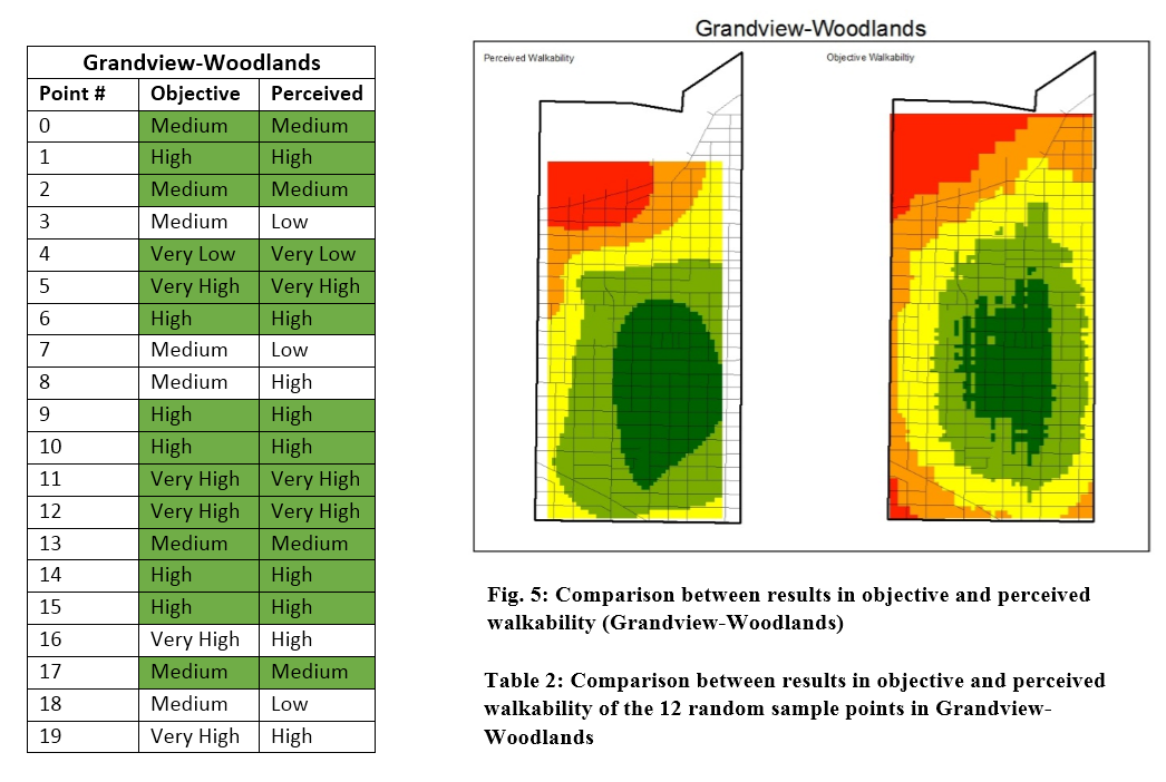
Grandview-Woodlands
The quantitative results confirmed what was suspected in the visual analysis. Grandview-Woodlands had the highest agreement between Objective walkability and perceived walkability. From the twenty random sample points fourteen matched across the two surfaces, indicating a 70% agreement. Very high objective and perceived walkability was found focused along Commercial Drive near the center of the neighborhood; a street well known for shops and restaurants surrounded by a range of dwelling types. Very low objective and perceived walkability was identified at the northwest corner of the neighborhood in an area that becomes increasingly industrial leading up to the waterfront area where Port Metro Vancouver operates.
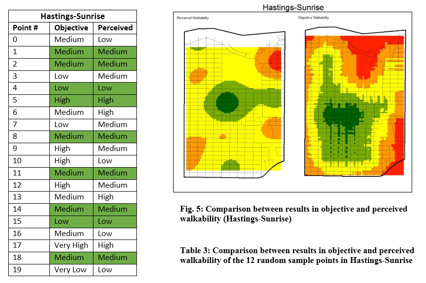
Hastings-Sunrise
Hastings-Sunrise had the second highest level of agreement between the two surfaces. Nine of the twenty sample points matched giving the neighborhood an estimated total agreement of 45%. Unlike Grandview-Woodlands this correspondence was not as clear during the initial visual examination. The perceived walkability of Hastings-Sunrise fell mostly into the Medium category, with higher levels of walkability towards the center of the neighborhood. This is an area where Hastings Street, one of the busier and better known streets in the area meets fairgrounds of the Pacific National Exhibition. Unlike the objective walkability surface which projects decreasing walkability away from the center of the neighborhood the perceived surface indicates pockets of higher walkability near the periphery.
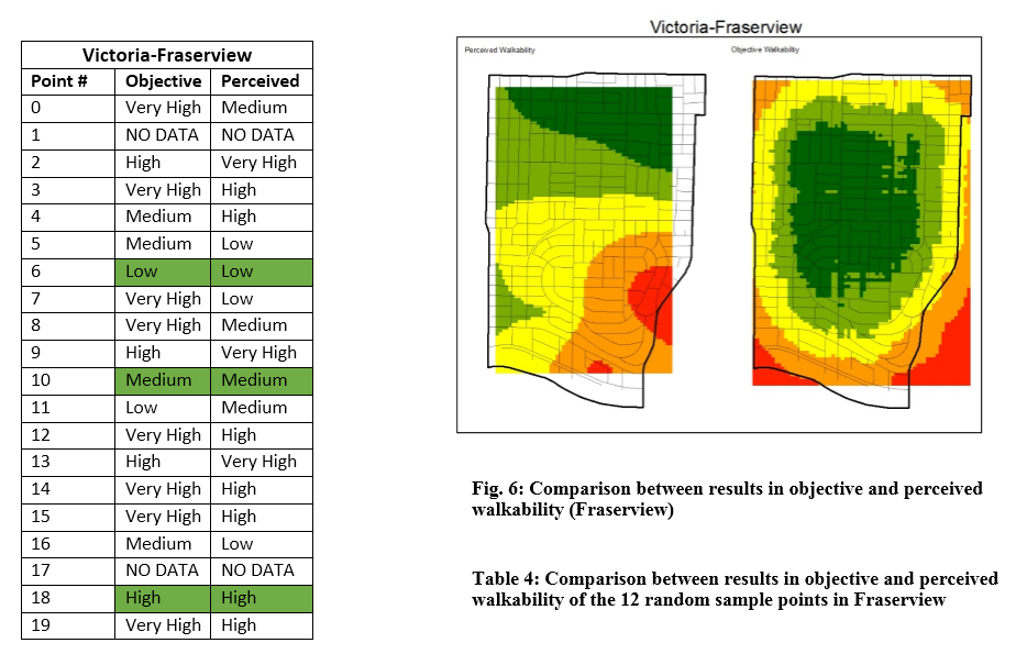
Victoria-Fraserview
Visually Victoria-Fraserview had the least amount of agreement. Again this was confirmed by the quantitative analysis. Of the twenty random points two, placed within the extent of the perceived walkability surface, fell outside of the irregularly shaped boundary of the neighborhood. These were excluded from the analysis and are listed below as “NO DATA”. From the eighteen remaining sample points three matched across the two surfaces, providing an estimated agreement of just 17%, the lowest of the three neighborhoods. As with the other objective surfaces the methods used indicated higher walkability towards the center of the neighborhood with walkability dropping off towards the periphery. Uniquely, the perceived walkability surface indicated a gradient of walkability within the neighborhood with higher walkability to the north, inland towards the center of the city, and lower walkability towards the south and the Fraser River.