| |
Results
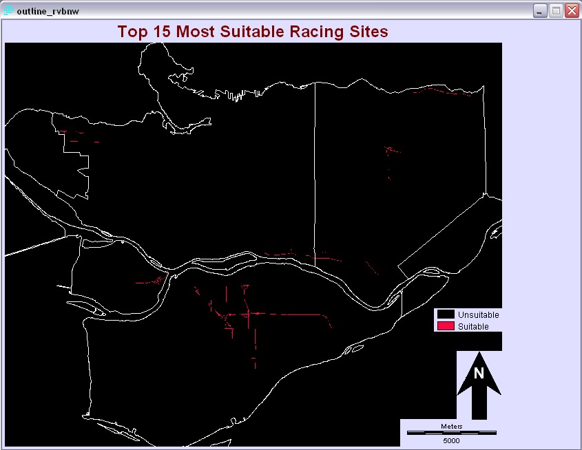
After performing a MCE via the Decision Wizard, the following image was produced. The image shows on a scale the road areas that are most suitable for street racing. Since there are so many highlighted suitable areas, I need to narrow my search to further analyze this image.

MCE Output Map
A typical street race will involve distances of over ¼ mile or 402 meters (ie. Drag race). I used this to estimate the minimum distance we would require to have a race. From the resolution of the image which is 1 unit equalling 12 meters, a minimum distance for a race would require 34 units. First I isolated the most suitable locations for street racing, by taking the top 25% from the suitability scale of the MCE output image. The top 25% values ranges from 216 to 255 and I used the module RECLASS to produce the result of that. Once I obtained this portion, I used the GROUP module to separate each area into individual segments. This resulted in 167 segments from the top 25% of the MCE output image. Because there is no module in IDRISI to measure distance along a line, I used the AREA module to produce a tabular chart to calculate the cell areas of each segment. Because our target area, Richmond, Vancouver, Burnaby, and New Westminster is so big and dense, enforcement of all of probably areas is just too much. With the chart, I organized it from greatest to least in order to find the top 15 areas the police can focus on.
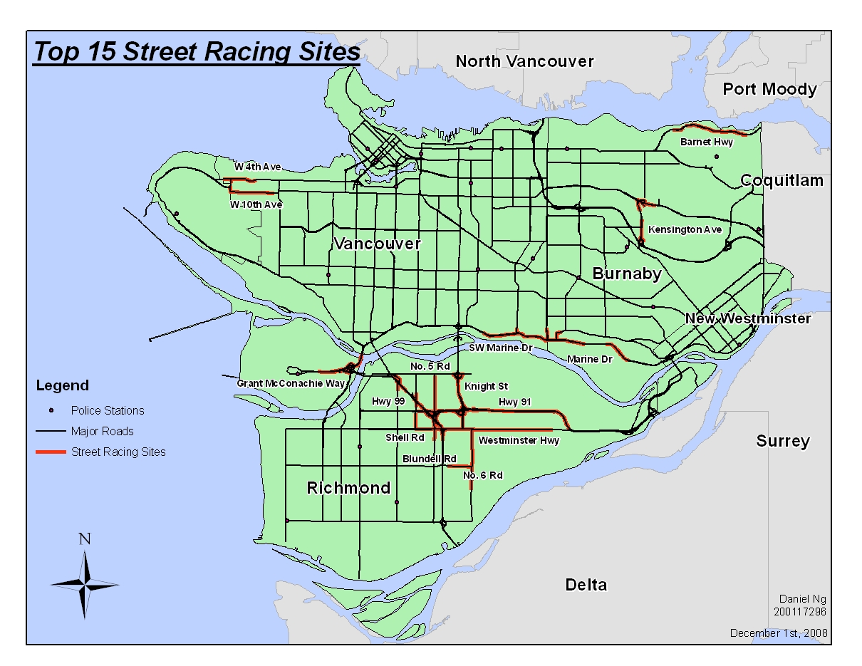
Top 15 Most Likely Places for Street Racing
Conclusions
This project is a very good first step in enforcing road and traffic safety at all times by minimizing reckless, unsafe drivers who indirectly uses their vehicles as weapons when they race on the streets. Of course, we need to expand this analysis to all parts of Metro Vancouver with more research and data so that an increasing population of people in the region can be a peace on the roads at anytime.
|
|