Spatial Analysis - Cost-Distance Analysis
As the most insuitable area on the MCE map had the highest value, the raster file was directly used to represent the cost to the nature in building a pipeline in that location. The model "Pathway" ran from cell to cell to find pathways with the least cost, which represented the route with the least cost to the environment. 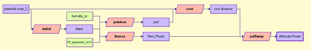
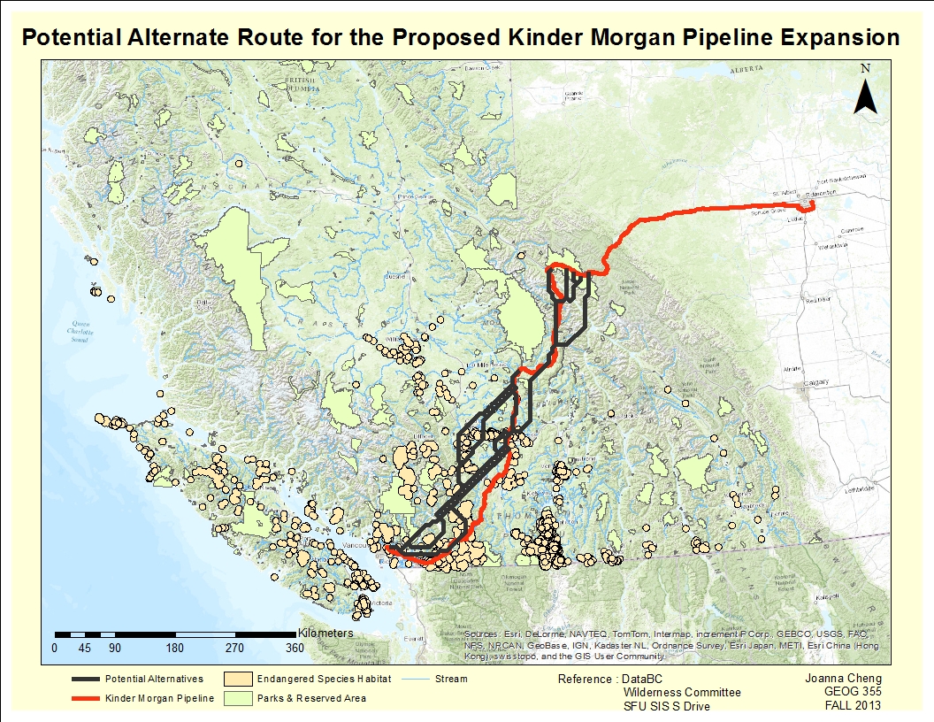
Here is the calculated potential route alternatives in comparasion to the Kinder Morgan proposed route.
.
The route in dark grey was the calculated pathway from the analysis. According to the analysis, there were couple of routes that the current Kinder Morgan proposed route could take in reducing the cost of the nature. However, the large area of endangered species habitat near Surrey, Chilliwack, and Abbotsford seems to be hardly avoidable. Also, highly dense endargered species habitat around Merrit, Kamloops, Cache Creek, and Lyton seems to be hard to avoid as well.
As this project only explore the alternatives route within BC boundary, the analysis start when the Kinder Morgan proposed pipeline hit BC boundary, which was located on Jasper National Park. Since park and reserved area was ranked as highly insuitable for building a pipeline, the calculated route hit south immediately as the analysis starts, in opposed to Kinder Morgan's northwest direction.