Suitable Areas for Evacuation and Emergency Facilities in North Vancouver, British Columbia
Introduction
With the Corridor glacier started to retreat in about 10,000 years ago, the landform of the north shore has been largely modified by the deglaciation. Besides those natural attractions, like ski resorts and alpine forests, the deglaciation process also left widespread unstable surficial material and steep hill slopes, which have triggered various natural hazards. Due to limitation of flat space and non-stoping urban development, many houses and propertties have been biuld in post hazard areas and potentially unstable areas, such as debris of landslide, flood plain, and coastal areas. In order to mitigate the impact of natural hazards and secure the safety of residents in North Vancouver, construction of emergency facilities and evacuation route are suggested.
In this project, I will find out the suitable areas to build emergency facilities and settle evacuated crowd in North Vancouver (include City of Vancouver and District of North Vancouver) with the help of MCE analysis on IDRISI.
Common Natural Hazards and Some Past Events in North Vancouver Area
- Slope Hazards: intensive failure of steep slope include landslide and debrisflow. They often triggered by saturated unstable surficial material, such as sand, till, and glacial lucastrine sediments.
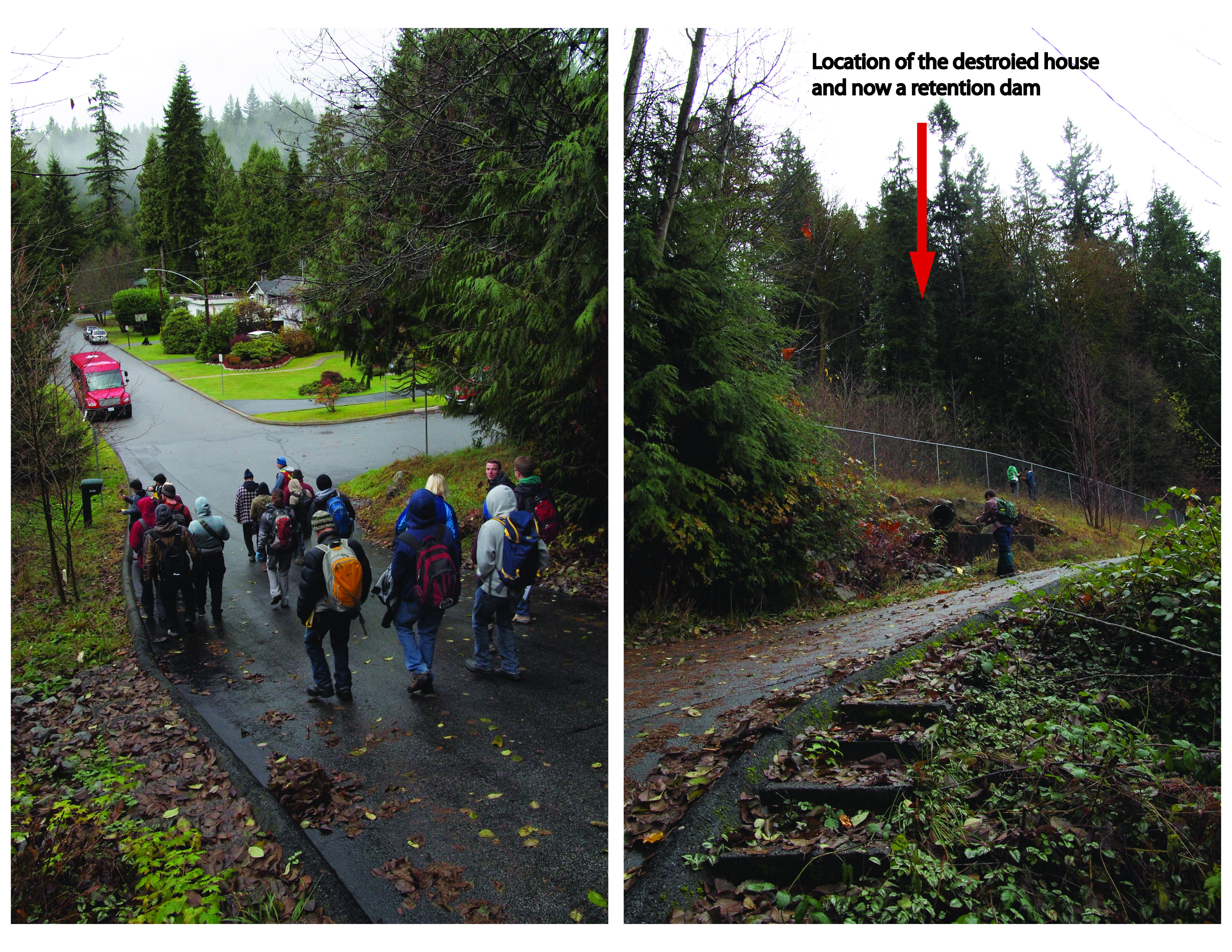
A Fatal North Vancouver landslide
The 2005 landslide location has been restored with a retention dam and other mitigation structures, but many people are still live at the the bottom of the slope. The following pictures were taken on November 16th, 2013.
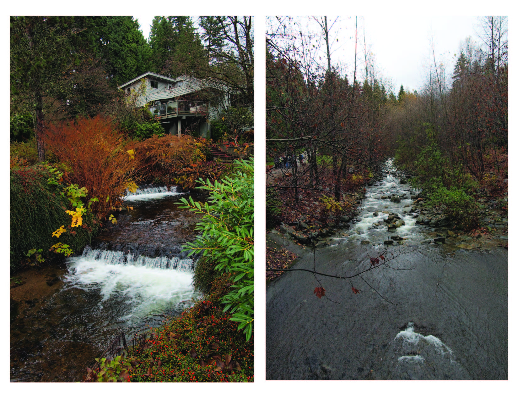
- Creek Hazards: commonly known as flood and flood related environmental issues, such as lateral movement of channels and undercutting on the banks.
Picture on the left shows a house is build right beside the channel of Mackay Creek in District of North Vancouver. The most recent flooding in this creek happened in 1981 and caused great damage. This section of the channel has been anthropogenically altered into a right angle to get larger space for urban development, which is a serious human induced risk of flood.
Picture on the right is the creek channel of Mosquito Creek in District of North Vancouver. Severe debris flood in this creek have happened in 1950s and 1980s. The return period of a normal size flooding in this creek is 20 years, which means the possibility of flood in this creek is 1/20 every year. The Evergreen basin at downstream of Mosquito Creek is a densely populated community.
- Liquefaction: earthquake-triggerd deformation of saturated and unconsolided surficial material, especially coastal anthropogenic fill.
Video of liquefaction during the earthquake in Japan on March 11th, 2011.
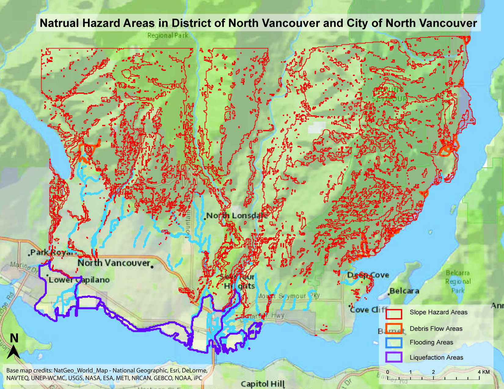
Map of Natural Hazad Areas in North Vancouver (click the image for large map in pdf.)