
|
||||
| Project
Home
Introduction
Data
acquisition Methodology
Spatial Analysis
Errors/Problems |
| Introduction | >Next
Page> |
|
According
to
the
Greater Vancouver Regional District Livable Region Strategic Plan, the
City of
Background Research The
information about the GVRD livable
region strategic plan is obtained from the Greater Vancouver Regional
District
website. The website contains a
lot of
information about ways to concentrate growth in the present urban areas. The
Translink website also has the “area
transportation plan” pages that give me some ideas on the project. Study
Design Presently,
skytrain and buses are
probably the most common modes of public transportation in the City of Hypothesis: The main
hypothesis of this project is
that to concentrate growth, we need to improve the attractiveness of
public
transit. The factors that
determine the
attractiveness of public transit are the proximity to public transit,
the
frequency of transit service, and the modes of public transit available
(skytrain more attractive than bus). Areas
that need to improve transit services are those
where most people
find transit to be unattractive and areas suitable for higher density
developments are those that already have sufficient public transit
services to support higher density development.
Potential areas for higher density developments also need a low
population density currently because the aim of the strategic
plan is to concentrate growth but not adding density to presently high
density areas. |
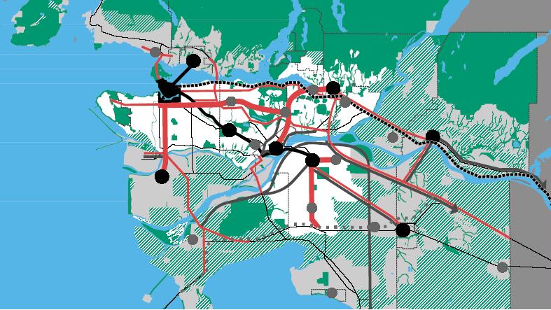 Fig 1. Map showing some context of the GVRD livable region strategic plan. The white areas are the "growth concentration area" and lines of different colours and thickness represent different mode of transit system. Photos courtesy: Greater Vancouver Regional District website. 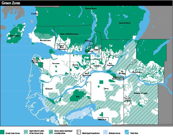 Fig 2. Map illustrating green zones that are going to be protected from development as a result of concentrating growth. |