Background research
Study site
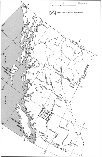 Location of the Taseko Lakes
|
The study area is the Fraser Plateau in the Chilcotin River/Taseko Lakes regions of British Columbia (map sheet 92O/NE in the National Topographic System). The Fraser Plateau is located within the Interior System of the Province. Over half of the area of the plateau is located on the west side of the Fraser River. For the purpose of this project, a cut block (clear-cut area) was assumed (713600 mE 1202350 nN , 776100 mE 1256850 mN). Ground water (Foweraker), soil (Valentine et al., 1987), geological (Schiarizza et al., 1997) reports provide information about the study site. Geological, climatic, vegetative, soil, tree species background is given into the following pages.
To provide more in-depth background research, the study site was examined for the following:
- Canada Land Inventory (CLI) classifications
- primary tree species
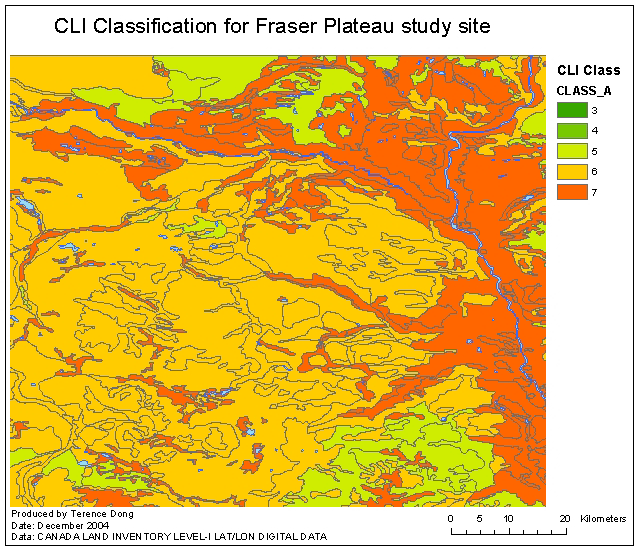 CLI Classification for Fraser Plateau |
The CLI classification groups all mineral and organic soils into one of seven classes based upon their inherent ability to grow commercial timber. The best lands of Canada for commercial tree growth will be found in Class 1 and those in Class 7 cannot be expected to yield timber in commercial quantities. It is found, for most of the study area, that CLI is classified as 6. From the primary tree species, the following indigenous species for the study area was then selected: Lodgepole Pine and White Spruce.
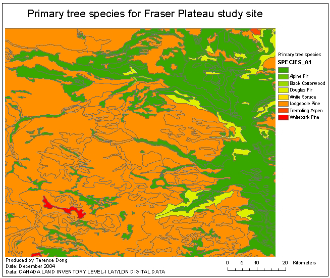 Primary tree species for Fraser Plateau |
Productivity of a forest is largely defined, within a given macroclimate, in terms of site quality (Daniel et al., 1979, p235). Daniel et al. (1979, p235) says that site quality is “the sum of many environmental factors: soil depth, soil texture, profile characteristics, mineral composition, steepness of slope, aspect, microclimate, species, and other”; and “[t]hese factors, in turn, are functions of geologic history, physiographic, macroclimate, and successional development.”
The indirect approaches for estimating site quality have been divided into site index, vegetative, and environmental categories. Daniel et al. (1979) provided a critique of site-index determinations and vegetative approaches. The site-index determined required the availability of height-age curves for the particular area and species. Without these normal yield tables, areas could not be classified. The vegetative approach was unable to provide reasonable estimates of site quality. Daniel et al. (1979) proceed to provide other efforts to explore the use of locally significant physical factors in an environment, such as: soil-site index, physiographic site types, ordination, Krajina biogeoconenoses. Smith (1986) also mentions that soil examination, shape of the terrain, and topography as key to site classification, and can also be translated into site index.
Topography in a landscape influences the microclimate by inducing variations in the amount of solar radiation reaching to the ground, and
changing the movement of local air currents (Wilson, 1970, p1). Vegetation
differences between north and south slopes are often the most extreme difference
to be found in a locality (Wilson, 1970, p1).
^ top