Introduction
This final project for Geography 355 (taught by Dr. Nadine Shurmann) is designed to incorporate and integrate a number of spatial analytic skills including project design, data collection, data manipulation and transformation, and cartographic presentation. It was required for the project to be designed and executed in Clarks Lab’s IDRISI and presented over the internet in html format.
In British Columbia, siliviculture is law. Logged sites must be reforested and managed until they are classified as ‘free to grow’, and the area is destined to become a healthy forest. The regeneration of stands is traditionally based on the pattern by which the pre-existing stand is removed (Smith, 1986). Maps of tree mixture ratios, to be planted in the cut blocks, are established on pre-logged vegetation cover ground truthing. The accuracy and relevancy of these maps are questionable. This project idea is initiated as a solution to the above problem as observed during my tenure as a treeplanter (circa 2003).
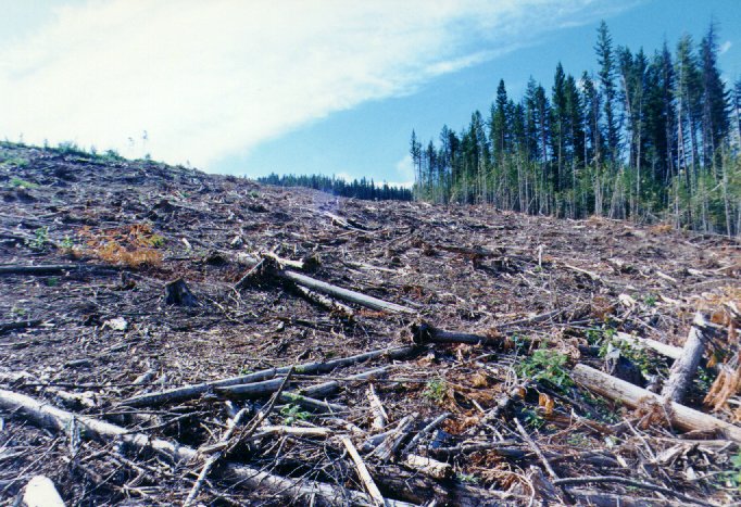 Clearcut Lodgepole Pine forest at Salmon River watershed (1994) © 2004 Dr. Robert Hay |
The project goal is to put the right tree in the right place. This involves “much opinion and analytical thought about ecology and human demands” (Smith, 1986). One view is that a stand should consist of those tree species best adapted to survive and reproduce on the site. The other view is to re-plant with the most suitable but highest profit generating species for human requirements and needs. This project intends to use indigenous species that will not only survive and thrive on the site but also potentially yield wood or other benefits at optimal rate.
The limiting factors for species composition are set by environmental factors, and species suitability (Smith, 1986). The objective of this project is to analyze the enormous amounts of data affecting tree growing conditions, and map, by using an environmental indirect approach, the optimal suitability locations for tree species. Ideally, because of this multi-criteria evaluation (MCE) decision-making, survival rates of tree saplings will increase. The project will utilize the fact that IDRISI is a raster system by using native raster data (i.e. DEM), and harness its superior GIS and spatial analysis. From internet and academic journal searching, there is very little evidence of reforestation decisions based on GIS analysis. Research materials about silviculture (Smith, 1986; Daniel et al., 1979), microclimate (Wilson, 1970), tree species (Grossnickle, 2000), and GIS (Lo & Yeung, 2002; Sample, 1994; Goodchild et al., 1993) are used.
^ top