Introduction
Defining Play Deserts
For the purpose of this project, play deserts are defined as geographical areas which lack one or more of the following qualities of outdoor play spaces for use by children for play:
Presence refers to the physical presence of a play space within a geographical area. If there is no outdoor play space present, then the area is considered to be a play desert. Once presence has been established, the other three criteria are used to place play spaces on a scale from ‘play desert’, meaning lack of accessibility, quality, and/or opportunity, to ‘play oasis’, which implies an abundance of each.
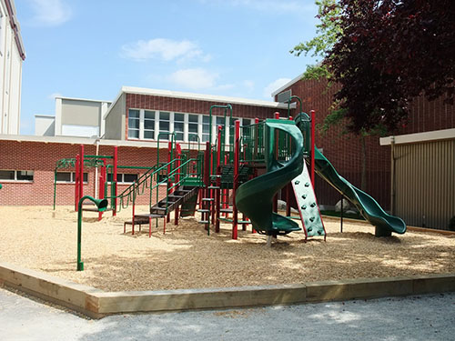
Image: Jules Quesnel Elementary, an example of good ‘presence’
Accessibility refers to how easy and safe it is, or is not, for children between the ages of 10 and 14 to access a play space. If the only play space within walking distance to a residential area requires crossing a major highway, despite presence, the lack of accessibility affects how a play space falls within the scale.
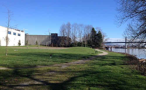
Image: Charleson Park, an example of good ‘accessibility’

Quality refers to physical quality of elements within a play space. If a play space is present and accessible, however the physical features of a play space are of poor quality and potentially hazardous to children, then the area is more likely to fare negatively on the scale.
Image: Park Site on Shaughnessy St, an example of poor ‘quality’
Opportunity refers to the possibilities for engaging in meaningful and risky play within a play space. If all the other criteria are met, but opportunity is lacking, a geographical space is less likely to be classified as a play oasis.
Image: Maple Grove Elementary, an example of good ‘opportunity’
