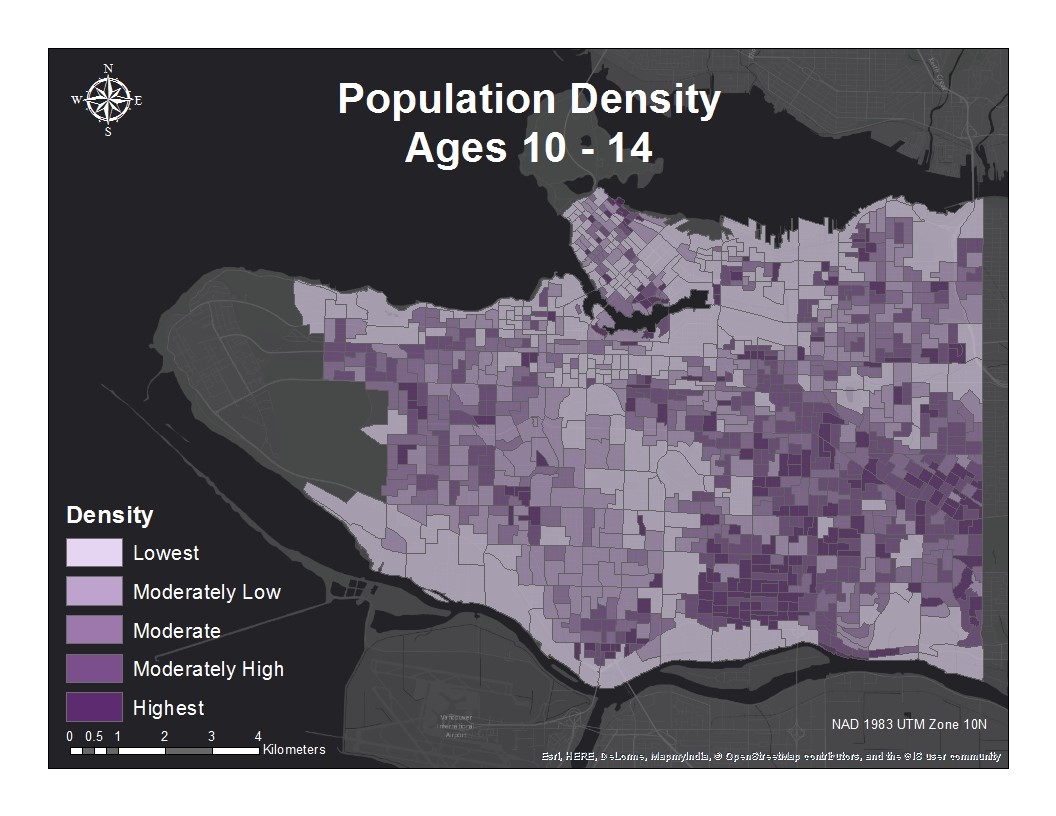
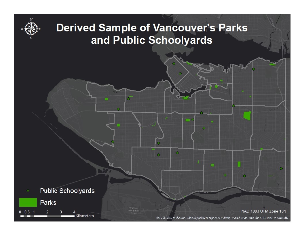
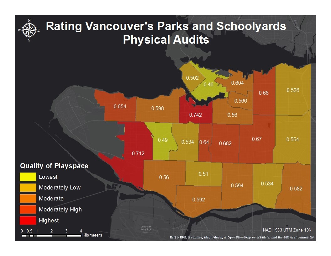
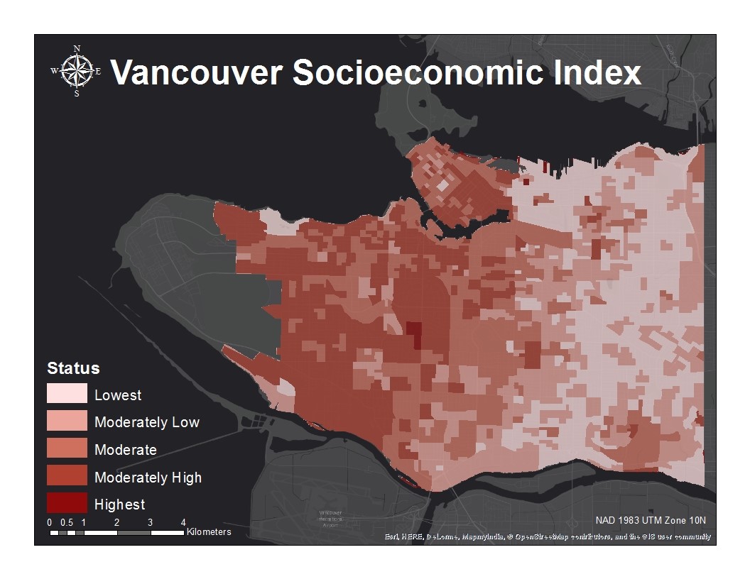
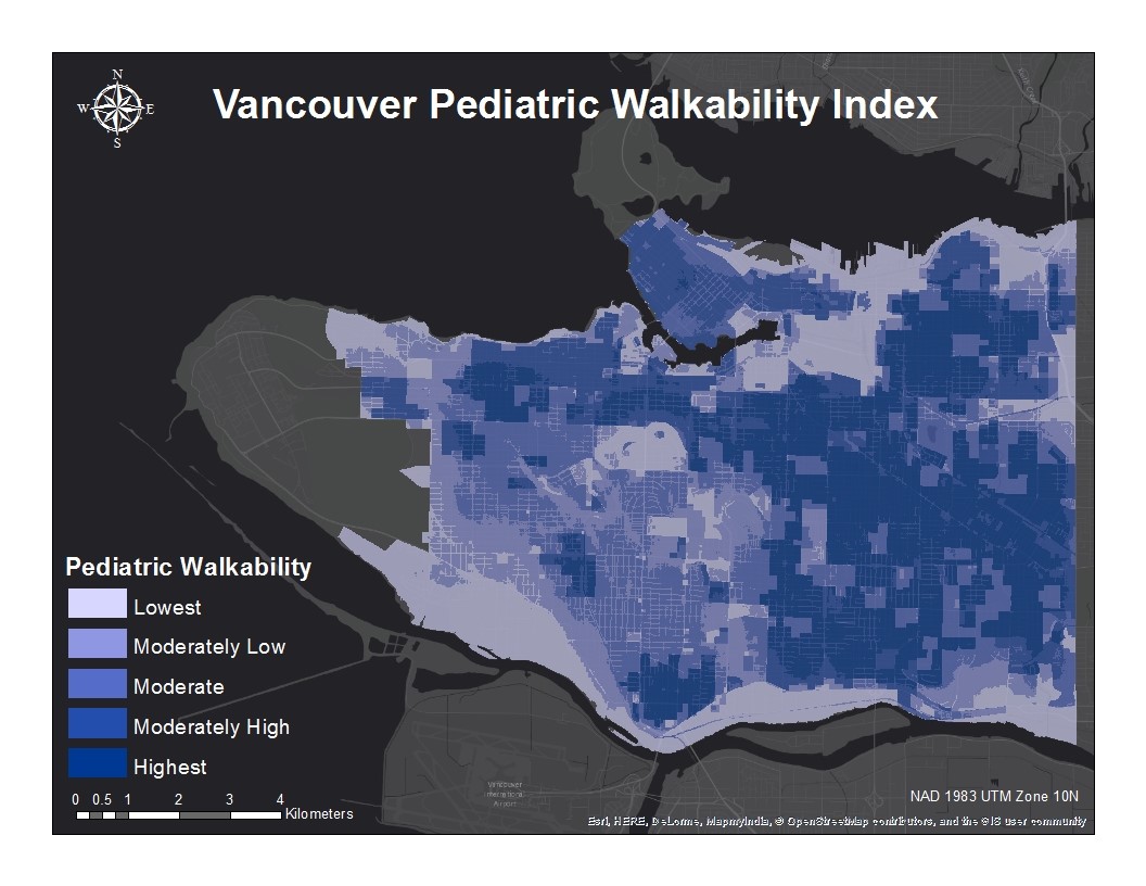
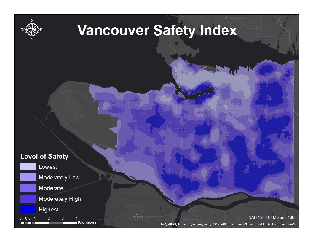
A critical analysis of play spaces involves more than simply identifying the presence, or lack thereof, parks within a region. It also assesses the quality of that play space, its accessibility, and the opportunities for risky play it affords to those who use it. This project examined multiple variables concerning these issues for a comprehensive view of the problem. These included the population density of children within the project’s age range, park quality ratings, SES, walkability, and safety. The spatial analysis software used for the completion of this project were ArcGIS and IDRISI Selva. The following sections of the Methodology discuss each of these variables in more detail.