GIS Project:
The Potentials for Environmentally Impacted Area in Fulton County
|
GIS Project: The Potentials for Environmentally Impacted Area in Fulton County |
|---|
| Result:
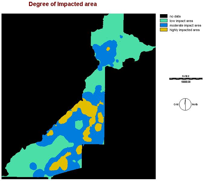
In this page, the results from all categories are shown. All the legend ranges are evenly divided within the entire range of data in the image. Long term impact on environment: Back This image is showing the area that damage by pollutants in a long run. These pollutants mainly stay in the soil. It was transported by ground water and/or surface water. Therefore, there is more time for harmful substances to damage the environment.
Immediate impact on environment: This image is showing the immediate impact on environment by toxic substance, industrial chemical, hazard substance and landfill. All these elements change the environment in the matter of minutes.
Air emission impact on environment: As mention in the title, this is a image that show environment impact created by air emission. This image is done by combining indfuzz, railfuzz, minfuzz, and manufuzz. These themes contain location that produce air pollution. The air pollution affects area from 5 to 10 km in radius.
Overall impact: By combining all criteria used in long term and immediate results, the overall impact site are created. The general pattern of all four images is that the highly impacted area is located near the central area of the state. It is where Atlanta city is located. Unbra area is the area that needed the most resource to improve the envirnment
|
|
|
Created by Alex Chan From SFU, Geography Department |