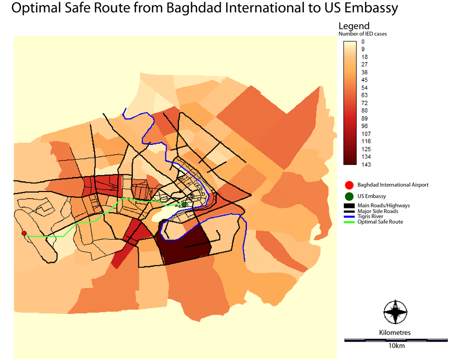
Distance and Pathway Analysis in Baghdad, Iraq
Spatial Analysis
Friction Image
The friction image was created by the following:
Combining the main roads, roads, and the neighbourhoods base map using the OVERLAY module (first + second).
Each polygon was reassigned (ASSIGN module) a friction value according to the number of cases of IEDs in that particular neighbourhood. The roads were also assigned similar friction values, where roads that had an IED would be given a higher value than roads that did not.
Reclassed Neighbourhoods
See Full Image

Main Roads
See Full Image

Roads
See Full Image

Cost Distance
See Full Image

COST
Using the COST module (costgrow), a cost distance map was created from the embassy point.
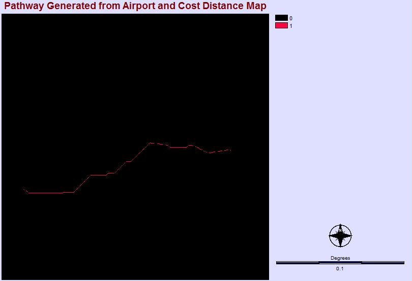
PATHWAY
Using the PATHWAY module, a path was created that shows the optimal pathway that attempts to avoid the most dangerous areas of Baghdad on the route from Baghdad International Airport to the US Embassy in the International Zone (formerly the Green Zone).
Pathway
See Full Image
Final Map
The final map is obtained by simply displaying all the components together. However, because this cannot be done with raster layers, everything except the neighbourhood base map was reconverted into vector layers using the RASTERVECTOR module. Lastly, a map composition was created with the following layers: