 |
|||||||||||||||
 |
 |
||||||||||||||
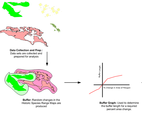
Introducing Known Error:
By buffering the historic species range maps we were able to increase and decrease the size of the maps. However, linking a known linear buffer size to a change in area for an irregular shape was beyond common geometrical calculation methods. As we wanted to control the area change in terms of percent change a method of determining the buffer length that would result in a specific percent change in area had to be found.By manually applying buffers to a polygon and recording the percent area change corresponding to the buffer length, empirical relationships could be determined. This method requires a relationship for each polygon considered.
To handle the large number of data files in our project a classification scheme was developed. Based on the size of the polygon and the amount of shape irregularity, we were able to use a representative polygon from each class for the empirical buffer / percent area determination. In the end, time did not allow for the entire dataset to be examined. Instead a subset of the data was used for the analysis.