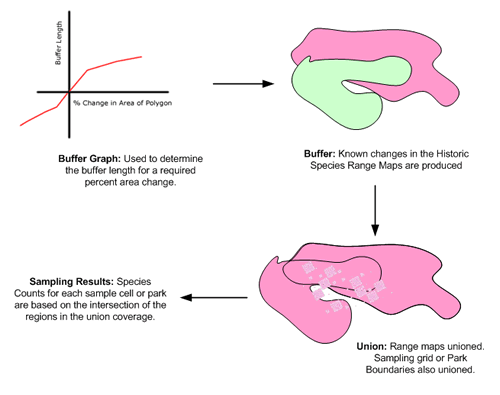
Historic
Range Map Sampling:
Historic
Range Map Sampling:
Random Sampling Method
The
random sampling method uses an irregular grid of different sized
cells over the area of interest (10, 100, 1,000, 10,000 km2).
In this case, the “mammal province” boundary is
used to establish the extent of the sampling grid. The benefit
of this method is that the influence of heterogeneities over
a region can be reduced.
Differences
from one place to another within the “mammal province”
can be smoothed out because the grid samples over the entire
region. The species / area curve developed then reflects the
mean situation for the mammal province.
Direct
Sampling Method
Direct sampling takes the boundaries of current parks and reserves
in a “mammal province” and overlays them on the
species range maps. The species richness for these boundaries
is determined. Species / area curves can then be determined
using the area of the parks and the sampled species values.
The results of this method are heavily dependant on the placement
of the parks. The resultant species / area curves are affected
by un-quantifiable social and political factors.