
Methods
Multi-Criteria Evaluation (MCE)
Decision Making for a New Location
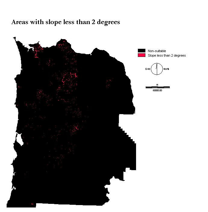
The main goal is to determine the best area for the new educational center in the Tillamook Park using a GIS analysis approach. Through a developers point of view relatively level slopes are favored to reduce the cost in building the foundation. After creating a slope image with IDRISI we can then determine land with a slope less than 2 degrees. These areas are only within the forest which developement will occur. When creating a Multi-Criteria Evaluation (MCE) all files must be in Boolean format.
Conversion of the DEM was required in order for the image to be usable through IDRISI. The slope analysis was applied which calculates the changes in elevation resulting in an image that displays gradients of slopes in degrees. To ensure that the data was only displaying northwest Oregon. The Marco-Modeler produces a flow chart that runs through each process and allows for conceptual processes to be better expressed. Our first assumption is that construction will take place within the Tillamook forest. With this in mind the slope values of concern are those within the management basin. An overlay between the slope layer and the forest boundary produces a new image.
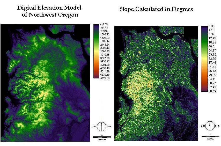
The digital elevation model of northwest Oregon was originally at 10m resolution but was not necessary to for the purpose of this project. Changing the all the resolutions to match was required to calculate the slope data. The slope is shown below producing range of values from 0 to 66.59 degrees.
By re-classing the values and selecting a slope range from 0 to 2 ranging. With this information we can we know that these areas are relatively flat and can be used for development. This is only possible assuming that any area in the forest is valid for construction.
Using the Macro-Modeler reclass module can be applied to each file to group all the various segments into one main category. Buffers are created to calculate the proximity to certain features. Transportation routes such as roads, rock roads, and railroads. Roads are for visitors, employees, and commercial use. To increase access from the new location rock roads are used to travel through the forest for management and control. If selective logging was to be attempted and tested transportation of resources can be easily transported.