Methods
Multi-Criteria/Multi-Objective Decision Wizard
Constraints are limitations that create an image with values that are either true or false. In this particular case selection of constraints were areas that are not within the forest boundaries that limited the developers. Other restrictions on development may be large infrastructure or transportation routes such as highways, rivers, or towns theses are extremely costly to move or build around and are often not in the budget for development. Land features such as streams and rock roads can be re-routed if necessary. The first constraint is the county boundaries of northwest Oregon. Other areas that are not possible for development are rivers, railroads, paved roads that have high friction factors. Cost can be a factor when comparing paved roads to rock roads. The rock road can easily be removed for development where as an ash fault road is very expensive to build and extract.
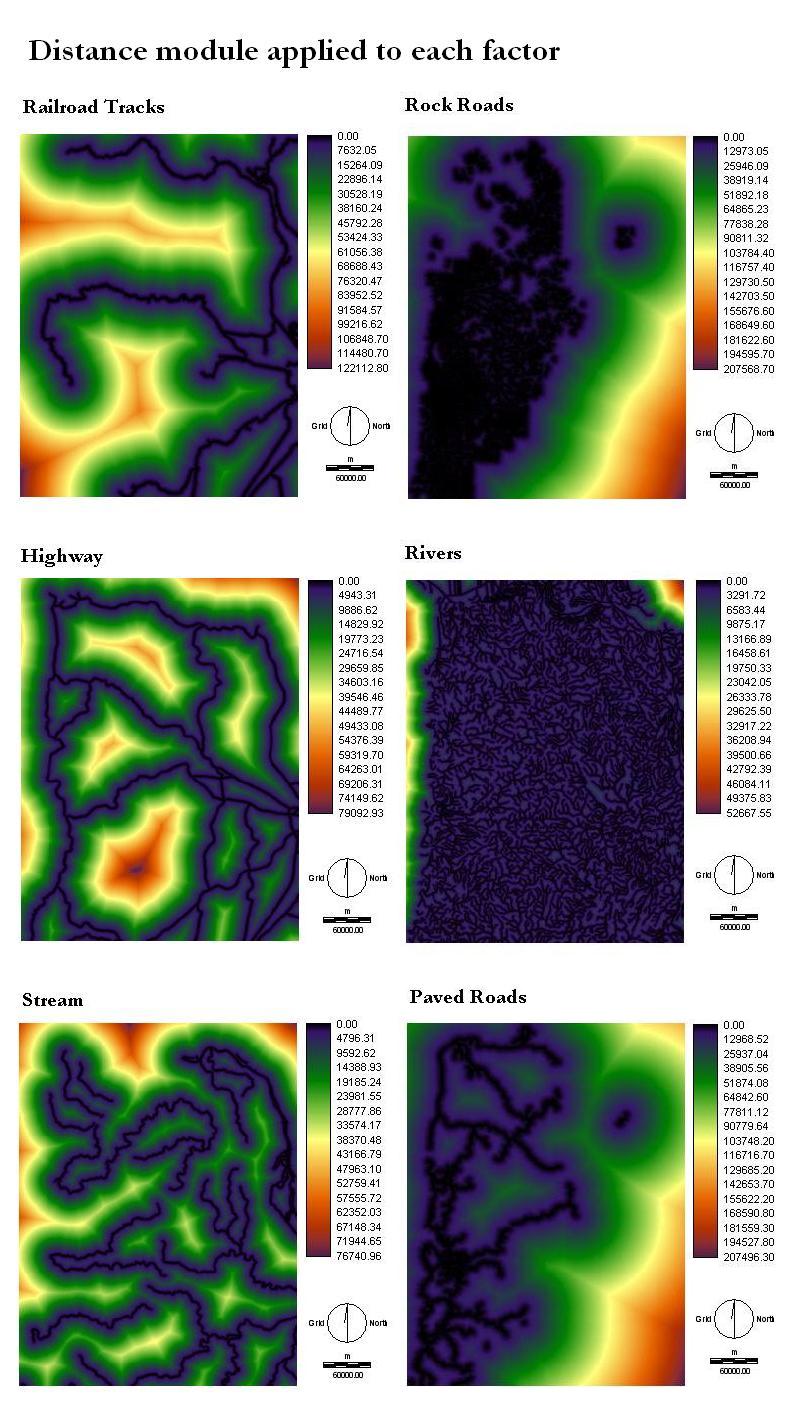
Distance images of the six factors are shown below. The distance module displays increasing distances from particular features. Railroad tracks are important to be near for ease of transporting the selectively removed logs. Proximity to rock roads provides possible areas to expand since they are not permanent and not as expensive to remove as paved roads. Highways are often built by non-residential areas due to the high volumes of exhaust and noise caused by heavy traffic. An advantage to having the interpretive center near a highway will draw more traffic into the site. Environmental concerns in the area are that the water does not get affected by this development. The water sheds in this area provide Oregonians drinking water and are home to the salmon in this region. Increasing distance from these sensitive water ways is advised. Rivers can also be a restricting factor risk of building on a flat floodplain would be a threat to the center. Paved roads provide access to the site is an important factor which nearness to a paved road would be desired.
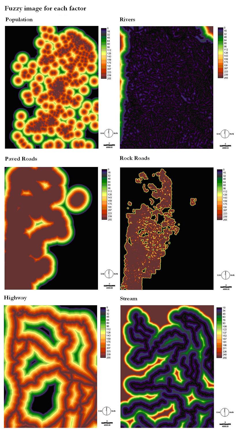
Fuzzy factors are applied to six variables. The first variable that this is applied to is the paved roads. A negative linear association was chosen for proximity to population. The distance one would walk to a park would be relatively close and 1 km was selected to represent this where as the furthest one would drive to the center was predicted to be 30 km. An increasing J-shaped graph was used to simulate river and stream fuzzy distances both with similar parameters of 20 km at the middle of the curve on the graph and 40 km at the peak as the maximum distance away from the water sources. These paved roads are necessary to provide transportation during and after development. Construction of the site will be accessible and there will be no need to build a road reducing the total cost. A monotonically decreasing linear graph was applied to the paved roads. Assuming that visitors will be willing to drive 20 minutes and at the most 60 minutes an approximate distance from 1.7 km to 50 km resulting in the graph below. Similar to the roads highways have a monotonically decreasing linear trend applied to the distance image. The proximity to a highway is ideal for increasing traffic flows and easy access from any direction.
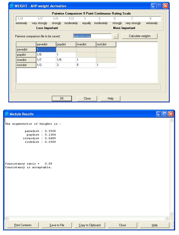
Weights are given to each factor in the image below. IDRISI allows this type of analysis using a weight derivation chart. Values of importance compared to other factors are arranged on the table so that statistical analysis of the eigenvectors.
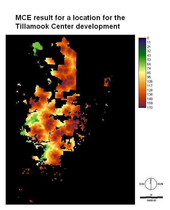
The final image displayed here represents the constraint factor being the forest and increasing suitability according to different weights on all the factors combined.