Methods
Spatial Analysis
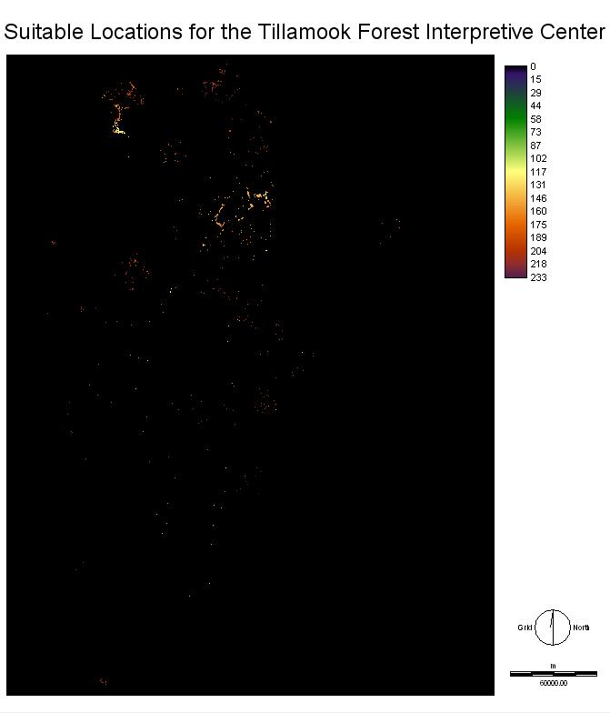
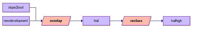
With the images produce from the two MCE procedures they are then overlayed affects of weights on various factors with the limiting areas with gentle slopes. The best areas determined according to highest suitability (red areas). By converting the image to a boolean we can group the areas together. In order to develop a large enough area must be available with all these factors in mind for the development to occur. With all the computerized analysis manual discrimination and criticism must be applied. The computer is a efficient tool but it is unable to make decisions.
With multiple areas that are suitable according to these analytical techniques future sites for other centers within the forest can be determined.