Results
Ten scenarios were run with variations in time of day, presence of earthquake damage,
and various percentages of the population accessing the cellular network. Results show the impacts to the
cellular network and areas of concern where the network can no longer be accessed.
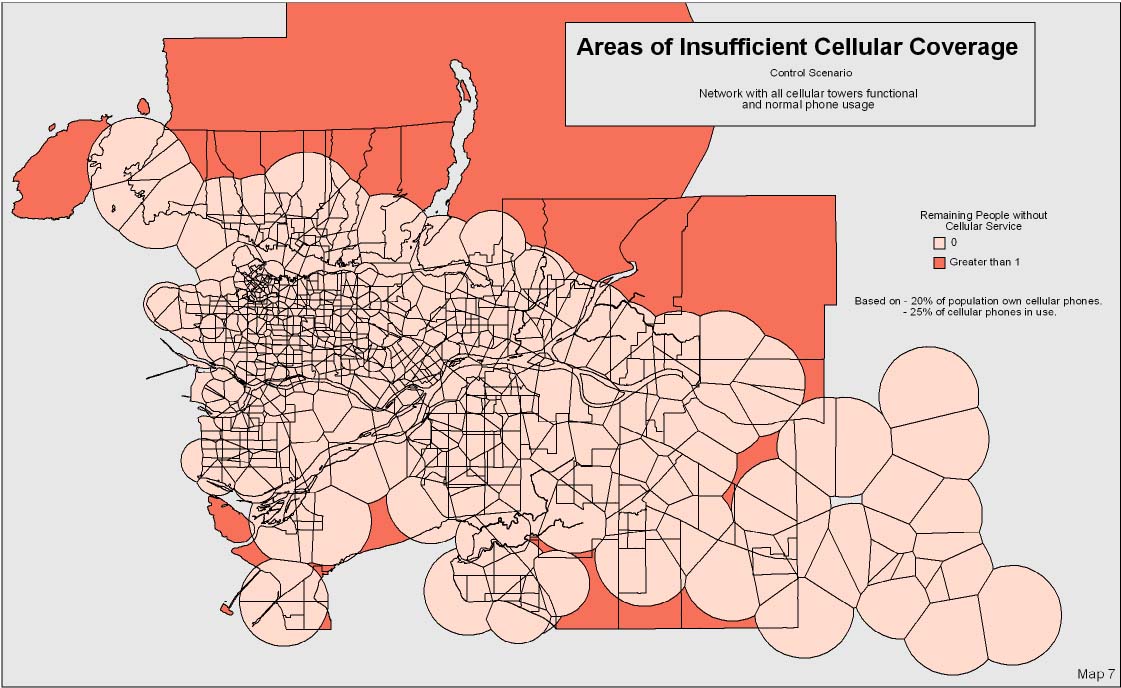
Control Scenario
Two control scenarios were run to ensure that the network would be operable during normal daytime and evening
population distributions. The control scenarios found that the network was indeed
fully operable and that all areas were receiving service.
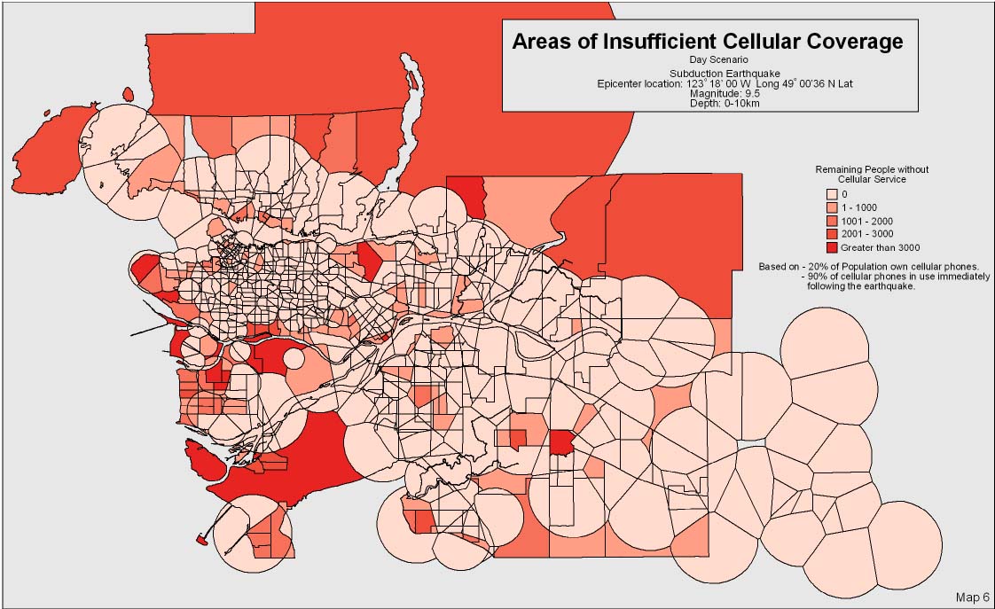
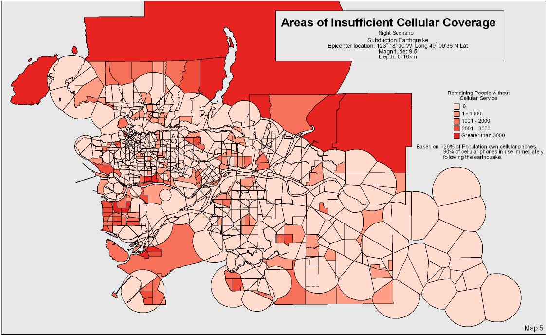
Subduction Zone Earthquakes
Several subduction zone earthquake scenarios were run to evaluate the response of the network.
Scenarios were carried out during both night and day times, and with variations in the number of cell phone owners actually
using their phones.
The largest problems occurred when large numbers of users attempted to access the network in areas where the towers were damaged.
As was expected, greater network overloads occured with increasing percentages of cell phone owners accessing the network.
This highlights the need to educate the public, encouraging cell phone users not
to use their phones in the event of an earthquake.
The differences between day and night population distributions show the
change in distribution of problems depending on the timing of the earthquake.
Daytime scenario:
Nighttime scenario:
Areas of concern vary depending on the timing of the earthquake. Many problem areas are evident during
the day, including Richmond, Vancouver Airport, North Burnaby, Langley, New Westminster, White Rock, and the UBC Endowment Lands.
During the night time scenario many of these problem areas change and network coverage is insufficient in
more evenly distributed areas.
Conclusions
The model produced reasonable results and successfully highlighted problem areas that develop when the
network is under stress (i.e. earthquake damage etc.). This study clearly shows the potential of Geographic Information Systems in
understanding, describing and modelling complex spatial processes.
The model results could be improved by improving the following input data to the model:
- Improvement of actual tower locations and more accurate tower ranges
- Improved modelling of individual carriers and towers, including roaming and priority access capabilities
- Improved structural information for the towers and building on which towers are mounted for earthquake damage prediction
- Addition of network topology data and power supply grid information
Improvements to the model should include:
- Inclusion of other network components including modelling of the power grid, tower-switching station topology, network switching capabilities, and accessability of each site to maintenance personnel.
- Improved modelling of the tower access areas including the addition of topographic effects and interference effects. Tower access areas should be modelled
in three dimensions rather than just as 'discs' in two dimensions
|