Conclusion
The goal of this project was to provide the city of Port Alberni with a local major tsunami vulnerability assessment that improves upon their past assessment while also presenting two possible new locations for tsunami warning sirens. This was gone about by using ESRI ArcMap software mainly, as well as Microsoft Excel, to analyse topographic data, as well as demographic data in order to create a holistic product that covers as many factors of vulnerability as possible while also maintaining strong support and rationale from literature review and logical solutions. It is due to this support, as well as our way of compiling risk for each dissemination area indiscriminately, that we feel our results are an improvement on past assessments, as well as a useful product for the city of Port Alberni. However, this assessment could be improved with the inclusion of wave modelling to give an even more accurate representation of which areas of town could be affected by a tsunami, as well as addressing the limitations that were previously discussed. Regardless, it is important for small communities such as Port Alberni to have some idea as to how their town could potentially be affected in the wake of such a disaster. With the information produced from this assessment, they could improve upon their emergency planning and as a result, be more prepared for when the next major tsunami hits.
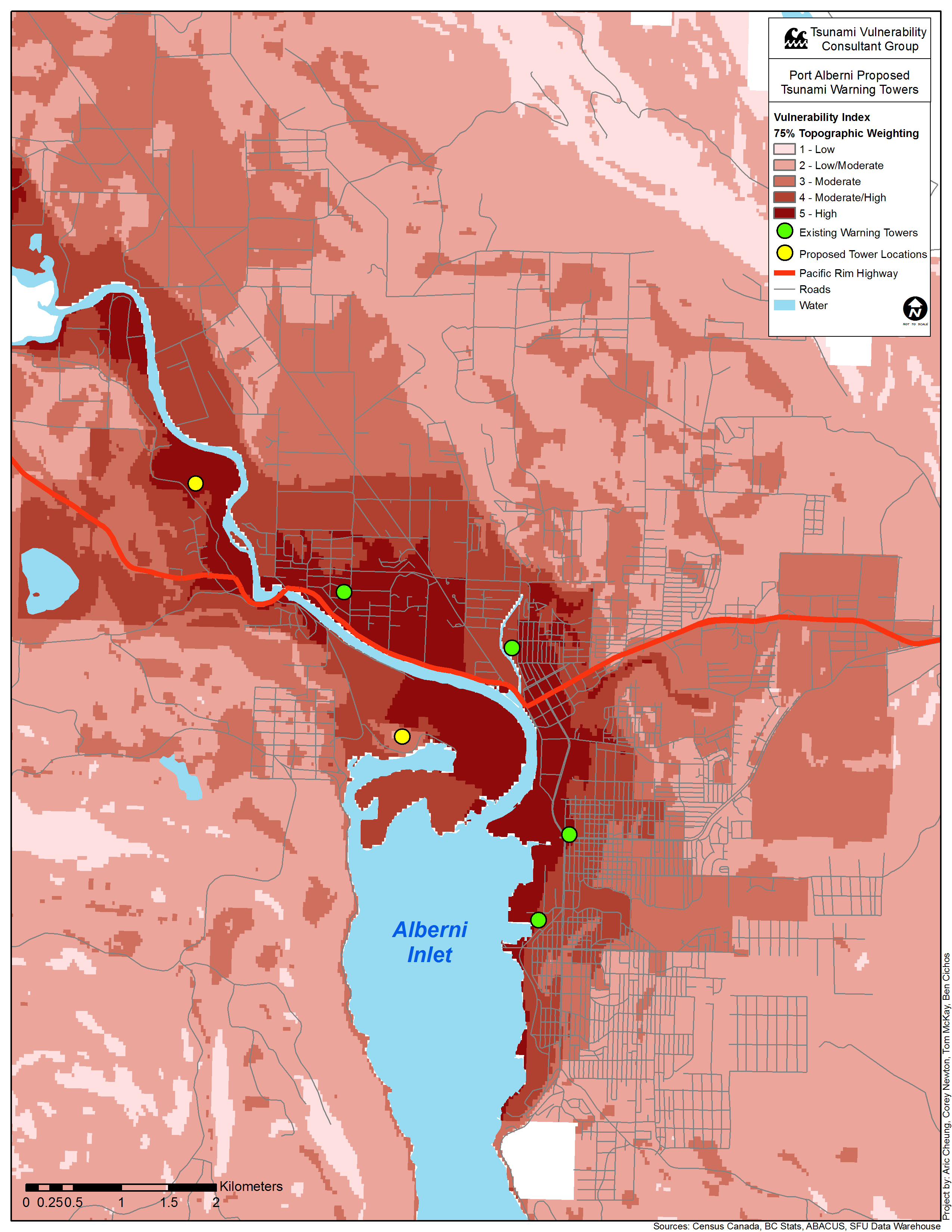
Application of Results: Warning Towers
Port Alberni is currently working on the placement of two additional tsunami warning alarm towers within their city. Using our vulnerability analysis, we are able to recommend locations for these towers: