Results
Data Fusion
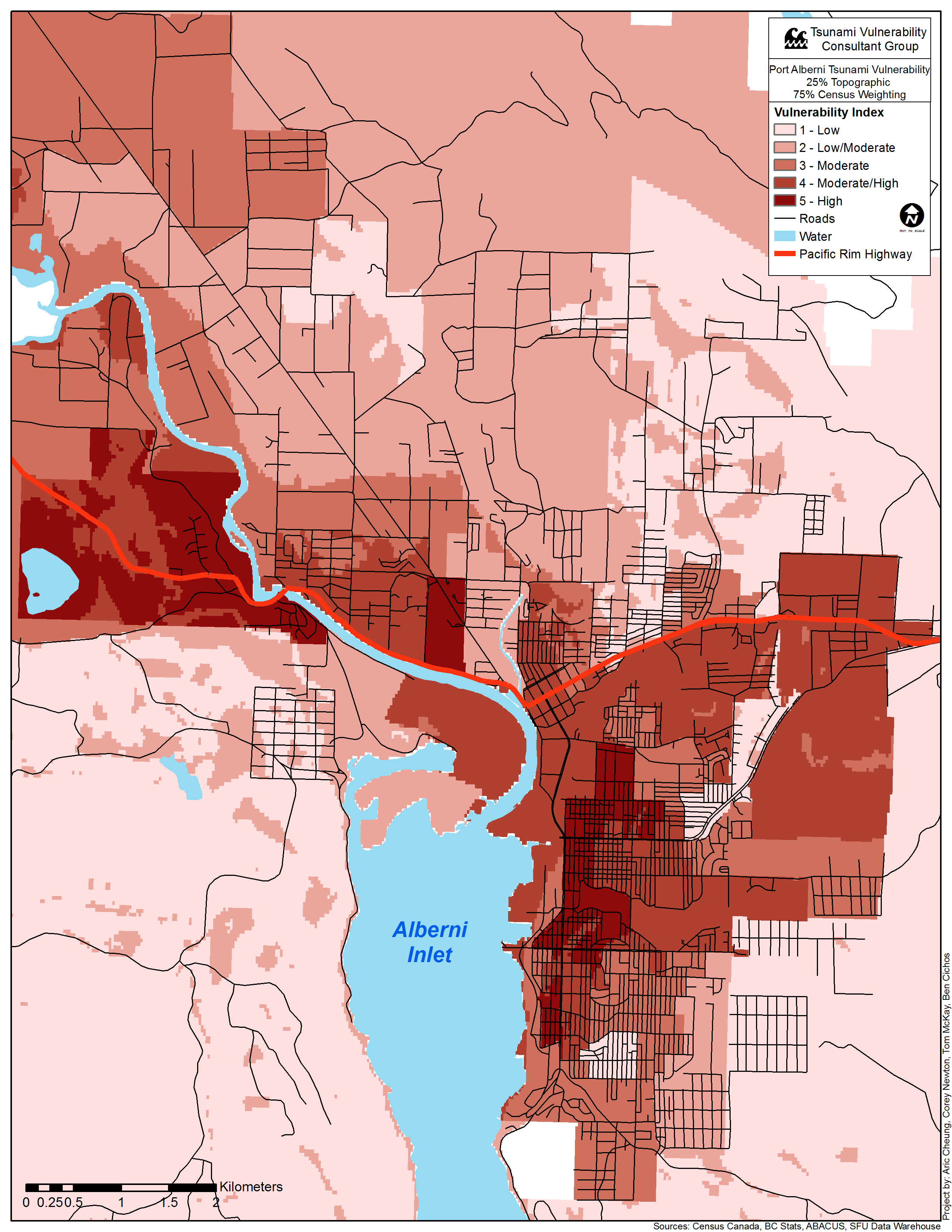
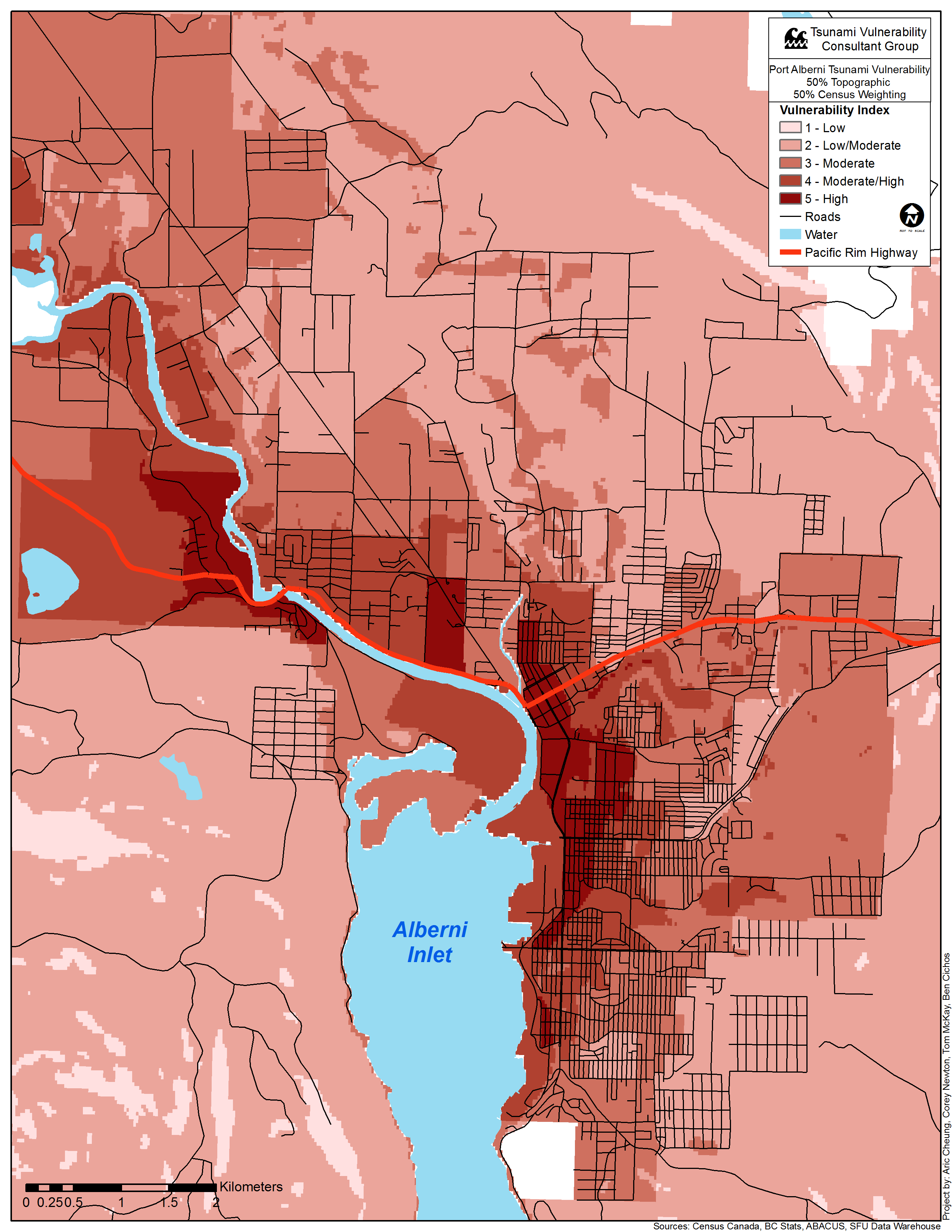
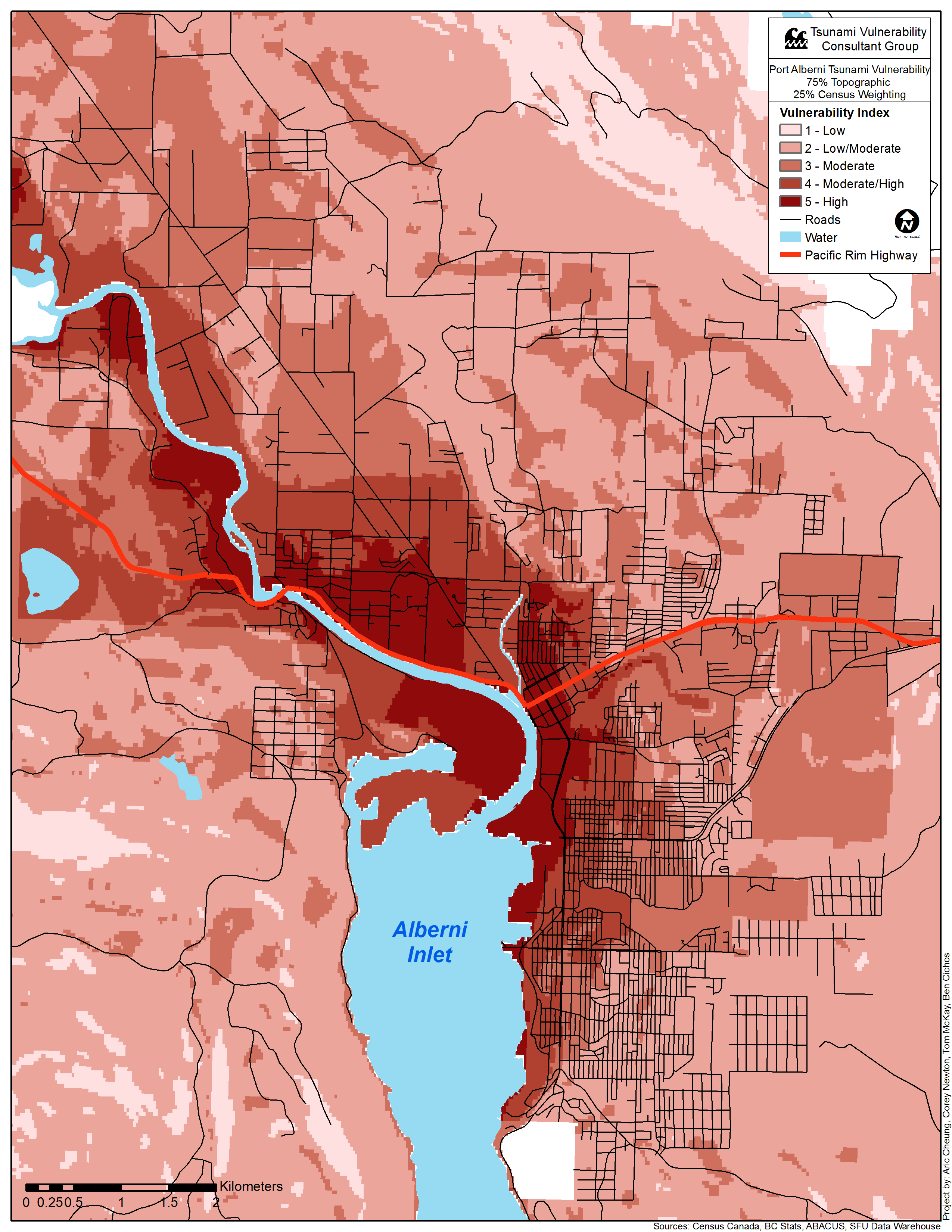
For the final vulnerability assessment of Port Alberni, the topographic and demographic data were combined to create a final map. To do so, we consulted with our advisor, Dr. John Clague as to how this could be accomplished with the most accurate solution presented. Dr. Clague then suggested we take the topographic and demographic vulnerabilities and subject them to a range of weighted overlays. This way a range of extremes can be delivered to the client and they could interpret each as they wish. This was ultimately achieved by first converting the demographic vulnerability map to a raster file by creating a shape file layer based on the feature with the Feature Class to Shape File tool, and then converted to raster using the Polygon to Raster tool in ArcMap. Then the two final vulnerabilities were combined using weighted overlay in the macro modeller in ArcMap (Figure 12). Including the separate topographic and demographic assessments, there were three weightings - 25:75, 50:50, and 75:25. In other words, the results would end up showing a map where there is equal influence given to topographic and demographic, a map where topographic data has more influence over demographic data and vice versa, and the original maps where either component has complete influence.
Composite Map Results
The 25% Topographic Hazard weighting map appeared as follows:
The 50% Topographic Hazard weighting map appeared as follows:
The 75% Topographic Hazard weighting map appeared as follows:
An interactive version of that map:
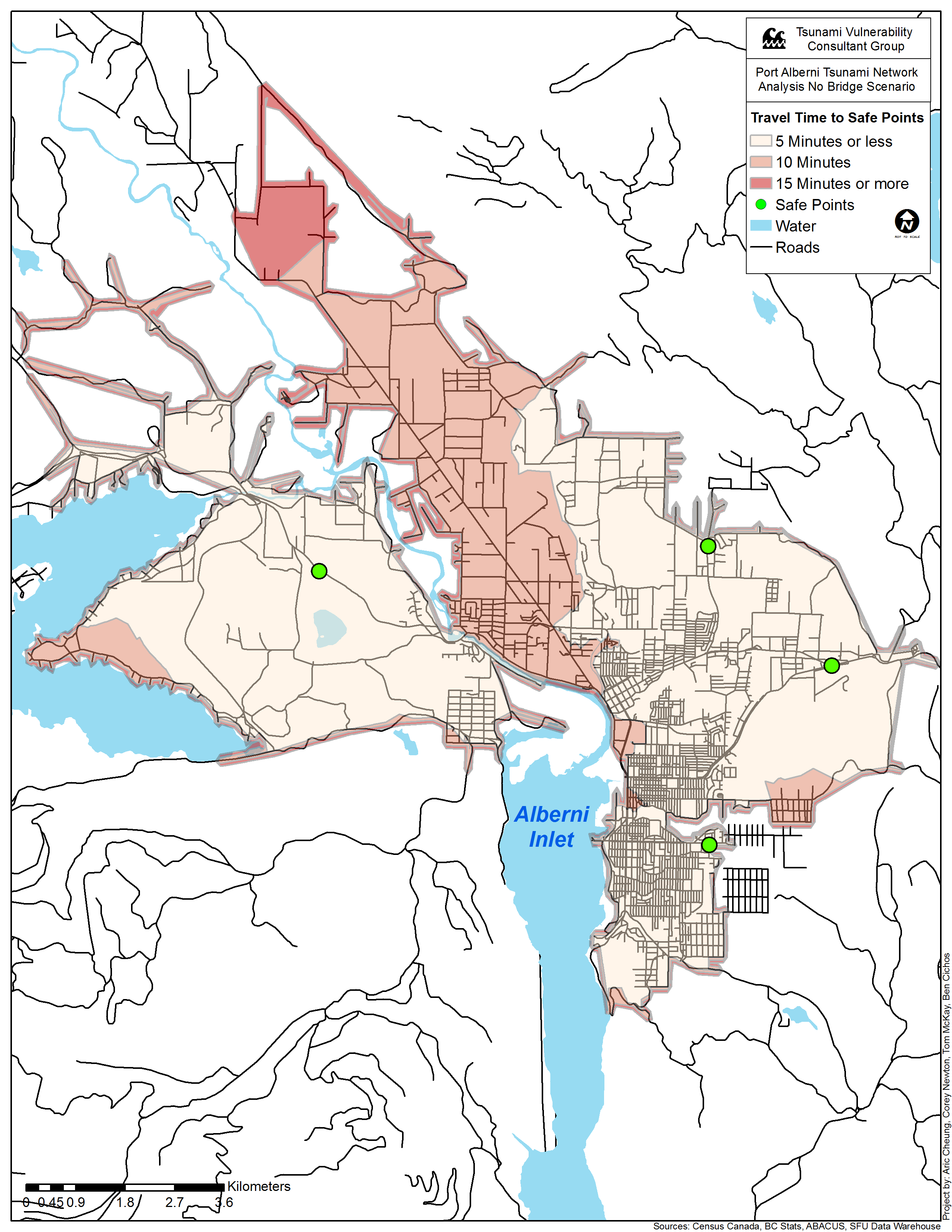
In addition to these vulnerability maps, we performed a network analysis that shows polygons of drive times to safe points that were found using previous analysis outputs. Conducting a evacuation route analysis is not possible in practice because it would assume that all residents were home during an earthquake and would leave immediately. This is especially difficult to do for a small area as generalisations can be made for much larger scenarios. Our scenario assumes that bridges have been damaged and are unusable for evacuation purposes. A safe point to the northwest of Port Alberni would reduce the evacuation time substantially for some residents.