
- About Us
- Services
- Stories
- Faisal Beg – Algorithms to Advance Research in Medicine
- Yasutaka Furukawa – Smart Building Technologies to Enhance Living Spaces and Create Opportunities
- Mo Chen – AI to Create Safe and Practical Robotics
- Sheelagh Carpendale – Understanding Data Through Interaction and Visualization
- Innovation to Improve 3D Navigation
- Voice AI is Helping Shoppers Make Better Decisions
- Geographic Information Science Can Help Better Track COVID-19
- Deep Learning to Inform Medical Diagnoses
- Protecting Killer Whales from Marine Traffic
- Using Big Data to Boost Athletic Performance
- Machine Reading for Literary Texts
- Finding a Cure for HIV with Big Data
- Linked Data for Women's History
- How Big Data Can Combat Fake News
- Algorithms for Safer Streets
- Discovering Wilde Data
- Deep Blue Data
- Big Data Meets Big Impact
- Previous Next Big Question Fund Projects
- Data Fellowships
- Using Data
Geographic Information Science Can Help Better Track COVID-19
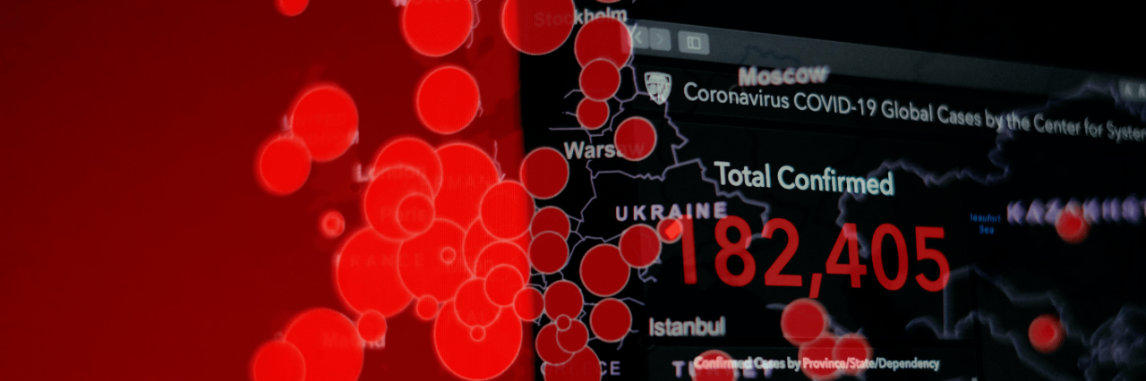
SFU scientists propose a Geographic Information Science (GIScience) approach to COVID-19 case tracking and reporting to provide a better understanding of how the pandemic is progressing, and what long-term impact it will have on global health.
Colour-coded maps currently being shared by public agencies and media can give a general overview of case numbers and ‘hot spots’. However, they are often messy and inconsistent, relying on limited data which may not provide an accurate picture of local transmission and risk or effectively inform prevention and mitigation efforts.
SFU’s Nadine Schuurman, Geography professor leading the GIScience research lab, and Leah Rosenkrantz, health geographer and PhD student, are recommending the wide-spread use of location-based intelligence tools, such as web and mobile apps where users volunteer to share information about their health and location.
The use of anonymous smartphone tracking paired with spatial analysis techniques can identify new disease clusters, help with contact tracing, and forecast potential hotspots.
Rosenkrantz believes it is critical to identify who is most at risk for both contracting the disease and experiencing severe outcomes. Understanding who is most vulnerable and where major outbreaks are occurring is essential.