
- News
- 2026 News
- Climate change and persistent contaminants deliver one‑two punch to Arctic seals, SFU study finds
- SFU women research chairs share what it takes to close the gender gap in science
- Paycheque before parchment: Data science co-op student earns pre-grad employment with RCMP
- Hubble tension – SFU researcher potentially one step closer to answering the universe’s biggest question
- Canada losing track of salmon health as climate and industrial threats mount
- 2025 News
- SFU Science Recognizes the 2025 Recipients of the Excellence in Science Public Engagement and Outreach Awards
- Congratulations to the 2025 recipients of the Faculty of Science Research Awards
- SFU Science Announces Recipients of 2025 Excellence in Teaching Awards
- Small grants seed change and belonging at Faculty of Science
- Scrap the ‘shrink it and pink it’ approach to women’s running shoes – SFU study
- Biological sciences grad finds a “beautiful fusion” of science and service in forensics
- BPK grad finds supportive community in cardiac research at SFU
- SFU physicists create new electrically controlled silicon-based quantum device
- Death by a thousand cuts: salmon falling through the cracks in B.C.’s fragmented policy landscape
- SFU welcomes Nobel Prize-winning chemist as visiting scholar
- Quantum of promise: how funding boost has enhanced quantum innovation at SFU
- SFU indoor berry research scales up and branches out with support from the Homegrown Innovation Challenge
- Brain wiring in early childhood could hold key to flagging future ADHD risk, SFU study says
- Faculty of Science Innovative Seed Grant supports novel research in cardiac arrhythmia
- SFU study suggests data may be masking steelhead declines in B.C.
- CIHR funds project to develop new tool for modelling long-term brain health
- Biophysics student headlines Canadian taekwondo team at the FISU World University Games
- SFU to pioneer two groundbreaking national training programs with $3.3 million in funding
- Fiona Brinkman receives award for scientific excellence from Life Sciences BC
- 'Talking fish' not heard by conservation policies, SFU study warns
- NSERC contributes $9 million in new funding for science research
- New Frontiers funding supports high risk, interdisciplinary research in Biological Sciences
- Quantum company led by SFU professor announces plans for new U.K. research facility
- 2024 Faculty of Science Teaching & Learning Grants Recipients
- SFU team joins international effort to track and monitor infectious diseases
- SFU Physics researchers unravel mystery of collagen’s instability
- SFU BPK grad finds a home at SFU, and purpose in biomedical research
- Erin Legros wins 2024 SFU Staff Achievement Award with a kind and compassionate approach
- Blueberry research bears fruit at SFU greenhouses
- SFU researchers developing wearable AI technology for stroke and spinal injury rehabilitation
- SFU researchers among winners of prestigious Breakthrough Prize in Fundamental Physics
- Trottier Observatory celebrates a decade of stargazing and wonder at SFU
- New funding for SFU Science researchers supports human health
- Social media use amplifies delusional disorders: SFU study
- Health of Fraser River Delta requires monitoring, management, SFU researchers warn
- BPK student research looks to history to find a way forward for Indigenous elder care
- CIHR contributes $3 million in new funding for health research at SFU Science
- SFU Sci-Space Celebrates Two Years
- Super enzyme that regulates testosterone levels in males discovered in ‘crazy’ bird species
- 2024 News
- SFU study sheds new light on what causes long-term disability after a stroke and offers new path toward possible treatment
- Congratulations to the 2024 recipients of the Faculty of Science Research Awards
- SFU Science recognizes 2024 Outreach Awards Recipients
- Silent damage and rays of hope: Nick Dulvy sheds light on ecological diversity in the world’s oceans
- SFU Science Announces Recipients of 2024 Excellence in Teaching Awards
- Scientists develop tool to predict sepsis in apparently healthy newborns
- Move along moose, SFU study reveals the ‘most Canadian’ animals
- Eve Meyer finds her path to research at SFU Biological Sciences
- New funding from the Canadian Foundation for Innovation supports health research at SFU Science
- Two Molecular Biology and Biochemistry researchers receive Michael Smith Health Research BC Scholar awards
- Isabelle Côté receives King Charles III medal for outstanding achievements
- SFU scientists working to build neutrino telescope to provide a new window into the universe
- SFU Science Dean elected as Fellow of the Canadian Academy of Health Sciences
- SFU breakthrough ID’s gene that may reverse Parkinson’s disease
- CIHR contributes $2 million in new funding for health research at SFU Science
- Monster fossils, helicopters and Science in Action: YuYen Pan reflects on nine years of public engagement
- Trio of Simon Fraser University Canada Research Chairs advance an inclusive and sustainable future
- SFU Science researchers receive $9.2 million in new NSERC funding
- Three SFU chemists honoured at national awards
- Driven by curiosity, SFU Physics student finds her space at the Trottier Observatory
- SFU Biological Sciences student builds community, in and out of the lab
- SFU Physics collaboration pushes an information engine to its limits
- New SFU-based Clean Hydrogen Hub to fuel clean energy research and innovation
- B.C. technology pipeline gets a boost with 500 new student spaces at Simon Fraser University
- Asian Heritage Month: Lin Zhang
- Asian Heritage Month: Dheva Setiaputra
- Musical medicine: SFU research highlights health benefits of hearing music for older adults
- SFU professor and alumnus win Governor General’s Innovation Award
- Why can’t robots outrun animals?
- Ant pheromones may help protect hikers and campers from ticks
- SFU Physics student representing Canada at Pan American Olympic Qualifier
- Physics lecturer receives award for excellence in teaching
- SFU research to bring fresh, local blueberries to B.C. markets in winter
- One in seven deepwater sharks and rays at risk of extinction
- SFU-led research team designs a cutting-edge protein lawnmower
- Science Rendezvous recognizes SFU Science Outreach creativity with national award
- Florence Nightingale Day at SFU inspires students with possibilities in statistics
- CIHR contributes $3.2 million in new funding for health research at SFU Science
- New funding for SFU Institute for Neuroscience and Neurotechnology to investigate dementia risk
- SFU professor and team win women’s class of World’s Toughest Row, cross the Atlantic in 38 days
- Growing pains? SFU research tracks 100 years of salmon adaptation to climate change
- SFU researchers zero in on what makes some people healthier than the rest of us
- 2023 News
- SFU Earth Sciences professor assessing carbon storage potential beneath Metro Vancouver
- SFU professor part of all-woman crew rowing across Atlantic for ocean conservation
- SFU researchers sound out Canadian military’s plan to combat ocean noise pollution
- Mining industry competing with salmon for rivers created by disappearing glaciers: SFU study finds
- Trio of new Chairs at SFU to build on Canada’s global research, innovation reputation
- Strategic partnerships give quantum technologies a boost
- Learning More About How Flu Strains Evolved May Help Guide Future Vaccine Development
- SFU Science Announces Recipients of 2023 Excellence in Teaching Awards
- Hockey head impact research highlights need to improve injury prevention
- SFU Science recognizes 2023 Outreach Awards recipients
- Esther Lam Dances Her Way to a Degree in Actuarial Science
- SFU MPM & PhD graduate explores an unknown ‘spiderverse’
- SFU Physics grad sets his sights on the stars
- Simon Fraser University researchers involved in major international antimatter breakthrough
- Fainting from needles may be alleviated by reducing pain – study
- SFU scientist captures the beauty of chemistry
- SFU Starry Nights expands the out-of-this-world experience virtually
- SFU aerospace physiology team to test health of UAE astronaut
- SFU Science researchers receive over $7 million in new NSERC funding
- After over 50 years at SFU Chemistry Paul Saunders is still having fun
- Over $2.6 million in new funding from CIHR for health research at SFU Faculty of Science
- Congratulations to the 2023 recipients of the Faculty of Science Research Awards
- SFU Faculty of Science Celebrates Excellence in Science Outreach
- MBB researcher studying against the grain strategy to improve cancer treatment
- Common denominator for math grad in finding next challenge: co-op experience
- Convocation medalist thrives as data scientist at top biotech firm
- Highschool student partners with SFU music specialist to research the developing teenage brain
- Biological sciences grad uses volunteer involvement to jumpstart a career in education
- Childhood experiences spark BPK grad’s passion for physiology and anatomy research
- Asian Heritage Month: Gary Shum
- Drug Discovered by SFU Researchers Shows Potential Life-Saving Results in Treating Cardiac Arrhythmias
- Asian Heritage Month: Amy Lee
- Asian Heritage Month: Himchan Jeong
- SFU university lecturer, associate dean, Sarah D. Johnson awarded 3M National Teaching Fellowship
- Juvenile salmon migration timing responds unpredictably to climate change
- David Lee wins 2022 SFU Staff Achievement award for numerous contributions to the Department of Physics
- SFU professor unearths the ancient fossil plant history of Burnaby Mountain
- SFU research aids fight against treatment-resistant superbugs
- 'Giant' ant fossil raises questions about ancient Arctic migrations
- CIHR awards SFU Science researchers $2M in new funding
- SFU Chemistry student wins international award with innovative take on plastics for renewable energy
- Sleuthing SFU scientists sniff out fake art
- SFU marine biologist rowing across the Atlantic to raise funds for ocean conservation
- Researchers counter healthy aging issues, isolation in cities with $6.8 million funding
- Natalia Bussard joins SFU Work Integrated Learning (WIL) as the Program Manager, Science and Environment Co-op
- Statistics and Actuarial Science researcher studying the effects of climate change on pension funds
- How salmon feed flowers & flourishing ecosystems: study
- Shark and ray populations rebounding in Northwestern Atlantic: SFU study
- Two-thirds of sharks and ray in coral reefs facing extinction: SFU study
- New Sci-Space creates room to connect for science students at Burnaby Campus
- SFU physicist Stephanie Simmons to help lead Canada's new quantum strategy
- Physics student helps inspire girls in Pakistan with opportunities in STEM
- SFU and UBC researchers receive $1.25M to study cumulative effects on B.C. salmon
- 2022 News
- 2022 Faculty of Science Teaching & Learning Grants Recipients
- SFU mathematician finding new insights on evolution through the lens of infectious disease
- New tool developed to monitor health of marine ecosystems and extinction risk of species
- Scientists reconstruct gravity to better understand the universe
- $2 million gift helps seed new ideas at SFU Science
- Welcome Angela Brooks Wilson, Dean of SFU Science
- Genomic data can improve pandemic modelling, SFU researchers say
- SFU Science Announces Recipients of 2022 Excellence in Teaching Awards
- BPK grad Donya Divsalar brings an interdisciplinary perspective to aerospace research
- SFU researcher receives Michael Smith Health Research Award for work harnessing machine learning to advance genetic sequencing
- A mid-degree refocus helped new alumnus Melissa Nguyen set her sights on a career in optometry
- Big picture thinking helps Maya Piddocke earn 2021 Staff Achievement Award for Work Performance
- CIHR contributes over $2.5 million in new funding for health research at SFU Faculty of Science
- A new dean for the Faculty of Science—Angela Brooks-Wilson
- Isabelle Côté and John Bechhoefer honoured as 2022 Distinguished SFU Professors
- SFU researchers developing new methods for controlling deadly honeybee parasites
- SFU researchers find the missing photonic link to enable an all-silicon quantum internet
- SFU researchers develop new chemical biological tools to monitor Parkinson’s disease
- SFU physicists continue to advance ATLAS project, 10 years after Higgs boson discovery
- SFU alumni levelling the playing field with new Sports Analytics Award for Indigenous Students in Science
- SFU Science researchers receive $4.8 million in new NSERC funding
- Proactive approaches needed to enable ecosystems to adapt to climate change
- SFU biochemist weaves western science with Indigenous ways of knowing
- Cory Macklin’s hard work leads to a Governor General’s Silver Medal
- Stephanie Simmons renamed Canada Research Chair in Silicon Quantum Technologies
- Data Science student discovers his passion for health at a business case competition
- SFU researchers exploit the body’s innate drive for safety to improve motor memory
- Asian Heritage Month: Kero Lau
- Lost or extinct? Study finds the existence of 562 animal species remains uncertain
- Asian Heritage Month: Becky Lin
- Study finds the brain searches for the best way to move the body
- Biomedical Physiology and Kinesiology creating a caring community, on campus and online
- Asian Heritage Month: Joanna Woo
- Bridging the gap between disciplines to better understand chemical reactions
- Student satellite project prepares for liftoff
- SFU to advance agritech, wearables sectors with $11.8M in federal research funding
- Department of Biological Sciences faculty member and previous Chair, Dr. Isabelle Côté Awarded as a Healthy Campus Community Champion
- Popular BPK lecturer receives SFU Excellence in Teaching Award
- SFU researchers help develop world’s first autonomous agriculture planning software
- SFU Science researchers among new and renewed Canada Research Chairs
- Prominent neuroscientist to advance brain research through new SFU institute
- Study finds that river flows linked to the ups and downs of imperiled Chinook salmon population
- SFU Science Announces Recipients of 2020/2021 Excellence in Teaching Awards
- Q&A: HOW SFU IS TAKING BRAIN RESEARCH IN PROMISING NEW DIRECTIONS
- 2021 News
- Faculty of Science Canada Research Chairs announcement
- Excellence in Science Public Engagement and Outreach Award winners announced
- Larger households contribute to COVID-19 transmission in Fraser Health Region
- Study finds Sawfish face extinction unless overfishing is curbed
- Astronaut "moves" to help prevent falls among older adults confined to bed rest
- Paleontologists discover major new insect group after solving 150-year-old mystery
- COVID-19 experts share 2020 SFU Media Newsmaker Award
- Chemistry professor awarded the 2021 John C. Polanyi Award for research excellence
- Where do we look when we walk?
- BPK prof honored with SFU Excellence in Teaching Award
- SFU lab one step closer to understanding how life started on Earth
- Research collaboration achieves world’s first laser-cooling of antimatter
- Fossil discovery deepens snakefly mystery
- Rain, rain go away! SFU Chemists develop new waterproofing solution.
- Asian Heritage Month; a profile of Hogan Yu
- IT team wins Staff Achievement Award for keeping us all connected
- Asian Heritage Month; a profile of Liangliang Wang
- New COVID-19 rapid test kit receives scientific seal of approval
- Asian Heritage Month: a profile of Ly Vu
- Asian Heritage Month: a profile of Weiran Sun
- Biology major completes degree while battling long-haul COVID
- SFU physicist Stephanie Simmons receives YWCA Women of Distinction Award
- SFU paleontologist honours Indigenous culture through collaboration
- Math alum creates award to support SFU students with mental health challenges
- SFU alum and scientist Kyle Bobiwash speaks on the importance of diversity of perspectives and worldviews in research.
- First Indigenous and Black Graduate scholarship established for SFU biology graduate students
- Global study shows major seagrass losses around the world
- Regular rapid testing detects COVID-19 soon enough to stop transmission in schools
- SFU Staff Achievement Award winner keeps Faculty of Science running smoothly through pandemic
- Faculty of Science profs receive Distinguished SFU Professorships
- SFU physics student uses machine learning technique to speed up image analysis
- Innovative coating for blood vessels reduces rejection of transplanted organs
- CFI invests more than $1.6 million in 10 SFU research projects
- Ground-breaking work from SFU identifies new source for earthquakes and tsunamis in the Greater Tokyo Region
- Faculty of Science researchers awarded Canada’s highest academic honour
- Science student graduates after an eight-year hiatus and a change of heart
- Microplastics in belugas worked their way up the food chain, SFU researchers find
- Salmon decline impacted by “squeeze” of combined river and sea stressors
- Melting glaciers could produce 1,000s of kilometres of new Pacific salmon habitat by 2100
- Biology professor relocates to Nunavut for new role at Polar Knowledge Canada
- 2020 News
- STUDY SUGGESTS SEA LICE ON SALMON IS UNDER-REPORTED AT B.C. SALMON FARMS
- ROYAL SOCIETY OF CANADA HONOURS FACULTY OF SCIENCE RESEARCHERS
- SFU STUDY NETS NEW DATA ON HEAD IMPACTS EXPERIENCED BY HOCKEY PLAYERS
- FAST AND LOOSE: NANOMACHINES WITH FLOPPY CONNECTIONS GO FASTER
- SFU CHEMIST’S NEW PROCESS FAST-TRACKS DRUG TREATMENTS FOR VIRAL INFECTIONS AND CANCER
- HOT WATER CAN SOMETIMES COOL FASTER THAN WARM WATER – SFU RESEARCH CONFIRMS
- EDNA TECHNOLOGY MORE EFFECTIVE IN MONITORING SALMON RUNS: SFU RESEARCH
- LOVE OF SPORTS, MATH LANDS SFU ALUMNUS JOB WITH SEATTLE’S NHL FRANCHISE
- STAFF KEEP RESEARCH ALIVE DURING PANDEMIC
- A WHISKER'S MORE PROTECTION FOR CLEAN-SHAVEN MASK WEARERS
- RESEARCHERS WORKING TO IMPROVE QUALITY OF LIFE FOR SENIORS IN LONG-TERM CARE
- NEW STUDY FINDS CORAL ISLANDS MAY NOT “DROWN” AMID CLIMATE CHANGE
- NEW FOSSIL DISCOVERY SHOWS 50 MILLION-YEAR-OLD CANADA-AUSTRALIA CONNECTION
- BPK GRAD AIMS TO MAKE A DIFFERENCE AMID CHALLENGES OF LAB WORK ON COVID-19 PROJECT
- HOW CANNABIDIOL MAY BE HELPFUL IN TREATING DIABETES-RELATED ARRHYTHMIAS
- SFU LAB HELPS PATIENT MANAGE RARE DISEASE THROUGH PROGRAMMED EXERCISE
- SFU SURREY SCIENCE LABS HOST COVID-19 HAND SANITIZER PRODUCTION
- SFU EPIDEMIOLOGIST’S RESEARCH INFORMS B.C. HEALTH POLICY ON COVID-19
- SFU PROFESSOR’S INVENTION APPROVED BY FDA TO HELP WEAN COVID-19 PATIENTS FROM VENTILATORS
- SFU STAFF AND FACULTY DONATE MASKS, GLOVES, ADDITIONAL COVID-19 SUPPLIES TO LOCAL HOSPITALS
- CORONAVIRUS TESTING KITS WILL BE DEVELOPED USING SFU-INVENTED RNA IMAGING TECHNOLOGY
- NEW "SMALL NUMBER" K-12 MATH LEARNING MATERIALS AVAILABLE
- SFU RESEARCH TEAM HELPS TEST POTENTIAL SUPERBUG-KILLING COMPOUND
- SFU CELEBRATES INTERNATIONAL DAY OF WOMEN AND GIRLS IN SCIENCE
- STUDY REVEALS HIDDEN RISKS OF ESTUARY DEVELOPMENT FOR YOUNG SALMON
- SFU RESEARCHER SCORES MAJOR FUNDING FOR ACUTE MYELOID LEUKEMIA RESEARCH
- SFU EARTH SCIENTIST JOHN CLAGUE NAMED TO ORDER OF CANADA
- FACULTY OF SCIENCE RECEIVES OVER $1M IN RESEARCH FUNDING FROM CANADA FOUNDATION FOR INNOVATION
- ABUNDANCE OF SALMON KEY TO FEEDING 'UNDERDOG' STREAM FISHES: SFU RESEARCH
- YOUNG INVESTIGATOR AWARD BESTOWED ON PHYSICS PROF.
- SFU PHYSICS PROFESSOR RECOGNIZED AS “TOP 40 UNDER 40” IN CANADA
- SFU RESEARCH FINDS CLUES TO UNDERSTANDING CBD AND ITS MEDICINAL EFFECTS
- SFU alumnus inspired by her organization’s 2020 Nobel Peace Prize
- 2019 News
- SFU RESEARCH POINTS TO UNPRECEDENTED AND WORRYING RISE IN SEA LEVELS
- SFU GLOBAL COLLABORATION CREATES WORLD’S FIRST OPEN-SOURCE DATABASE OF NATURAL MICROBIAL PRODUCTS
- VIRTUAL CADAVERS BRING LEARNING TO LIFE AT SFU
- SFU RESEARCHERS DISCOVER POTENTIAL WAY TO MANAGE INSECTS WITHOUT CHEMICALS
- FIRST FOSSIL DRAGONFLIES FROM B.C. IDENTIFIED AND NAMED
- INTERNATIONAL STUDY FINDS NEW GENETIC FEATURES IN RARE BURKITT LYMPHOMA CANCER
- TRIO OF SFU SCIENCE PROFESSORS HONORED
- NEW EVIDENCE SHOWS HUMAN PRESENCE IN HAIDA GWAII 2,200 YEARS EARLIER THAN PREVIOUS ESTIMATES
- SFU CHEMISTRY PROF NAMED TO ROYAL SOCIETY OF CANADA
- POPULAR BUT DANGEROUS LAB DEMO NOW SAFER THANKS TO SFU CHEMISTS
- SFU PHYSICS WELCOMES NEW ASTROPHYSICIST
- WATCH YOUR SPEED—WHALE ZONE AHEAD!
- DEPARTMENT OF STATISTICS & ACTUARIAL SCIENCE WELCOMES DONALD ESTEP
- COMPLIANT FLOORING NOT THE ANSWER TO PREVENTING FALL-RELATED INJURIES
- SFU WELCOMES NEW SHRUM CHAIR IN BIOLOGICAL MECHANISMS OF DISEASE
- PEST BUSTING SFU PROF NAMED FELLOW OF THE ENTOMOLOGICAL SOCIETY OF CANADA
- INTERNATIONAL STUDENT BUILDS HIS OWN ADVENTURE AT SFU
- THE DIRT ON SUSTAINABLE SHEEP FARMING
- TINY FISH A BIG LURE FOR LIFE ON CORAL REEFS
- BIG ENERGY SAVINGS FOR TINY MACHINES
- BIOLOGY CLASS ANALYZES DOG DNA FOR BODY SIZE, SNOUT LENGTH AND COAT LENGTH
- SFU STUDIES CAUSES BEHIND SUDDEN UNEXPECTED DEATH IN INFANTS
- ANAL SECRETIONS OF APHIDS PROVIDE SUSTENANCE FOR MOSQUITOES
- CITIZEN SCIENTISTS' RARE FOSSIL BIRDS SHED NEW LIGHT ON AVIAN HISTORY
- STATISTICS STUDENTS IMPRESS THE NFL WITH THEIR MOVES
- 3D IMAGES IN PDFS IS A GAMECHANGER FOR CHEMISTRY EDUCATION
- DAVID SHIFFMAN NAMED PRESIDENT'S SOCIAL MEDIA NEWSMAKER OF THE YEAR
- EARTH SCIENCES TECHNICIAN DIGS DEEP TO DEVELOP ENGAGEMENT
- EARLY-CAREER LECTURER KEVIN LAM DRIVEN BY LIFE-LONG PASSION FOR TEACHING
- CHEMISTRY TEAM "FIXES" CANCER-SUPPRESSING P53 PROTEIN
- SFU RESEARCHERS FIND NEW CLUES TO CONTROLLING HIV
- STUDY PREDICTS WARMER, DRIER MOUNTAINS POSE A DOUBLE WHAMMY FOR COLD-ADAPTED AMPHIBIANS
- “MICROSCOPIC” IMPROVEMENTS YIELD BIG GAINS IN SFU’S RESEARCH CAPABILITIES
- 2018 News
- SFU PROF’S WORLDWIDE INFLUENCE ON SHARKS AND RAYS RESEARCH LEADS TO ACCOLADE AND A NEW CONSERVATION PROGRAM
- SFU TEAM LEADS $12-MILLION EFFORT TO EXPAND SYSTEM OF WORLDWIDE HEALTH RESEARCH DATABASES
- SFU FACULTY MEMBERS SET SIGHTS ON HOLLYWOOD NORTH
- NEWLY HIRED STATS PROF BRINGS EXPERTISE IN BIG DATA AND MACHINE LEARNING
- MUSCLES KNOW BEST
- NANOMACHINES HAVE ALL THE MOVES
- PHD CANDIDATE IN MARINE BIOLOGY WINS MAJOR ENVIRONMENTAL PRIZE
- ENGAGED STUDENT DOES IT ALL
- GENETIC MUTATION PROVIDES POTENTIAL CLUE TO NON-HODGKIN LYMPHOMA
- BUILDING MOLECULAR MOTORS – ONE STEP AT A TIME
- NEW STUDY ON EFFECTS OF CANNABIS ON PAIN AND SEIZURE CONTROLNEW STUDY ON EFFECTS OF CANNABIS ON PAIN AND SEIZURE CONTROL
- FACULTY OF SCIENCE WELCOMES NEW DEAN!
- SCIENCE INQUIRY VIDEOS FOR HIGH SCHOOL STUDENTS LAUNCHED
- SFU MATHEMATICIAN RECEIVES ROYAL SOCIETY AWARD
- JOHN REYNOLDS NAMED CHAIR OF THE COMMITTEE ON THE STATUS OF ENDANGERED WILDLIFE IN CANADA
- SFU STUDY BUSTS MYTH ABOUT FACIAL HAIR ON PILOTS
- NOT SO FAST: FROM SHREWS TO ELEPHANTS, ANIMAL REFLEXES SURPRISINGLY SLOW
- SFU TEAM RECEIVES FUNDING TO EXPAND SYSTEM OF WORLDWIDE HEALTH RESEARCH DATABASES
- MEET THE LATEST WINNERS OF THE FACULTY OF SCIENCE EXCELLENCE IN TEACHING AWARDS.
- MEET NEW MATH PROF & CANADA 150 RESEARCH CHAIR, CAROLINE COLIJN
- SCIENTIFIC TEAM SCOOPS MAJOR AWARDS FOR WORK CONFIRMING THE STANDARD MODEL OF COSMOLOGY
- HOW SALMON "OUST THE LOUSE"
- ABORIGINAL SUMMER CAMP ALUMNI JOIN SFU AS UNDERGRADS
- OUTSTANDING ALUMNI AWARD FOR STEVEN HOLDCROFT
- SCIENTISTS ON TWITTER: PREACHING TO THE CHOIR OR SINGING FROM THE ROOFTOPS?
- SFU KICKS OFF SPORTS ANALYTICS CONFERENCE
- NEW METHOD FOR DETECTING DOPING IN CYCLISTS PROPOSED
- SFU’S LONGEST SERVING SENATE FACULTY MEMBER STEPS DOWN
- PRIME GROWING AREAS FOR B.C. OYSTERS CONTAIN ALARMINGLY HIGH CONCENTRATIONS OF PLASTIC MICROBEADS
- TALK ABOUT SCIENCE!
- 2017 News
- FLIRTING ON THE FLY: HUMANS CAN LEARN A THING OR TWO FROM BLOW FLIES ABOUT ATTRACTION ON DATING APPS
- SFU RESEARCHERS SHINE LIGHT ON ANTIMATTER
- SARAH JOHNSON WINS FACULTY OF SCIENCE EXCELLENCE IN PUBLIC OUTREACH AND ENGAGEMENT AWARD
- SCIENCE TECHNICAL CENTER WINS SFU TEAM ACHIEVEMENT AWARD
- SFU's Trottier Observatory wins national award for landscape design
- SFU PROF SCORES POSITION WITH NBA
- STUDY FINDS GREATER RISK OF EXTINCTION AMONG HIGH DIVERSITY AMPHIBIAN GROUPS
- 2017 CONVOCATION STAR - DANIELLE JEONG
- 2017 CONVOCATION STAR - ANDY ZENG
- 2017 CONVOCATION STAR - JOHN THOMPSON
- PERFECT PAIRINGS: COUPLE MEETS AT SCIENCE FROSH & HEAD TO MED SCHOOL TOGETHER
- EXTREME SCIENCE IN VOLCANOLOGY
- NEW CANADA RESEARCH CHAIR BOOSTS FUNDING FOR ENERGY-CONVERSION TECHNOLOGY
- CHEMISTRY BUILDING EARNS GOLD, LEED AWARD
- NEW CLASSROOMS + SOCIAL AREA = [MATH WEST]
- NEW STUDY SHOWS BANNING SHARK FIN IN THE U.S. WON’T HELP SAVE SHARKS
- NEW RESEARCH LINKS HEART ATTACKS TO GENETIC MUTATION
- CONSERVATION ACTUALLY WORKS
- NATIONAL GOLD MEDAL HONORS GERHARD GRIES' INSECT EXPERTISE
- REVVING YOUR NANOSCALE ENGINE
- "ROCK STAR" GEOSCIENTIST RECEIVES LEGGET MEDAL
- PUBLIC HEALTH MATHEMATICIAN JOINS SFU AS CANADA 150 RESEARCH CHAIR
- VOLCANIC SIMULATION TEACHES EARTH SCIENCES STUDENTS CRISIS MANAGEMENT SKILLS
- MARS' SURFACE WATER: WE FINALLY KNOW WHAT HAPPENED
- 2016 News
- HANDS-ON LEARNING ON THE MOUNTAIN
- SEA STARS SHED LIGHT ON HUMAN REPRODUCTION
- EXERCISE MAY PUT SOME HEART PATIENTS AT RISK
- ZIKA VIRUS AND THE RIO 2016 OLYMPIC GAMES
- STAFF ACHIEVEMENT AWARD FOR THE FACULTY OF SCIENCE
- DIGGING FOR ANTIBIOTICS
- FROM STUDENT TO CEO
- FACULTY OF SCIENCE SWEEPS EXCELLENCE IN TEACHING AWARDS
- STATS STUDENT SAYS THANKS TO HIGH SCHOOL MATH TEACHER
- SWEET AWARD FOR STATISTICS PROF
- ECONOMICS DRIVE THE EXTINCTION OF LARGE MARINE ANIMALS
- SFU RESEARCHERS STUDY DNA TO FIND GENETIC MUTATION BEHIND RARE DEVELOPMENTAL DISORDER
- EMPU DIRECTOR RECEIVES "HIGH-FLYING" AWARD
- SFU'S POPULAR ACADEMIC SUMMER CAMP FOR ABORIGINAL STUDENTS A HIT WITH ALUMNI
- SEA STAR DEATH TRIGGERS ECOLOGICAL DOMINO EFFECT
- DUGAN O'NEIL WINS COMPUTE CANADA TRAILBLAZER AWARD
- INTERNATIONAL ENTOMOLOGY AWARD FOR ‘BED BUG’ BIOLOGIST
- UNDERGRAD GETS MUSCLE MECHANICS RESEARCH PUBLISHED
- TRAILBLAZING SCIENTIST AND ADVISOR PASSES AWAY AT 102
- UNDERSTANDING HOW THE "BLOOD-BRAIN BARRIER" IS BREACHED IN BACTERIAL MENINGITIS
- NEW SFU PROFESSORSHIP TO BOOST RESEARCH COLLABORATION WITH RCH
- SFU RESEARCHERS WORK TO FINE-TUNE COLLAGEN GROWTH
- EVERGREEN LINE 'CORES' PROVIDE EARTH SCIENTISTS WITH WEALTH OF HISTORICAL DATA
- 2015 News
- JOHN REYNOLDS NETS AWARD
- ISABELLE COTÉ & WENDY PALEN RECEIVE PRESTIGIOUS LEOPOLD FELLOWSHIPS
- HUMAN GENOMICS CLASS GETS UP CLOSE AND PERSONAL
- TRIPLE WIN FOR MATHEMATICIANS
- DATING TECHNIQUES: ILLUMINATING THE PAST
- HOWARD TROTTIER WINS BC SUGAR ACHIEVEMENT AWARD
- TEMPERATURE CHANGE CAN TRIGGER SUDDEN CARDIAC DEATH
- FAT ACCUMULATION IN HUMAN SKELETAL MUSCLES EFFECTS ABILITY TO PERFORM EVERYDAY ACTIVITIES
- SFU TO HOST SITE OF RESEARCH CYBER NETWORK
- STATISTICS PROF. SNAGS HIGHEST HONOR
- NEW CANCER-FIGHTING FUNDS TO HELP PATIENTS WITH AGGRESSIVE NON-HODGKIN LYMPHOMA
- WIRED FOR LAZINESS
- SFU CO-LEADS NATIONAL PROJECT TO REVIVE COHO SALMON
- NEW PROFESSORSHIP FOCUSES ON NEW TREATMENTS FOR AUTISM
- NEW RESEARCH OPENS DOORS TO UNDERSTANDING TONSIL CANCER
- NEW DISEASE-CARRYING MOSQUITO ARRIVES IN BC
- GENES RESPONSIBLE FOR THE THREE KINDS OF MALE RUFFS IDENTIFIED
- SCIENTISTS TAKE AIM AT DISEASE-CARRYING “KISSING BUG”
- BURNABY AND CHILEAN ELEMENTARY STUDENTS LEARN ASTRONOMY TOGETHER
- SCRATCH THESE OFF OF YOUR CHRISTMAS SHOPPING LIST
- 2026 News
- About Us
- Undergraduate
- Graduate
- Research
- Teaching and Learning
- Outreach
- Faculty & Staff
- Departments
- Core Facilities
- Donate

POSTDOCTORAL FELLOW JEFFREY ZUREK, CENTRE, CONFERS WITH STUDENTS IN THE 'EMERGENCY MANAGEMENT B.C. TEAM' DURING A VOLCANIC SIMULATION EXERCISE IN EARLY DECEMBER 2017.
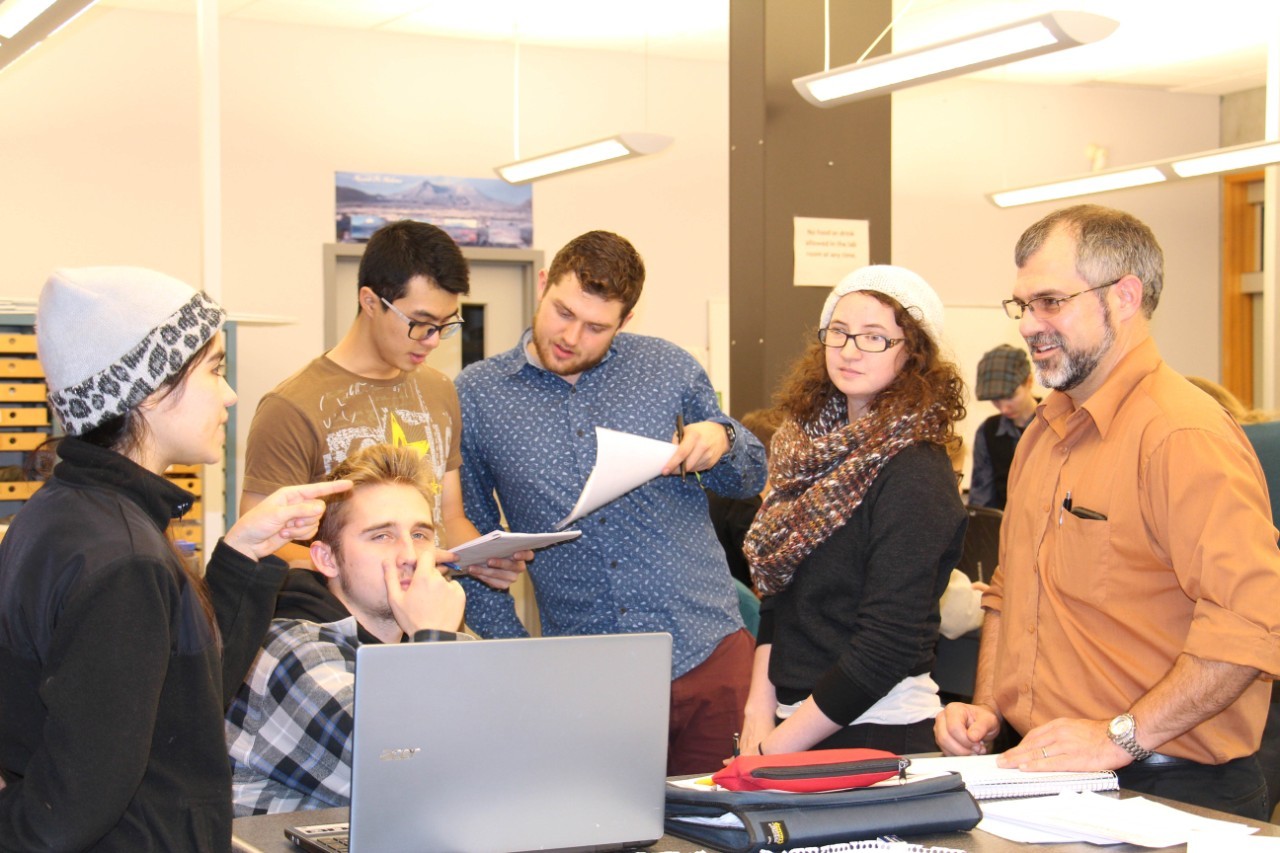
EARTH SCIENCES PROFESSOR GLYN WILLIAMS-JONES, RIGHT, CONFERS WITH THE STUDENTS ON THE 'GEOLOGICAL SURVEY OF CANADA' TEAM DURING THE VOLCANIC SIMULATION EXERCISE.
VOLCANIC SIMULATION TEACHES EARTH SCIENCES STUDENTS CRISIS MANAGEMENT SKILLS
Imagine a scenario where a volcano is about to erupt and you are responsible for deciding what to do next. Who should be alerted and who needs to be evacuated? Where and when might lava start flowing? How dangerous will the gas and ash emissions be?
This is what Earth Sciences 421 students experienced during a five-hour volcano simulation exercise in early December.
Initially developed at the University of Canterbury in New Zealand, the simulation received a Canadian spin from earth sciences professor Glyn Williams-Jones and postdoctoral fellow Jeffrey Zurek, thanks to a grant from SFU’s Institute for the Study of Teaching and Learning in the Disciplines.
“We substituted Mt. Meager near Pemberton, B.C. as the live volcano and adapted the data to fit the style of activity we would expect from Mt. Meager—something similar to the 1980 eruption of Mt. St. Helens” says Williams-Jones.
Students were divided into two teams; the Emergency Management B.C. team responsible for B.C. parks and human, agricultural and biological impacts; and the Geological Survey of Canada team responsible for deciding which level of emergency should be activated based on field data such as seismic and ash reports, geochemistry and weather conditions.
Both teams were fed “real-time” events and data condensed from a three-month timescale of a hypothetical eruption. From the time that the first earthquakes were felt, to a large eruption and subsequent dome explosions of built up lava, students were expected to work with their team to assess the danger, impact and actions necessitated by each event.
When the teams felt they had enough sound information to share with the public and their emergency partners, they staged a press conference. Colleagues and graduate students played the roles of the Prime Minister, the Mayor of Pemberton and concerned citizens, and posed difficult questions to the teams.
To keep the simulation as realistic as possible, Williams-Jones and Zurek had earlier led the students on a two-day field trip to explore Mt. Meager. The class spent the remainder of the semester analyzing the volcanic activity that has taken place since Mt. Meager’s last eruption more than 2,400 years ago.
Teaching assistant Rachel Warwick did the exercise as an undergrad and says, “It was an eye-opening experience on hazard and crisis management.”
She admits it was pretty stressful but says, “It was a great way to actually use knowledge that we had been learning all semester long.”
Zurek agrees that the realistic aspect of the simulation is key to the exercise.
“I think it’s important for the students to get real examples of how the course information can be used in the real world.”
He adds, “Without a multi-day field trip to a recent large volcanic eruption, I cannot think of a better way to bring the hazards and associated impacts into the classroom in a more tangible, hands-on way.”